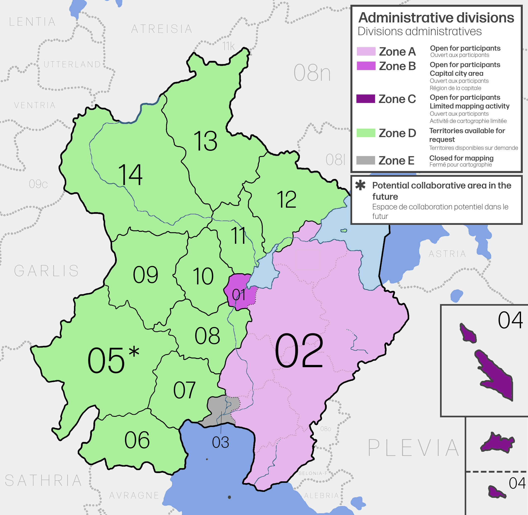
File:FQ Admin.png
Size of this preview: 615 × 599 pixels. Other resolution: 2,120 × 2,066 pixels.
Original file (2,120 × 2,066 pixels, file size: 621 KB, MIME type: image/png)
Summary
Self-made.
Licensing
| This map is a derivative of the OpenGeofiction base map, which is licensed under the Creative Commons Attribution-NonCommercial-ShareAlike License and is released under the same license. |
File history
Click on a date/time to view the file as it appeared at that time.
| Date/Time | Thumbnail | Dimensions | User | Comment | |
|---|---|---|---|---|---|
| current | 12:47, 18 July 2024 | | 2,120 × 2,066 (621 KB) | Bixelkoven (talk | contribs) | |
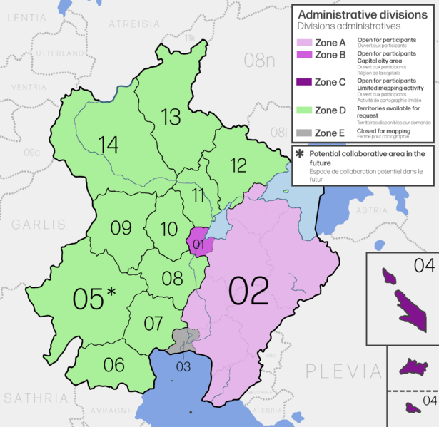
| 19:00, 16 July 2024 | 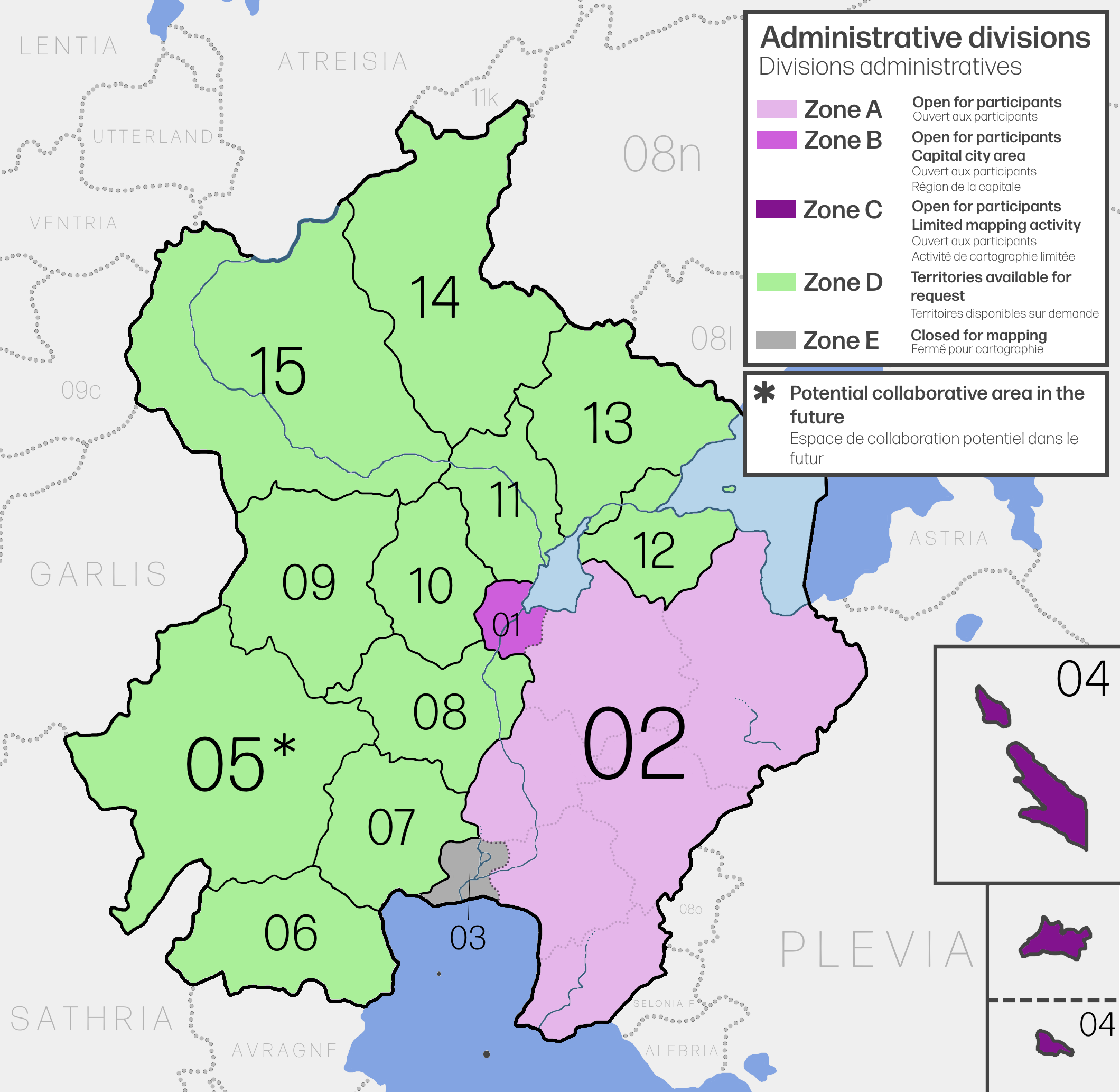 | 2,120 × 2,066 (625 KB) | Bixelkoven (talk | contribs) | U[dated territory codes | |
| 18:59, 14 July 2024 | 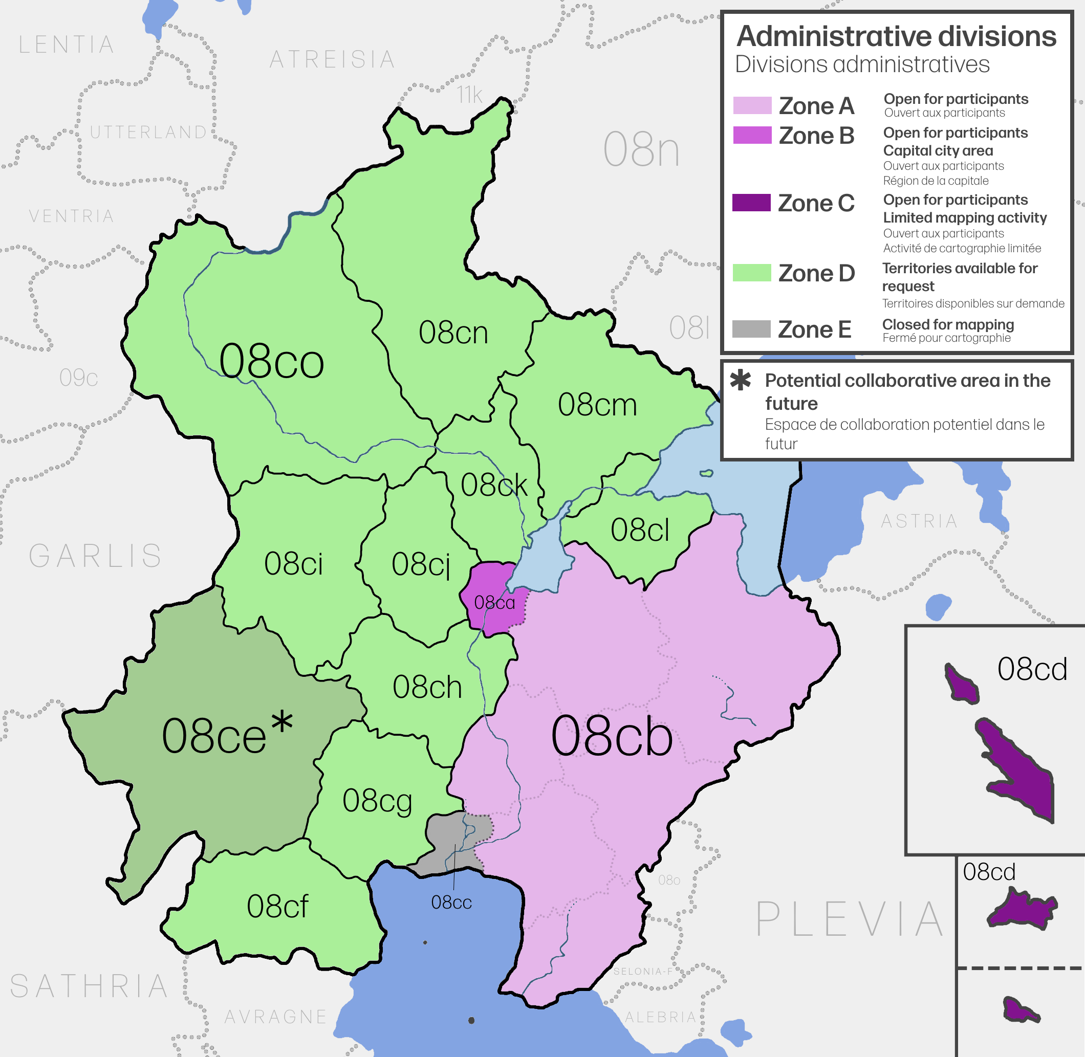 | 2,120 × 2,066 (648 KB) | Bixelkoven (talk | contribs) | Self-made. Category:Franqueterre Category:Franqueterre collaborative documentation |
You cannot overwrite this file.
File usage
The following 2 pages use this file: