File:Faston ward map.png
Size of this preview: 494 × 599 pixels. Other resolution: 1,576 × 1,912 pixels.
Original file (1,576 × 1,912 pixels, file size: 340 KB, MIME type: image/png)
Summary
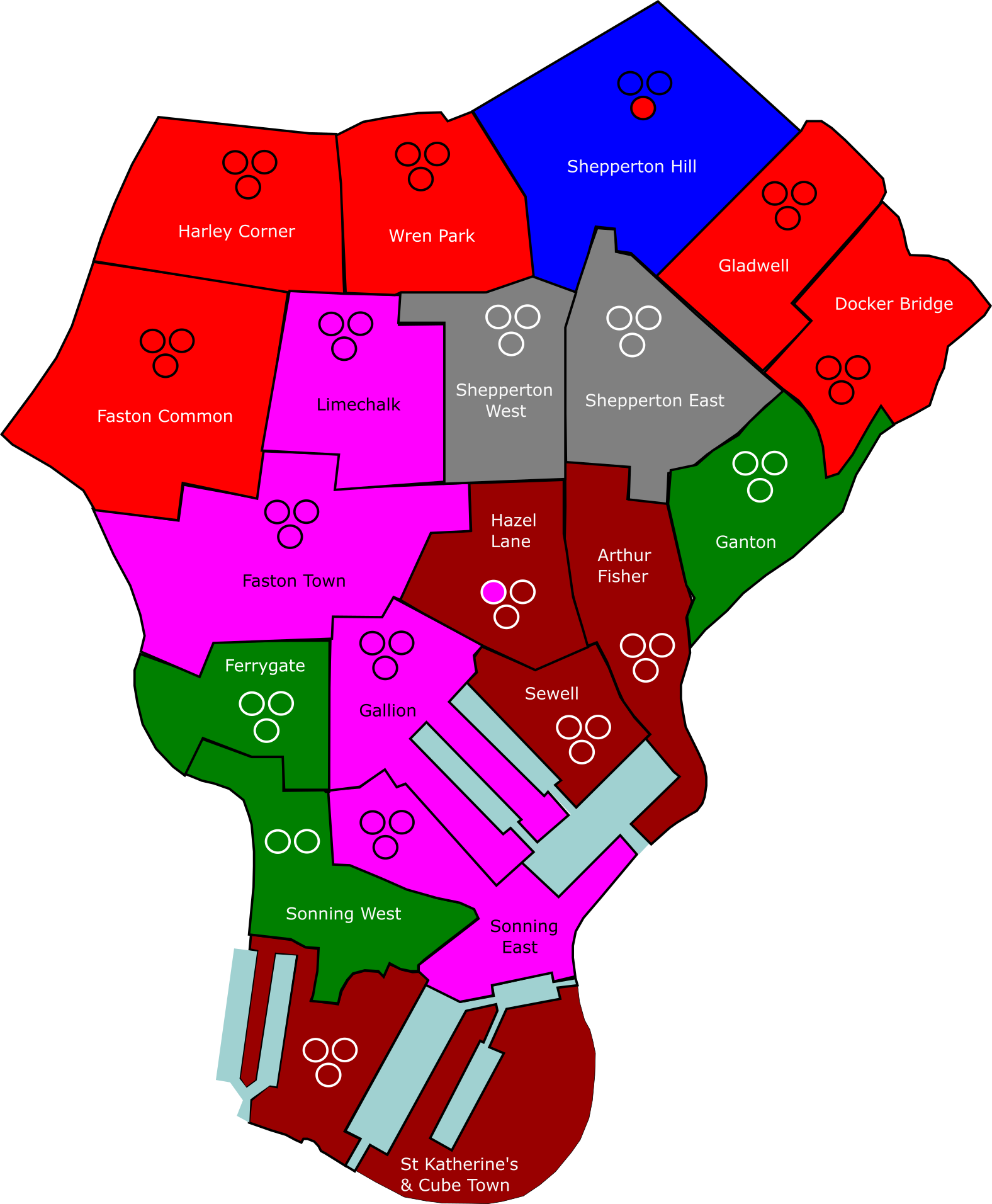
boundaries of borough of Faston in Bromley City
Own work
Licensing
| This image is licensed under the Creative Commons Attribution License |
File history
Click on a date/time to view the file as it appeared at that time.
| Date/Time | Thumbnail | Dimensions | User | Comment | |
|---|---|---|---|---|---|
| current | 02:29, 13 April 2026 | | 1,576 × 1,912 (340 KB) | KTheBritMC (talk | contribs) | boundaries of borough of Faston in Bromley City Own work |
You cannot overwrite this file.
File usage
The following page uses this file: