File:Ingerland sudo91 2.png
Size of this preview: 800 × 568 pixels. Other resolution: 816 × 579 pixels.
Original file (816 × 579 pixels, file size: 116 KB, MIME type: image/png)
Summary
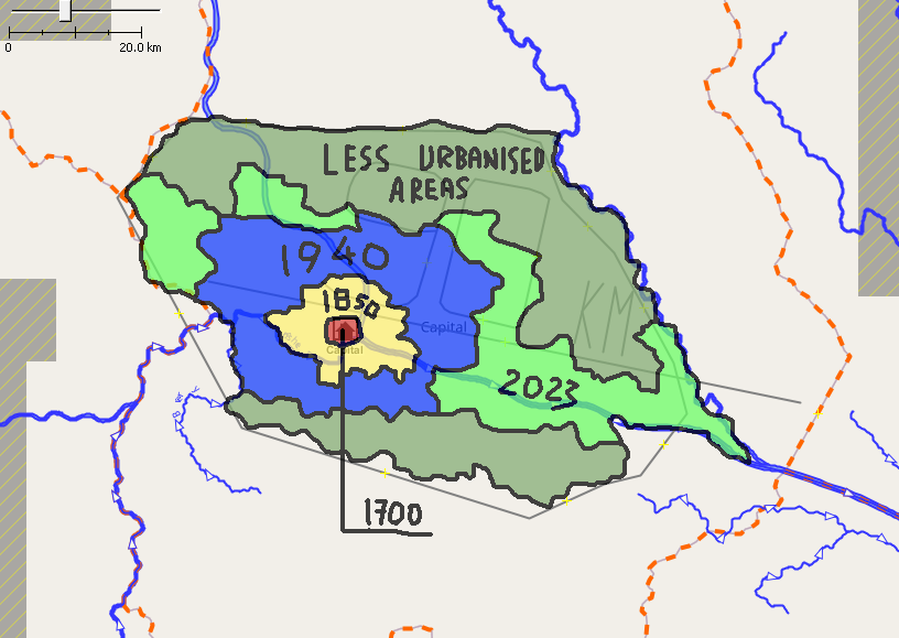
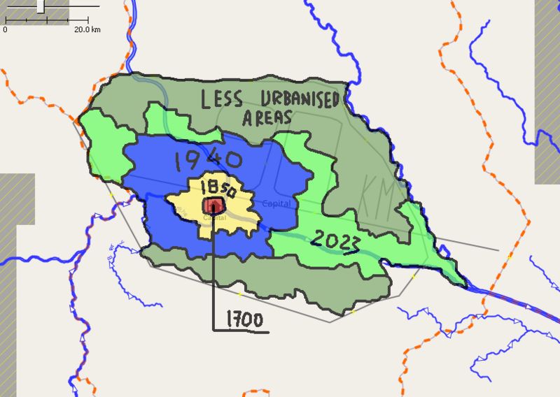
A screenshot from JOSM with sudo91's sketch on Winburgh's agglomeration.
Licensing
| This map is a derivative of the OpenGeofiction base map, which is licensed under the Creative Commons Attribution-NonCommercial-ShareAlike License and is released under the same license. |
File history
Click on a date/time to view the file as it appeared at that time.
| Date/Time | Thumbnail | Dimensions | User | Comment | |
|---|---|---|---|---|---|
| current | 18:48, 3 May 2023 | | 816 × 579 (116 KB) | Sudo91 (talk | contribs) | A screenshot from JOSM with sudo91's sketch on Winburgh's agglomeration. |
You cannot overwrite this file.
File usage
The following page uses this file: