File:Northeastern FSA motorways 2.png
Size of this preview: 572 × 599 pixels. Other resolution: 594 × 622 pixels.
Original file (594 × 622 pixels, file size: 327 KB, MIME type: image/png)
Summary
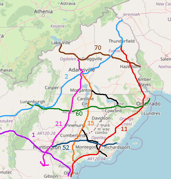
Plan for motorways in the Northeastern FSA, including established and more recently proposed routes. Proposal 2 of 2.
Licensing
| This map is a derivative of the OpenGeofiction base map, which is licensed under the Creative Commons Attribution-NonCommercial-ShareAlike License and is released under the same license. |
File history
Click on a date/time to view the file as it appeared at that time.
| Date/Time | Thumbnail | Dimensions | User | Comment | |
|---|---|---|---|---|---|
| current | 03:09, 21 February 2024 | | 594 × 622 (327 KB) | Fluffr Nuttr (talk | contribs) | Plan for motorways in the Northeastern FSA, including established and more recently proposed routes. Proposal 2 of 2. |
You cannot overwrite this file.
File usage
The following page uses this file: