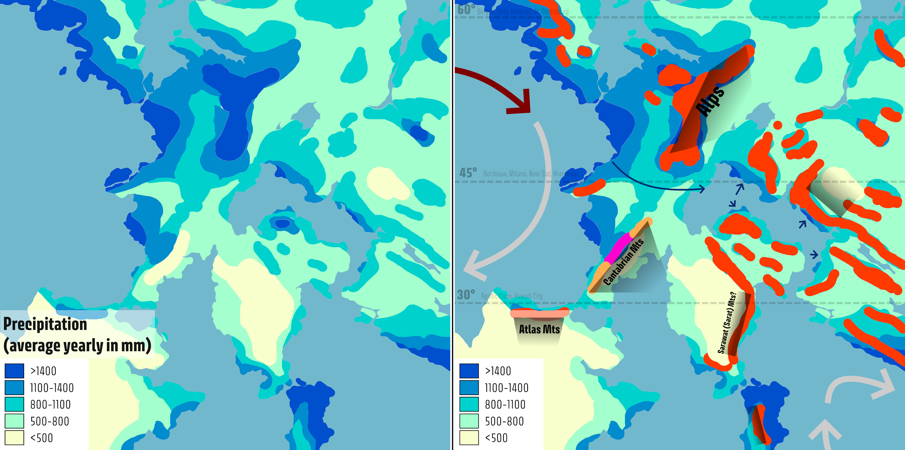
File:WU admin plan Sathria precip.png
Size of this preview: 800 × 398 pixels. Other resolution: 2,894 × 1,440 pixels.
Original file (2,894 × 1,440 pixels, file size: 1,000 KB, MIME type: image/png)
Summary
Self-made.
Licensing
| This map is a derivative of the OpenGeofiction base map, which is licensed under the Creative Commons Attribution-NonCommercial-ShareAlike License and is released under the same license. |
File history
Click on a date/time to view the file as it appeared at that time.
| Date/Time | Thumbnail | Dimensions | User | Comment | |
|---|---|---|---|---|---|
| current | 21:40, 6 July 2025 | | 2,894 × 1,440 (1,000 KB) | Bixelkoven (talk | contribs) | Resizing |
| 21:21, 6 July 2025 | Error creating thumbnail: File with dimensions greater than 12.5 MP | 6,030 × 3,000 (1.47 MB) | Bixelkoven (talk | contribs) | Self-made. |
You cannot overwrite this file.
File usage
The following page uses this file: