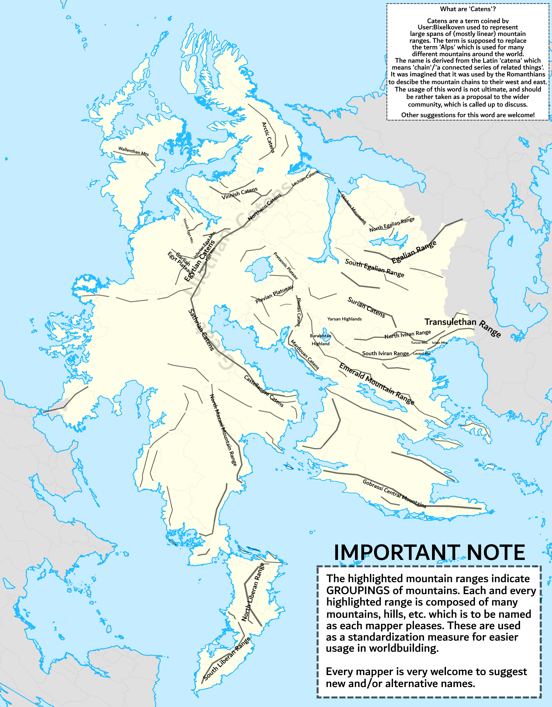
File:Wu mt ranges.png
Size of this preview: 468 × 599 pixels. Other resolution: 1,937 × 2,480 pixels.
Original file (1,937 × 2,480 pixels, file size: 1.11 MB, MIME type: image/png)
Summary
First instance. Future changes are inevitable. Self-made.
Licensing
| This map is a derivative of the OpenGeofiction base map, which is licensed under the Creative Commons Attribution-NonCommercial-ShareAlike License and is released under the same license. |
File history
Click on a date/time to view the file as it appeared at that time.
| Date/Time | Thumbnail | Dimensions | User | Comment | |
|---|---|---|---|---|---|
| current | 20:20, 13 May 2024 | | 1,937 × 2,480 (1.11 MB) | Bixelkoven (talk | contribs) | First instance. Future changes are inevitable. Self-made. Category:Administrative images Category:West Uletha |
You cannot overwrite this file.
File usage
The following page uses this file: