Utterland
Utterland lies at the southern end of the Firth of Hetzer, which penetrates down from the Bay of Morcanol.
it is surrounded by Lentia to the west and northwest, Ventria to the south, Sonnenburg to the northeast and Altresia to the east.
The state was created through secession from Lentia in 1844. Unrest in that nation led to large numbers of refugees crossing the mountains, and settling in the valley of Mosen.

Cities like Galmosen and Rijksbergen grew large in that time. The Duke of Solsburg, now the nation's capital, took charge of the western part of Utterland, west of the River Utter; the Duke of Hemmel and the Duke of Schalmen to the east of the Firth of Hetzer. The mountains remained lawless until the end of the 19th century, when the Viscount of Almons started to assert his authority in the Loden Valleys along the Altresian border. Utterland emerged as a fully fledged nation by 1910, when the various Duchies agreed to merge, as prompted by the Treaty of Karelshoven.

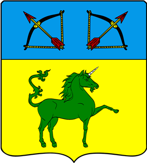
The Coat of Arms shows the Azure of the Firth of Hetzer, the Or of the rolling hills of the river valleys, the Vert of the mountains and the Unicorn of Fiction. The bows and arrows indicate the strife that led to the formation of the territory.
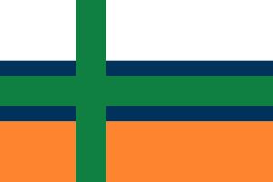
Similarly, the flag is made up of the white of the snow-capped mountains in the east; green of the rolling hills and orange of the fertile soils.
Natural features
Valleys
The south and east of Utterland are the domain of mountains and lower hills, intersected by steep-sided valleys. That is particularly in evidence in the Loden Valleys, between Almons and Karelshoven, along the border with Atreisia.
Schaalense Klip
In the south, we find the phenomenon of Schaalense Klip. The Klip (a cliff) is a 7 km long valley, north Schaalen, through which the river Kleine Utter cascades down from the higher Gamel Valley (near Gamelhorst) to its lower reaches at Lijsterdalen. The Klip is a major tourist attraction, with several cable cars taking visitors from the clifftop down into the river valley. The cliffs are up to 100 metres high and mainly accessible from the western side, from the main road between Schaalen and Lijsterdalen, and is also served by two railway stations at either end. From the Klip, walking routes extend to nearby hills and mountains.
Grote Vallei
The Grote Vallei (Big Valley) was gouged out by glaciers in times long gone by. It extends for about 40 km from Berenhoven in the south to near Loosteren on the border with Sonnenburg. Towns in the Vallei include Peringen and Cutenburg. Mountain tops line the valley, with ridges tapering down to the west, in the general direction of Solsburg and Ilvoorde, along the Firth of Hetzer.
Karelse Kom
To the east of the Grote Vallei the major mountain massif rears up north of Karelshoven, peaking at the Laavense Gletscher (Laaven Glacier). The border with Atreisia, in this area, runs along another major glacial valley until the border crossing near Vallenberg.
The city of Karelshoven lies south of the glacier, along the river Razend Water (Raging Water), which is indeed a wild-water paradise as it cascades down the valleys towards Heezel, Elkern and finally joining the Loden River at Almons