File:Lentia around the tenth century.png: Difference between revisions
No edit summary |
Rustem Pasha (talk | contribs) mNo edit summary |
||
| Line 1: | Line 1: | ||
Map depicting Lentian proto-states and events leading up to the Western Migration, as well as main migration routes. | Map depicting Lentian proto-states and events leading up to the Western Migration, as well as main migration routes. | ||
== License == | |||
{{cc-ogf-map}} | |||
[[Category:Historical maps]] | |||
[[Category:Lentia]] | |||
Latest revision as of 13:50, 5 April 2025
Map depicting Lentian proto-states and events leading up to the Western Migration, as well as main migration routes.
License
| This map is a derivative of the OpenGeofiction base map, which is licensed under the Creative Commons Attribution-NonCommercial-ShareAlike License and is released under the same license. |
File history
Click on a date/time to view the file as it appeared at that time.
| Date/Time | Thumbnail | Dimensions | User | Comment | |
|---|---|---|---|---|---|
| current | 23:02, 27 March 2025 | 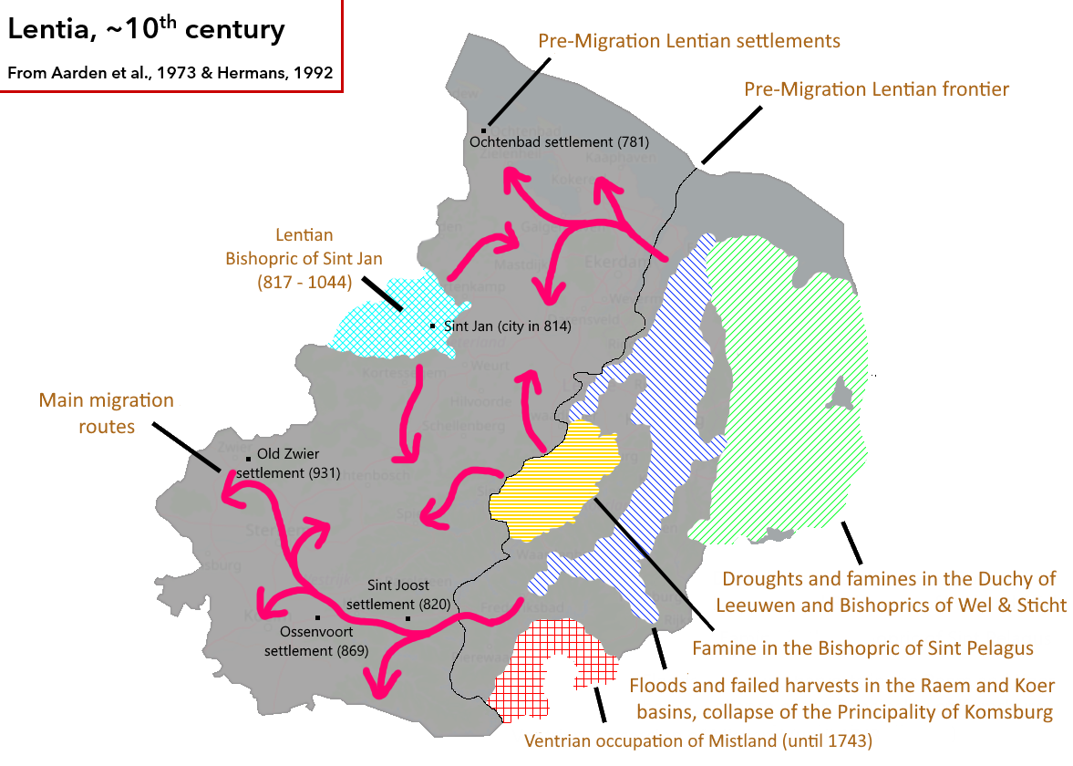 | 1,177 × 840 (369 KB) | Mantan (talk | contribs) |
You cannot overwrite this file.
File usage
The following page uses this file: