File:FSA Core Motorway Network.png: Difference between revisions
licensing... |
mNo edit summary |
||
| Line 2: | Line 2: | ||
{{cc-ogf-map}} | {{cc-ogf-map}} | ||
[[Category:Federal States collaborative documentation]] | |||
Latest revision as of 20:10, 22 October 2025
Sketch of the proposed FSA Core Motorway Network. Annotated OGF screenshot.
| This map is a derivative of the OpenGeofiction base map, which is licensed under the Creative Commons Attribution-NonCommercial-ShareAlike License and is released under the same license. |
File history
Click on a date/time to view the file as it appeared at that time.
| Date/Time | Thumbnail | Dimensions | User | Comment | |
|---|---|---|---|---|---|
| current | 19:39, 26 September 2025 | 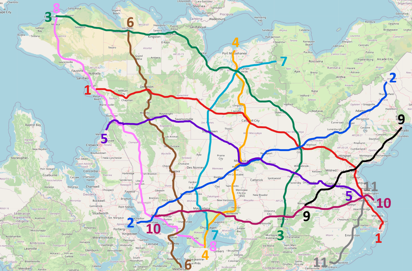 | 1,313 × 865 (1.34 MB) | TheMayor (talk | contribs) |
You cannot overwrite this file.
File usage
The following page uses this file: