File:Les Petites Régions de Libérie Franque.png
Size of this preview: 800 × 451 pixels. Other resolutions: 2,560 × 1,442 pixels | 4,408 × 2,483 pixels.
Original file (4,408 × 2,483 pixels, file size: 423 KB, MIME type: image/png)
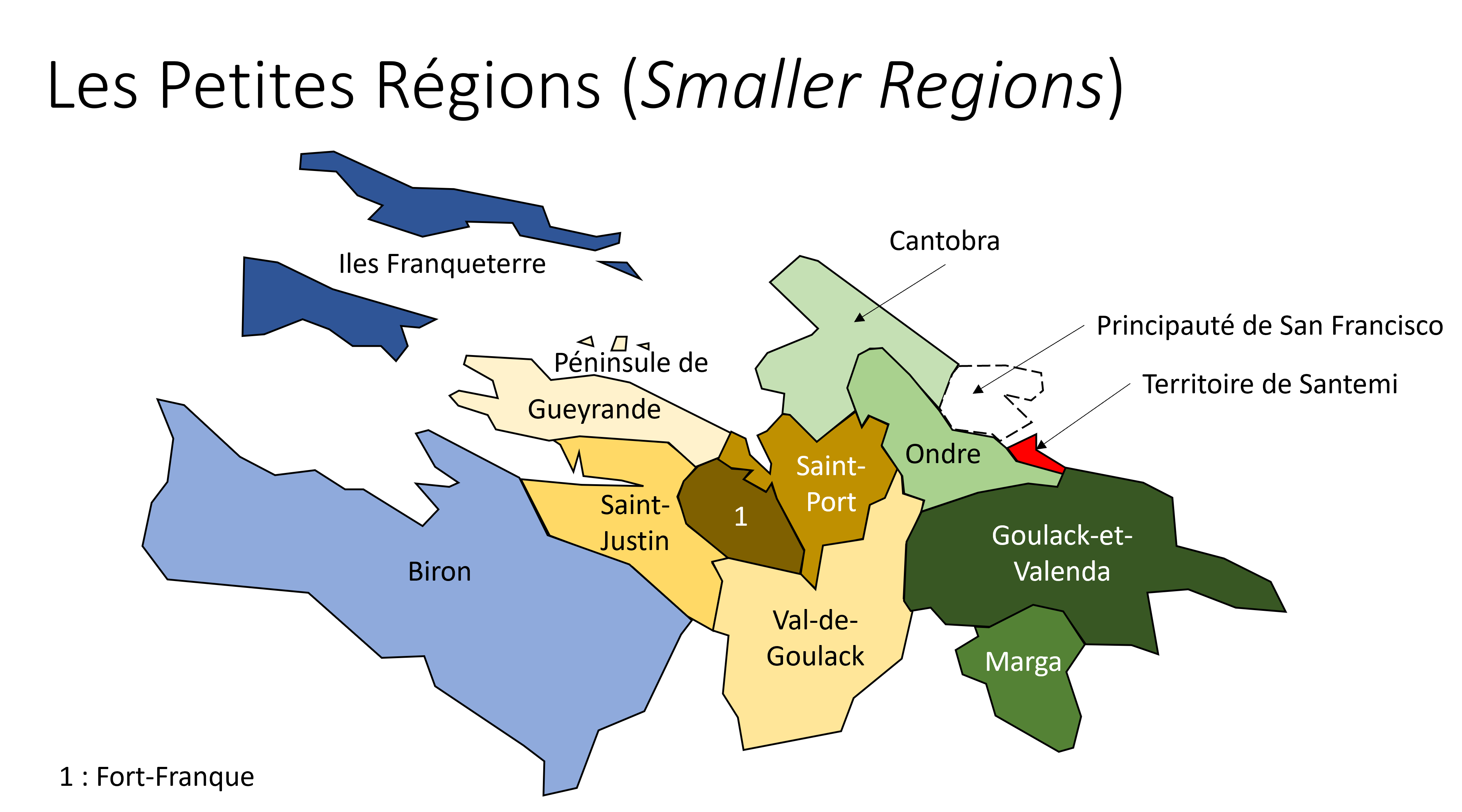
Schematic map of the Small Regions of Franquese Liberan.
License
| This map is a derivative of the OpenGeofiction base map, which is licensed under the Creative Commons Attribution-NonCommercial-ShareAlike License and is released under the same license. |
File history
Click on a date/time to view the file as it appeared at that time.
| Date/Time | Thumbnail | Dimensions | User | Comment | |
|---|---|---|---|---|---|
| current | 10:14, 26 October 2024 | | 4,408 × 2,483 (423 KB) | Paul Pfh (talk | contribs) | |
| 20:09, 12 September 2024 | Error creating thumbnail: File missing | 4,445 × 2,483 (393 KB) | Paul Pfh (talk | contribs) | ||
| 20:07, 12 September 2024 | Error creating thumbnail: File missing | 4,445 × 2,483 (387 KB) | Paul Pfh (talk | contribs) | ||
| 16:13, 25 August 2023 | Error creating thumbnail: File missing | 4,018 × 2,232 (349 KB) | Paul Pfh (talk | contribs) |
You cannot overwrite this file.
File usage
The following page uses this file: