File:JKP-25-04 D2.3 - Watersheds.png

Size of this preview: 800 × 594 pixels. Other resolution: 2,388 × 1,774 pixels.
Original file (2,388 × 1,774 pixels, file size: 717 KB, MIME type: image/png)
Summary
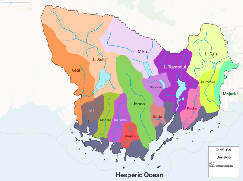
Watershed plan for JKP-25-04. Shows general drainage basins in the country.
Own work, with OGF map in background.
File history
Click on a date/time to view the file as it appeared at that time.
| Date/Time | Thumbnail | Dimensions | User | Comment | |
|---|---|---|---|---|---|
| current | 17:44, 28 June 2025 | | 2,388 × 1,774 (717 KB) | Varnel maiser (talk | contribs) | Watershed plan for JKP-25-04. Shows general drainage basins in the country. Own work, with OGF map in background. Category:Joriskjo |
You cannot overwrite this file.
File usage
The following page uses this file: