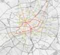
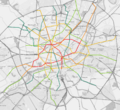
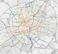
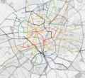
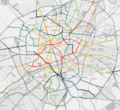
 | File:LCTAmap.png [[Category:Transport maps]]
(3,780 × 1,050 (1.34 MB)) - 21:54, 8 May 2023 |
My biggest hobbies are public transport and maps, however I also like photography and cooking.
3 KB (365 words) - 18:40, 25 May 2024
...route on the sea, rivers, or other waterways. Ferries are a form of public transport that operate to connect road networks and to provide passenger service much
...e to have on the map in my opinion, especially as they often represent key transport routes for the people who live in these remote communities. --[[User:Lithi
5 KB (772 words) - 20:05, 16 May 2022
...r flooding with few high points. [https://i.imgur.com/1cIogC8.png Proposal maps] Climate will be hot and wet similar to neighbor territories.
...t facilities. Roads but little or no cars and mainly scooters and feet for transport.
4 KB (582 words) - 22:18, 5 March 2023
...an do is make a detailed observation of cities in the real world. Look at maps of real cities, especially ones you might want to use as a model for your f
...e them and explore the different principles and patterns behind them. The maps below illustrate parts of various cities around the globe, all shown at the
13 KB (2,117 words) - 16:03, 9 October 2021
* [[Help:Using the MultiMaps extension|Using slippy maps]]
...ps://wiki.opengeofiction.net/util/route_relations.html Route relations and transport viewer]
8 KB (1,000 words) - 10:27, 19 August 2022
...a military base, four hydroelectric dams, historical monuments, a complete transport network with metro, tram, regional trains, three major stations as well as
*** It's ok, I added the link of the two sketch maps in the sections concerned.
6 KB (1,012 words) - 08:27, 31 August 2022


