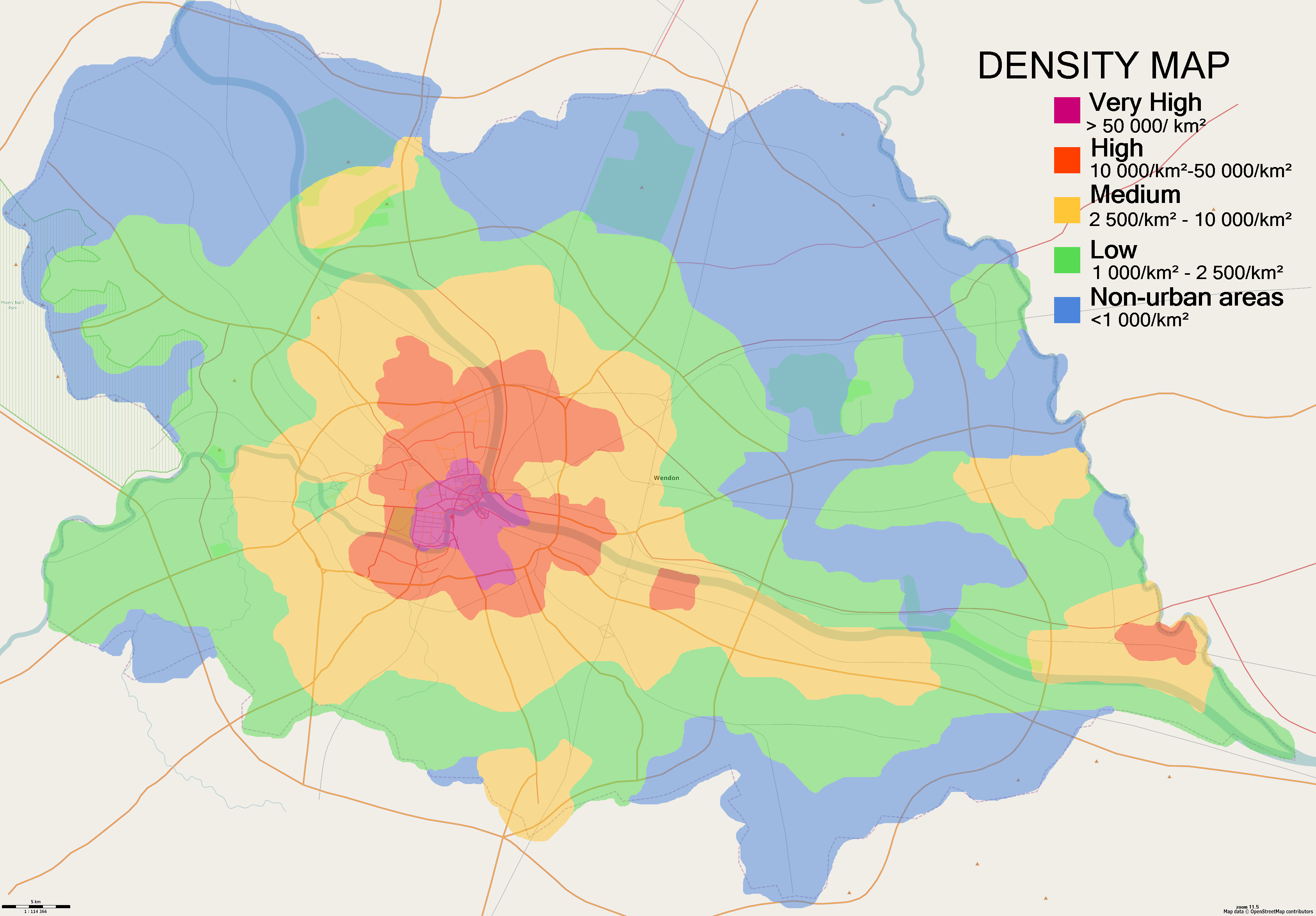
File:Wendon - Density 2024-05-21.png
Size of this preview: 800 × 557 pixels. Other resolutions: 2,560 × 1,782 pixels | 3,372 × 2,347 pixels.
Original file (3,372 × 2,347 pixels, file size: 1.01 MB, MIME type: image/png)
Own work. Made with Maperitive and JOSM.
License
| Error creating thumbnail: Attribution | This map is a derivative of the OpenGeofiction base map, which is licensed under the Creative Commons Attribution-NonCommercial-ShareAlike License and is released under the same license. |
File history
Click on a date/time to view the file as it appeared at that time.
| Date/Time | Thumbnail | Dimensions | User | Comment | |
|---|---|---|---|---|---|
| current | 03:47, 21 May 2024 | | 3,372 × 2,347 (1.01 MB) | Sudo91 (talk | contribs) |
You cannot overwrite this file.
File usage
The following page uses this file: