File:AN136-split.svg

Size of this PNG preview of this SVG file: 796 × 599 pixels. Other resolution: 2,560 × 1,927 pixels.
Original file (SVG file, nominally 1,121 × 844 pixels, file size: 674 KB)
Summary
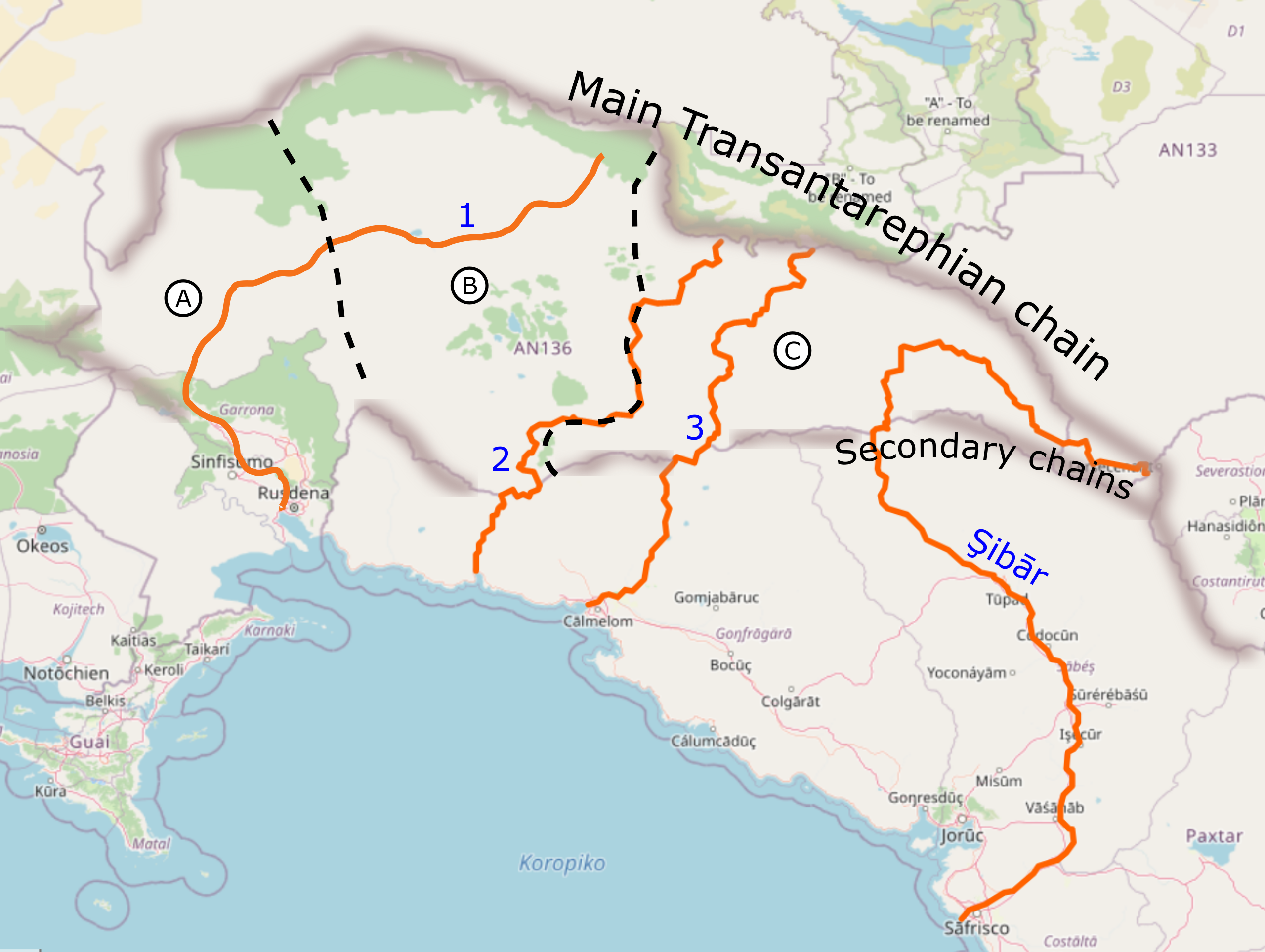
Map for Forum topic: A,B,C are potential splits for AN136 with the dash lines as rough border location
Licensing
| This image is licensed under the Creative Commons Attribution-NonCommercial-ShareAlike License |
File history
Click on a date/time to view the file as it appeared at that time.
| Date/Time | Thumbnail | Dimensions | User | Comment | |
|---|---|---|---|---|---|
| current | 14:29, 13 February 2022 | | 1,121 × 844 (674 KB) | Aiki (talk | contribs) | Map for Forum topic: A,B,C are potential splits for AN136 with the dash lines as rough border location Category:Regional maps |
You cannot overwrite this file.
File usage
The following page uses this file: