File:Map Vinn Sea with stuff.jpg
Size of this preview: 501 × 600 pixels. Other resolution: 1,620 × 1,940 pixels.
Original file (1,620 × 1,940 pixels, file size: 497 KB, MIME type: image/jpeg)
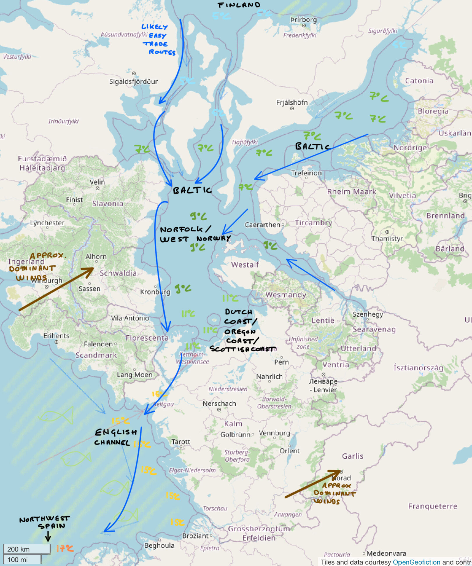
A further attempt at thinking about what the climate in the Vinn sea area looks link, in the form of a more detailed map.
License
| This map is a derivative of the OpenGeofiction base map, which is licensed under the Creative Commons Attribution-NonCommercial-ShareAlike License and is released under the same license. |
File history
Click on a date/time to view the file as it appeared at that time.
| Date/Time | Thumbnail | Dimensions | User | Comment | |
|---|---|---|---|---|---|
| current | 18:29, 11 March 2023 | | 1,620 × 1,940 (497 KB) | Portier (talk | contribs) |
You cannot overwrite this file.
File usage
The following page uses this file: