File:Northeastern FSA Geography.png: Difference between revisions
Fluffr Nuttr (talk | contribs) (Ideas for northeastern FSA geography, including fall lines, lakes, rift valleys and the Quep-Marlington basin) |
Rustem Pasha (talk | contribs) m (license) |
||
| Line 1: | Line 1: | ||
== Summary == | == Summary == | ||
Ideas for northeastern FSA geography, including fall lines, lakes, rift valleys and the Quep-Marlington basin | Ideas for northeastern FSA geography, including fall lines, lakes, rift valleys and the Quep-Marlington basin | ||
== License == | |||
{{cc-ogf-map}} | |||
[[Category:Suggestion drafts]] | |||
Latest revision as of 09:56, 28 July 2023
Summary
Ideas for northeastern FSA geography, including fall lines, lakes, rift valleys and the Quep-Marlington basin
License
| This map is a derivative of the OpenGeofiction base map, which is licensed under the Creative Commons Attribution-NonCommercial-ShareAlike License and is released under the same license. |
File history
Click on a date/time to view the file as it appeared at that time.
| Date/Time | Thumbnail | Dimensions | User | Comment | |
|---|---|---|---|---|---|
| current | 01:39, 28 July 2023 | 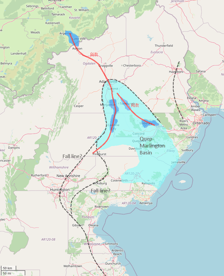 | 744 × 915 (374 KB) | Fluffr Nuttr (talk | contribs) | Ideas for northeastern FSA geography, including fall lines, lakes, rift valleys and the Quep-Marlington basin |
You cannot overwrite this file.
File usage
The following page uses this file: