File:Tolulu base map.png
Size of this preview: 742 × 600 pixels. Other resolution: 1,501 × 1,213 pixels.
Original file (1,501 × 1,213 pixels, file size: 232 KB, MIME type: image/png)
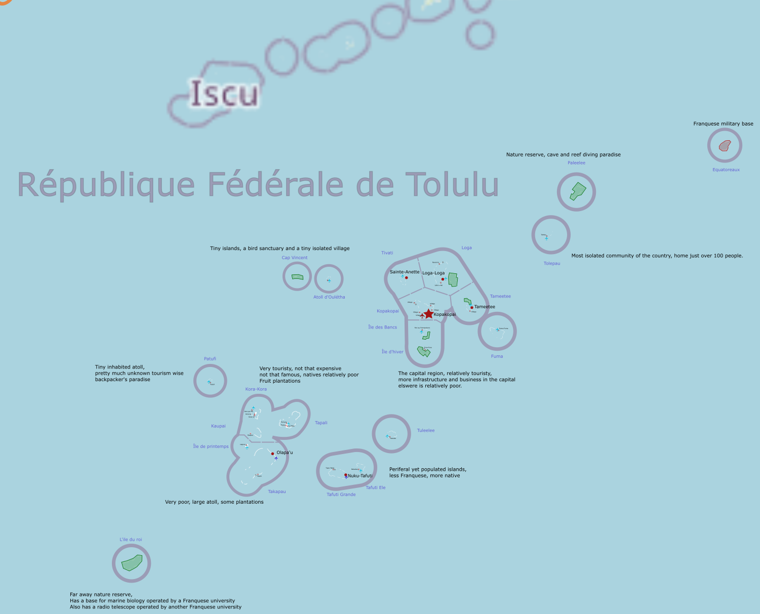
Map of Tolulu for the purpose of territory request, showing islands, their names and settlement placements as well as airport and airfield locations and some large scale land use such as nature reserves or military installations.
File history
Click on a date/time to view the file as it appeared at that time.
| Date/Time | Thumbnail | Dimensions | User | Comment | |
|---|---|---|---|---|---|
| current | 20:02, 5 February 2023 | | 1,501 × 1,213 (232 KB) | Liadrien (talk | contribs) | smaller resolution |
| 19:59, 5 February 2023 | Error creating thumbnail: File with dimensions greater than 12.5 MP | 5,500 × 4,446 (1.11 MB) | Liadrien (talk | contribs) |
You cannot overwrite this file.
File usage
The following page uses this file: