Huysburg
History
Early Colonial Period (1520-1630)
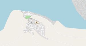
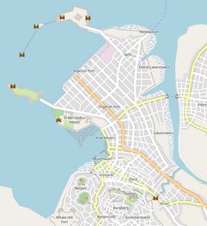
The exact timing of the founding of Huysburg is disputed, but documents from Noordkaap mention a "Huys met Burg ende Have" in 1543, most probably corresponding to Huysburg. A small fortress was build before 1550 as indicated by archaeological findings, while the a wall was build around the hilltop town center around 1575, and around the downtown harbor around 1580. Lentia trading archives from 1594 mention "Huys-by-Burgh" as a small harbor from where wood and fruits were exported. In the early 1600s Huysburg grew as an important trading center for southern Fayaan. New settlements in the Klaarmeer area produced more and more fruits that were exported to Lentia, while the logging industry became a major economic driver for the area. Huysburg became the major ship building town of northern Archanta.
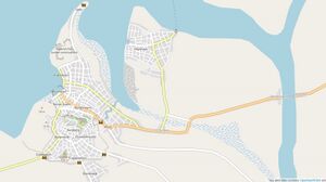
The Leeye River mouth shifted northwards after a major hurricane in 1618, resulting in fast silting up of the harbor area. Several attempts to dredge the harbor failed. A small new harbor community (Kleynhave) developed on the Leeye banks more to the north, while the old harbor became completely useless in 1628.
Late Colonial Period (1630-1720)
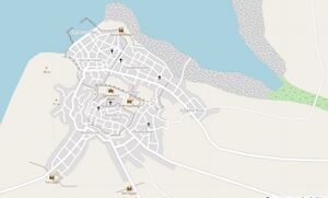
In 1629 the governor ordered the construction of a new harbour near the city center. The mudflats north of the city were drained and between 1630 and 1647 a new downtown city centre was built. City walls were extended and a new fort (Fort Domestica) was constructed. The new harbour was also walled with a seawall, partially constructed from stone, protecting the harbour from storms. But the same wall also increased siltation and harbour maintenance costs remained high.
After the Ingerish occupation in 1690, Huysburg remained an importing trading centre. New Ingerish markets opened for trade, and Ingerland further developed farming, logging and mining in the hinterland. But from the early 1700s on more and more trade went to the Fayaan City area.
During the early 1700s further silting up of the bay and harbour posed more and more challenges for the port. The Ingerish further fortified the city, connecting the city walls in the hilly southern suburbs around 1710. The construction of a large seaside citadel was started in 1712, but never finished due to increasing costs and the coastline shifting seawards (making the citadel useless).
Away from the Ingerish controlled city centre, Kleynhave developed as a secondary urban centre. It flourished thanks to uncontrolled smuggling. A small fishing port/dock was built around 1695.
Ingerish Expansions 1720-1783
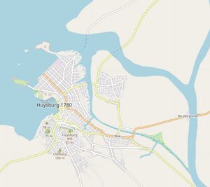
During the late 1710s saltation problems increased, while the population was growing fastly due to the fast development of the hinterland and the Klaarmeer area. A new Ingerish governor, William Clarke, decided on a large urban renewal project. An entire new harbor was build on reclaimed land, protected by seaside forts and a seawall. The new city was flanked by the new Sint Bernardus Abbey and hospital. A fort was build on the Whale Hill in the southern parts of town, while also landside defenses were enforced. The Kleynhave area expanded and became an important transport center, connecting the city with the north through ferries.
