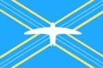
Marize

|
Republic of Marize Capital: St. Niles
Population: 368,509 (2020) |
Loading map... |
Marize, officially the Republic of Marize, is a constitutional republic in the northern part of Antarephia.The country is composed of 6 districts. The largest cities are Marize Town, St. Miles, and Dabago. The majority of the population lives along the coasts of the country while the interior is sparsely populated and undeveloped. Furthermore, the country is bordered by AN104 in the south. The most common languages spoken are Ingerish and Marizean Creole. Marizeis a member of the Ingerish Commonwealth and the Assembly of Nations.
| Marize | |||
|---|---|---|---|
| |||
Loading map... | |||
| Capital | St. Niles | ||
| Largest city | Marize Town | ||
| Official languages | Ingerish • Marizean Creole | ||
| Demonym | Marizean | ||
| Government | Constitutional republic | ||
| • Prime Minister | |||
| Area | |||
| • Total | 4,781.23 km2 1,880.79 sq mi | ||
| Population | |||
| • Census (2020) | 368,509 | ||
| Drives on the | right | ||
Etymology
History
Geography
The landscape in Marize consists of forested hills, volcanoes, rocky cliffs, and sandy beach's. The principal rivers of Marize are the Grappellu River and the Priddy River
Administrative Divisions: Saint Milton: Dabago Turacaya: Marize Town Eastmore: St. Niles Kings Church: Stedman Saint Laurel: Folkerts Bay Mantabee: Bambril
