File:Glaster+Kingswin plan.png
Size of this preview: 654 × 600 pixels. Other resolution: 869 × 797 pixels.
Original file (869 × 797 pixels, file size: 242 KB, MIME type: image/png)
Summary
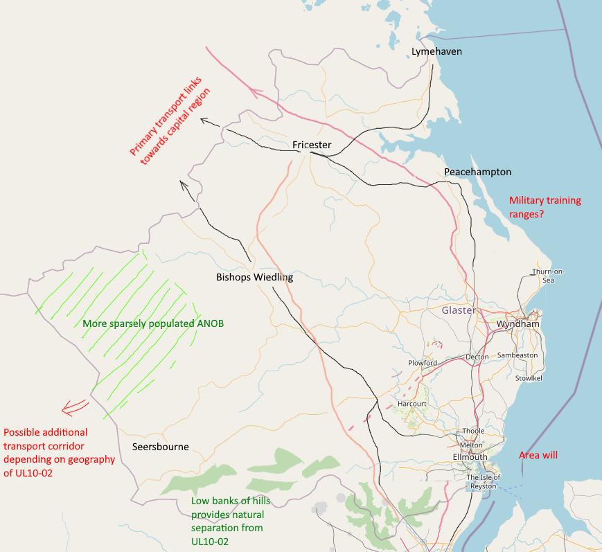
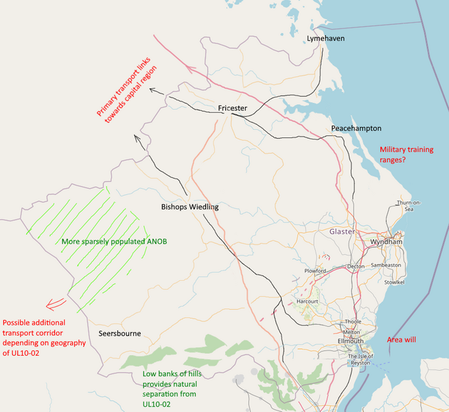
Preliminary geographical sketch of Glaster and Kingswin. Own work.
Licensing
| This map is a derivative of the OpenGeofiction base map, which is licensed under the Creative Commons Attribution-NonCommercial-ShareAlike License and is released under the same license. |
File history
Click on a date/time to view the file as it appeared at that time.
| Date/Time | Thumbnail | Dimensions | User | Comment | |
|---|---|---|---|---|---|
| current | 00:26, 1 July 2023 | | 869 × 797 (242 KB) | Yuanls (talk | contribs) | Preliminary geographical sketch of Glaster and Kingswin. Own work. |
You cannot overwrite this file.
File usage
The following page uses this file: