Index:Territory descriptions and Sainðaul: Difference between pages
No edit summary |
|||
| Line 1: | Line 1: | ||
{{ Infobox settlement | |||
|coords_zoom = | |||
|coords_y = | |||
|coords_x = | |||
|layer = | |||
|name = Sainðaul | |||
|native_name = <span style="font-size:120%; line-height: 1.31em;">安作崎・首都特別自治区</span><br/> [[File:Saindzaul_in_kasechi.png|70px]] | |||
|settlement_type = [[Capital Special Administration District]] | |||
|image_flag = Sainzaul flag.png | |||
|flag_caption = Flag of Sainðaul | |||
|image_coat = | |||
|coat_caption = | |||
|loc_type1 = Country | |||
|loc_name1 = [[Izaland]] | |||
|loc_type2 = | |||
|loc_name2 = | |||
| image_custom = | |||
| alt_custom = | |||
| custom_caption = | |||
|image_map = Saindzaul_montage.jpg | |||
|alt_map = | |||
|map_caption = '''From top, left to right''': Tsumiji Station area, Shiitehongi Sumatai Shrine, the dense skyscraper cluster of Eigandan-Senpyan, the Presidential Palace in Kokendake, a view of Kanbata Business Center, the pedestrian street of Tofyushanku Lan, a skater jumping in front of the city skyline, Saint Jeronym Cathedral, night view of Jaihonmu Lan | |||
|ethnic_groups = | |||
|ethnic_groups_year = | |||
|nationalities = Izaki | |||
|demonym = Saindzaulian | |||
|leader_title1 = City Governor | |||
|leader_name1 = Jumyo Attenki<br/>(寿苗掬石) | |||
|leader_title2 = Vice Governor | |||
|leader_name2 = Nahami Tossari | |||
|area_type1 = Total | |||
|area_size1_km2 = 591,12 | |||
|area_type2 = | |||
|area_size2_km2 = | |||
|elevation_m = 0 - 567 | |||
|elevation_ft = | |||
|population_estimate = 14,829,146 | |||
|population_estimate_year = 2021 | |||
|population_census = | |||
|population_census_year = | |||
|population_density_km2 = | |||
|population_density_sq_mi = | |||
|postal_code = 100-0001 - 100-0599 | |||
|telephone_code = 02 | |||
|metro = tbd | |||
|tram = | |||
|website = toshi.saindzaul.gov.iz | |||
|}} | |||
: | '''Sainðaul''' (𖬖ᣟᛁᐡ𖬪𖬰ᣟ𐐢ᘁ, 安作崎・首都特別自治区 ''Sainðaul shuto tukubyes jitsiku''; traditional name in Ingerish '''Sinezawool''', Gaerman '''Zeinzwaül''', IPA reading: /'sainʣa‿ul/) is the largest city and the national capital of [[Izaland]], located one third from north of the country across the Tandan Strait. Sainðaul is one of the most crucial international hubs for economym, culture, finance, production and tourism with nearly 15 millions inhabitants in the metropolitan city (the National Capital District, which corresponds to the city area plus some suburbs), increasing to 22,6 millions including the [[Greater Sainðaul Metropolitan Area]]. | ||
| | |||
* '' | == Etymology - 地名由来== | ||
* '' | The name Sainðaul has uncertain origins, and the first records showing something similar to the current name date back to 1243, as in the '''Kojunjasshishū''' (古旬雑詩集) poem the name "Saen Tsoi Ōl" is mentioned. The [[hanji]] currently used for the city name, 安作崎, literally mean "peace - making - promontory", and were first introduced in the Agahaki Reforms of 1659, probably to represent the sound rather for the real meaning. | ||
== Geography - 地質== | |||
Sainðaul is located accross the two shores of the Tandan Strait, occupying either the continental part of Izaland, either part of Kubori island. | |||
The original, oldest and historical core of the city is located on [[mount Kokendake]], a less than 200 m hill located 6 km from the central station, that represents the new center of the city. As the settlements expanded towards the sea, along the [[Ariston river]] delta and the nearby islands, since the beginning of the 20th century a wider expansion on the [[Kubori island]] side has seen a major development. Until 1946, the urbanization on Kubori island was actually a different entity, as it was made up of many villages and towns, being '''Bajikoe''' (桐塚, ''Bajikoe'') the main center, with a population of less than 800,000 people in 1945. Even today, going to the western side of the city is referred as "traveling to Bajikoe", although being the western part larger than the original center, the definition is quite wide, so usually one specifies in which area is heading to. [[Bajikoe river|Bajikoe]] is also the name of one of the three rivers crossing the city and eventually reaching the [[Sound of Pa]] in the western area, the other two being [[Jaiken river]] and [[Kunkobe river]]. | |||
The city is almost located on a flat location, however many of the islands in the bay are mountainous, such as Mount Romokagego (567) and Mount Kingaus (456 m), creating a beautiful views when crossing the strait. In the districts of Takarimoto and Tomanae, south west, there are also low mountains and hilly areas, while Garotsu ward also has a vast wetland area, and many little lakes. | |||
On the eastern part of the National Capital Special District, there are a bunch of towns under the special administration of the capital: Shakihori, Shimoroboe, Dankau, Kaimura and Yōneo. | |||
=== Climate === | |||
== History == | |||
The first settlements in the current area of Sainðaul date back to 7500 BC, as the necropolis of Chikurai and Oebatsun suggest. | |||
At that time the Ariston river delta was more inland than it is nowadays, and the civilization dwelling in this area was probably devoted to fishing. | |||
Talking about the first record of a community in the area, the most ancient settlement was probably the nowadays Pakkishoi, then called Arawis. | |||
==Neighborhoods and cityscape== | |||
[[File:Plaza Carso - CDMX - 2013 - 2.jpg|thumb|right|300px|External view of the DANKORE Museum of Art]] | |||
As already stated, Sainðaul is deeply divided geographically into the eastern, traditional area, and the western relatively recently developed portion, and this division is actually easy to feel while traveling within the city. | |||
The people living in the eastern part, still considered the city center, as it keeps the old town in Kokendake, the central station, most of the government buildings and some of the most ancient universities, watch from a position of superiority the newer western side (Bajikoe), located on Kubori island. | |||
Although nowadays the income and wealth differences between the two parts are nearly not visible, almost until half of the previous century Bajikoe area was widespreadly known to be relatively poor and undeveloped comparing to the affluent old city. | |||
Since the early 1990s, the west side has been the focus of a large number of public and private investments, with the construction of railways, subways and large real estate projects, particularly following the opening of the new Asunahama International Airport in 2014. This has attracted a large number of foreign companies, which have located their representative offices near the Eisen area (Eigandan-Senpyan), which is now a pole of competition with the traditional business district of Herubori, to the east. | |||
=== East side (東部) === | |||
<div style="float: right; padding: 2px"> | |||
{{#multimaps: | |||
| zoom = 12 | |||
| height = 500px | |||
| width = 500px | |||
| center = 36.0216, 128.9876 | |||
| Marker = 36.0164, 129.0320 ~ Kokendake ~ 古剣舘 | |||
| Marker = 36.02371, 129.04748 ~ Eikuku-ji Temple ~ 永國寺 ~ | |||
| Marker = 36.02644, 129.02727 ~ St. Anthony Cathedral ~ 聖𖬮ᐢ𖬁ᐤ𖭑ᛁᒢ大聖堂 | |||
| Marker = 36.0289, 128.9975 ~ Kushidaru Amiya Station ~ | |||
| Marker = 36.0108, 128.9881 ~ Herubori Station ~ 杏登駅 | |||
| Marker = 36.0204, 128.9663 ~ Sainðaul Central ~ 安作崎𖬖ɭᐢ𖬁𐐢𖬬ᐡ | |||
| Marker = 36.0374, 128.9754 ~ Ekinðuka / Rosemane ~ | |||
| Marker = 36.0567, 129.0087 ~ Jufurai ~ 朱布來 ~ | |||
}} | |||
</div> | |||
The official name of the east side, in Izaki, is '''Dōnbu'' (東部), and this area indicates all the extension of Sainðaul on the Ulethian (continental) side. | |||
The core of the city is located on the delta of the Shirusano River, and on 27 islands located in front of it. Originally the Shirusano River flowed into the Tandan Strait with three branches, but some modifications made during the 19th century have diverted the course of the river and dried up some of the lateral branches, modifying the structure of the delta. | |||
The most notable areas of the east side are: | |||
*'''Kokendake''', placed on the central-eastern area of the city, is the original core, with the historical center located on Mount Kokendake, registered as a [[Ulethan Heritage Site]]. This old town like area, places at a height of 100 to 150 m on the sea level, overlooks the rest of the newest urban development, and is often considered as the "Terrace of Sainðaul". On the back of Kokendake there are two wide Buddhist temple areas, also part of the historical and cultural heritage, while the front area downhill hosts the huge '''Kokendake Palace''' esplanade and the park itself, extending more than 1,3 square kilometers. | |||
* North-east of the Kokendake hill we find the '''Eikuku-ji temple''', founded in 1467, and its surrounding, one of the oldest areas of the historic center. | |||
* Near '''Kushidaru-Amiya station''' the most upscale and elegant area of Sainðaul takes place, with boutiques, refined restaurants and well established hotels in traditional historical buildings. The style of the buildings in this area, mostly built between the 18th and 19th centuries, are influenced by the cultural and architectural styles of the nations of the western Axian peninsula, with some Victorian, Neoclassical and Neo-Gothic buildings. During this age, many architects from Kojo and Saikyel built several noteworthy buildings, including the National Opera, St. Anthony's Cathedral, and the Parliament building, designed by .... | |||
*'''Herubori''' is a major business area, where most of the company headquarters are located, spreading as well towards '''Aketsue''' station, where media companies and design studios are concentrated. in the west area of Aketsue we also find '''Tomobeye Lan''', one of the hearts of the famosu Izaki teen culture, where apparel shops, cafes, restaurants and game centers are especially spread. | |||
* The '''Sainðaul Central Station''' east area, the result of an urban refurbishment project carried on during the 80s, with the 750 m long Noujinkade Boulevard, notable buildings such as the '''Sainðaul City Hall''', designed by the famous Izaki architect Pakali Yassukōri or the central library (architect: Kinshōn Erauki). Other points of interest include the Botanic Gardens, the '''Higoi Tamutta Museum of Art''', visited every year by 20 millions of visitors, especially for objects like "the shadow" or "suspended", the Kaipō-ji Temple and Saint Luke cathedral. The west square of the station covers the [[IZX]] high speed trains and the Airport Express platform, and continues with the Oboehari Business Park. | |||
* The area between '''Ekinðuka''' and '''Rosemane''' is the main museum area of the city, where there is also an open air fossil park with some dinosaurs and other prehistorical animal rests exhibited open air. Also, in this area there are most of the embassies. | |||
* '''Shakihori''', with a population of over half a million, is an important satellite city, located north of the capital. Initially developed as bed-town, in recent years it has seen a very high growth in population, thanks to lower costs and the presence of some new university campuses that have attracted students from all countries. Here there are also Mount Katanase and Mount Yunchukahe, favorite destinations for the inhabitants of Sainðaul to be able to spend a day in nature just a few minutes from the center. | |||
* '''Jufurai''' is located north of the central area of the city, and is one of the most affluent residential areas. Here is the park of the same name, the largest in Sainðaul, and some of the most expensive homes, including villas with swimming pools and luxury residential towers. | |||
<gallery caption="Views of the East side" widths="220px" heights="150px" > | |||
Guangzhou_Opera_House.png|Herubori business district seen from the Eigan-ji Temple | |||
Changdeokgung Palace Oct 2014 006.JPG|The entrance to the Yotaidyen Royal Palace | |||
Ministry_of_Justice_Japan03s3200.jpg|The Parliament House building | |||
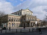
Hannoveraner_Opernhaus.jpg|The Opera House | |||
Mongchonhaeja_1.jpg|The Ekinðuka Park | |||
Matsugamine_Catholic_Church_(front)_2013-01-30.JPG|The Cathedral of Saint Anthony | |||
</gallery> | |||
===West side (西部)=== | |||
Although most of the people say "Bajikoe Area" to indicate the west side, on Kubori island, of Sainðaul, the official calling is '''Saibu'' (西部), literally meaning "west area". | |||
Coming from the east side, the first approach is probably going to be '''Kasakuri Station''', also a stop for the IZX services, and most of the [[Izarail]] cross-city network. | |||
Kasakuri Station is mainly a junction point, although some corporation headquarters, high rise residential towers and some shopping malls are also located. North of Kasakuri, the main logistics and goods shipping port area extends, with some cultural venues such as the '''DANKORE Museum of Art'''. | |||
Most of Hokusei ward is residential in its western side, and occupied by port facilities, warehouses and distribution centers on the eastern side. | |||
;Eigandan-Senpyan (永玵段船駢 / 𖬮ɭᛁ𖬖ɭᐢ) | |||
[[File:Eisen night view(ai-gen).jpg|400px|thumb|right|View of the business district of Eigandan-Senpyan by night]] | |||
Eigandan-Senpyan, commonly known as Eisen by the locals, is the bustling business core of western Sainðaul. Renowned for its vibrant commercial atmosphere, it serves as a hub for numerous international companies and multinationals, which have established their local branch offices here. One of the key factors contributing to its popularity is its direct and convenient link with the '''Asunahama International Airport''', just a short 15-minute ride away on the Airport Express. | |||
The area underwent a significant transformation with the 1996 redevelopment masterplan, resulting in a modern and dynamic cityscape, and it is home to some of the tallest buildings in Izaland, including "The Zenith." This iconic skyscraper stands tall with an impressive 94 floors and reaches a towering height of 423 meters. The presence of such architectural marvels adds to the skyline and symbolizes the district's economic prowess and cosmopolitan appeal. | |||
Despite the urbanity and towering structures, Eigandan-Senpyan seamlessly incorporates elements of natural beauty and tranquility into its modernity. The '''Ikasurun Park''', located in Pikamatsu, offers a serene oasis amidst the bustling city. Here, visitors can enjoy lush greenery, open spaces, and various recreational amenities, providing a perfect escape from the hectic urban lifestyle. Furthermore, the district is adorned with a picturesque green area that runs along the Baijikoe canal network. This carefully designed landscape harmoniously blends with the modern infrastructure, creating a refreshing environment for residents and visitors alike. The canal network not only enhances the aesthetic appeal of Eigandan-Senpyan but also contributes to the overall sustainability and ecological balance of the district. | |||
Eigandan-Senpyan stands as a testament to the city's commitment to progress, innovation, and the seamless integration of nature and urban development. It represents a vibrant and thriving business center, attracting international enterprises, while simultaneously offering a balance of modern amenities, green spaces, and recreational opportunities to ensure a high quality of life for its (rich) inhabitants. | |||
;[https://opengeofiction.net/#map=16/35.9798/128.7509&layers=B Riihisano] | |||
Riihisano, a vibrant district in south-western Sainðaul, is known for its unique blend of pop subculture, eccentric fashion, and youthful energy. It has captured the hearts of teenagers and university students, making it a popular destination for those seeking a trendy atmosphere. Riihisano's transportation is highly convenient, with excellent access provided by railways, subways, and trams. The picturesque Bajikoe canal is a major attraction, attracting people of all ages for leisure activities such as strolling, cycling, and picnicking. The canal is particularly enchanting during springtime when the district becomes famous for its breathtaking cherry blossoms. | |||
Riihisano's distinctive appeal lies in its thriving pop subculture, which is a hub of creativity and artistic expression. The streets are adorned with vibrant graffiti, and its shops and boutiques offer unique fashion items reflecting the district's eclectic and avant-garde style. The district also boasts a bustling nightlife, with numerous clubs, bars, and live music venues catering to the energetic and diverse tastes of its residents and visitors. From underground music scenes to mainstream pop performances, Riihisano's entertainment venues ensure there is never a dull moment in the district. | |||
=== Notable landmarks === | |||
;List of the tallest structures | |||
{|class="wikitable sortable plainrowheaders" | |||
|- | |||
!scope="col"| Name | |||
!scope="col"| Image | |||
!scope="col"| Height<br /><small>[[Metre|m]] ([[Foot (length)|ft]])</small> | |||
!scope="col"| Floors | |||
!scope="col"| Year | |||
!scope="col"| Ward | |||
!scope="col" class="unsortable"| Notes | |||
|- | |||
!scope="row"| {{way|20625217|Twaisahanga Tower 156}} | |||
| | |||
[[File:Tswaisahanga tower.png|150px|center]] | |||
| align="center"|782 (2566) | |||
| align="center"|156 | |||
| align="center"|2017 | |||
| | |||
| One of the tallest buildings in the world | |||
|- | |||
!scope="row"| {{way|25845866|Koneei BOX}} | |||
|[[File:Koneei BOX.png|40px|center]] | |||
| align="center"|485 (1591) | |||
| align="center"|86 | |||
| align="center"|2016 | |||
| | |||
| | |||
|- | |||
!scope="row"| {{way|21622256|Eigandan Senpyan The Zenith}} | |||
| | |||
[[File:Eigandan Senpyan The Zenith.png|60px|center]] | |||
| align="center"|423 (1388) | |||
| align="center"|94 | |||
| align="center"|2016 | |||
| | |||
| | |||
|- | |||
!scope="row"| {{way|22403749|Rosemane Gate Tower 105}} | |||
| | |||
[[File:Rosemane Gate Tower 105.png|40px|center]] | |||
| align="center"|416 (1364) | |||
| align="center"|105 | |||
| align="center"|2008 | |||
| | |||
| | |||
|- | |||
!scope="row"| {{relation|242654|Vertigo Tower}} | |||
| | |||
| align="center"|401 (1315) | |||
| align="center"|76 | |||
| align="center"|1998 | |||
| | |||
| | |||
|- | |||
!scope="row"| {{way|22673110|Firanda Tower}} | |||
| | |||
| align="center"|397 (1302) | |||
| align="center"|86 | |||
| align="center"|2008 | |||
| | |||
| | |||
|- | |||
!scope="row"| {{relation|261284|Kashimas Tower NE}} | |||
| | |||
| align="center"|367 (1204) | |||
| align="center"|78 | |||
| align="center"|2010 | |||
| | |||
| | |||
|- | |||
!scope="row"| {{node|279009891|iLand Tower A}} | |||
|[[File:ILand Tower AD.png|40px|center]] | |||
| align="center"|342 (1122) | |||
| align="center"|85 | |||
| align="center"|2016 | |||
| | |||
| | |||
|- | |||
!scope="row"| {{node|279009888|iLand Tower D}} | |||
|[[File:ILand Tower AD.png|40px|center]] | |||
| align="center"|342 (1122) | |||
| align="center"|85 | |||
| align="center"|2016 | |||
| | |||
| | |||
|- | |||
!scope="row"| {{way|18555683|IDK Building}} | |||
| | |||
| align="center"|351 (1151) | |||
| align="center"|82 | |||
| align="center"|2008 | |||
| | |||
| | |||
|- | |||
!scope="row"| {{way|26332610|Ippenjaki Kajaringa Jutaku}} | |||
| | |||
| align="center"|331 (1085) | |||
| align="center"|68 | |||
| align="center"|2019 | |||
| | |||
| | |||
|- | |||
!scope="row"| {{way|23840468|Ippenjaki Kajaringa Jutaku}} | |||
| | |||
| align="center"|323 (1063) | |||
| align="center"|67 | |||
| align="center"|2008 | |||
| | |||
| | |||
|- | |||
!scope="row"| {{way|22673113|Eisen Station Tower}} | |||
| | |||
| align="center"|296 (971) | |||
| align="center"|69 | |||
| align="center"|2010 | |||
| | |||
| | |||
|- | |||
|} | |} | ||
{| class="wikitable" style=" | ''To be continued'' | ||
==Administrative divisions== | |||
Sainðaul does not exist as a '''city''' (市, ''shi'') per se, like the other cities of Izaland. Instead, its top level administrative definition is the '''Capital Special Administration District'''. The subdivisions of Sainðaul are 20 '''wards''' (區, ''ku''), four cities (市, ''shi'') and two towns (町, 'nata'): | |||
===Special Wards (特別区) === | |||
{| class="wikitable" width = 650px style="font-size:90%;" align=center | |||
! Name | |||
! Askaozhi | |||
! Byakuzhi | |||
! Location | |||
! Population<br> (2021) | |||
|----------bgcolor=lightblue | |||
|Colspan=5 align=center|'''— Wards —''' | |||
|---------- | |||
| Asaji-ku || 𖬮𖬖𖬐𖬰ᛁ𖬭𐐢|| 安佐寺區|| East || tbd | |||
|- | |||
| Bajikoe-ku || 𖬇𖬰𖬐𖬰ᛁ𖬭ᐤɭ𖬭𐐢|| 桐塚區|| West || tbd | |||
|- | |||
| Garotsu-ku || 𖬭𖬰𖬬ᐤ𖬑𐐢𖬭𐐢|| 賀呂都區 || East || tbd | |||
|- | |- | ||
| Hayatogaru-ku || 𖬨𐭘𖬮𖬁ᐤ𖬭𖬰𖬬𐐢𖬭𐐢|| 久松區|| East || tbd | |||
| | |||
| | |||
|- | |- | ||
| Intsushitsa-ku || 𖬮ᛁᐢ𖬑𐐢𖬔ᛁ𖬑𖬭𐐢 || 鰤基區|| East || tbd | |||
| | |||
| | |||
|- | |- | ||
| | | Jufurai-ku ||𖬐𖬰𐐢𖬌𐐢𖬬꜉𖬭𐐢|| 朱布来區|| East || tbd | ||
| | |||
|- | |- | ||
| | | Juwon-ku || 𖬐𖬰𐐢𐩪𖬮ᐢ𖬭𐐢|| 中央區|| East || tbd | ||
| | |||
| | |||
| | |||
| | |||
|- | |- | ||
| Keiyān-ku || 𖬭ᥫ𐭘𖬮⸠ᐢ𖬭𐐢|| 桂陽區 || West|| tbd | |||
| | |||
| | |||
|- | |- | ||
| | | Kokendake-ku || 𖬭ᐤ𖬭ɭᐢ𖬒𖬰𖬭ɭ𖬭𐐢|| 古剣館區 || East || tbd | ||
|- | |- | ||
| | | Kyōði-ku || ꓩ𖬭⸠𖬑𖬰ᛁ𖬭𐐢|| 峡上區 || East || tbd | ||
|- | |- | ||
| Kyōyos-ku || ꓩ𖬭⸠ꓩ𖬮ᒢ𖬭𐐢|| 峡越區 || East || tbd | |||
| | |||
| | |||
| | |||
|- | |- | ||
| | | Riihisano-ku || 𖬬ᛁ⸠𖬨ᛁ𖬖𖭑ᐤ𖬭𐐢|| 尾本區 || West|| tbd | ||
|- | |- | ||
| | | Saikō-ku || 𖬖꜉𖬭ᐤ⸠𖬭𐐢|| 西港區 || West|| tbd | ||
| | |||
|- | |- | ||
| | | Shiki-ku || 𖬔ᛁ𖬭ᛁ𖬭𐐢|| 北區 || East || tbd | ||
| | |||
|- | |- | ||
| | | Shutazai-ku || 𖬔𐐢𖬁𖬖𖬰꜉𖬭𐐢|| 守多彩區 || West|| tbd | ||
|- | |- | ||
| | | Takarimoto-ku || 𖬁𖬭𖬬ᛁ𖬊ᐤ𖬁ᐤ𖬭𐐢|| 浚里鏡區 || West|| tbd | ||
| | |||
|- | |- | ||
| | | Tanahama-ku || 𖬁𖭑𖬨𖬊𖬭𐐢|| 多那島區 || West|| tbd | ||
|- | |- | ||
| | | Tobeskauri-ku || 𖬁ᐤ𖬇𖬰ɭᒢ𖬭'𐐢𖬬ᛁ𖬭𐐢|| 鴨沼區 || East || tbd | ||
|- | |- | ||
| | | Tomanae-ku || 𖬁ᐤ𖬊𖭑'ɭ𖬭𐐢|| 庥内區 || West|| tbd | ||
| | |- | ||
| Wikkaman-ku || 𐐊𖬮𖬘𖬳𖬊ᐢ𖬭𐐢|| 昱賀満區|| West|| tbd | |||
|} | |||
===Special cities=== | |||
* '''Shakihori-shi''' (石登市) | |||
* '''Shimoroboe-shi''' (亀岡市) | |||
* '''Dankau-shi''' (檀洪市) | |||
* '''Ibaruno-shi''' (齒琉能市) | |||
===Special towns=== | |||
* '''Kaimura-nata''' | |||
* '''Yōneo-nata''' | |||
==Transportation== | |||
Sainðaul is the main hub of the whole country transportation, and all the north-south transit passes through the city. For this reason Sainðaul boasts a very specialized network of road and rail corridors, beside being the main aviation terminal of the country. | |||
===Railways=== | |||
The railway network expands north and south-west from the station of [[Sainðaul Central Station|Sainðaul Central]], one of the busiest stations in the world, with about 3 million users daily. From here conventional and high speed railway ([[IZX]]) cross the Tandan Strait linking the city center with Bajikoe area and other destinations on Kubori Island. At the same way, from the central station other lines diramate to connect with the capital the other main cities of the Ulethian side of Izaland. | |||
[[File:Kanmon-tunnel railway.jpg|thumb|300px|View of the eastern entrance to the Millennium Tunnel]] | |||
In particular, the main rail link between the two sides of the capital runs in a 3 km 6 tracks undersea tunnel, called [[Millennium tunnel]] connecting the stations of Shin-Ikashuni and Kasakuri. | |||
Another railway link is the Line X of the subway, providing a direct connection for the northern suburbs of Sainðaul to the center of Bajikoe. Lastly, another undersea link is the Kawashaku Line, linking Bajikoe with [[Kawayatsu]], a city north from Sainðaul on the Ulethain side. | |||
The suburban railway system of Sainðaul is called [[Capital Suburban Network (Sainðaul)|Capital Suburban Network]], and is composed by 16 lines operated by Izarail, including the [[Loop Line (Sainðaul)|Loop Line]], a circular line running in the original center. On the western side of the city, the railway infrastructure runs on a north-south double corridor. | |||
====Izarail Network==== | |||
; Loop Line | |||
{| class="wikitable" | |||
!style="border-bottom:solid 4px #34589F;"|Code | |||
!style="border-bottom:solid 4px #34589F;"|Station | |||
!style="border-bottom:solid 4px #34589F;"|Izaki | |||
!style="border-bottom:solid 4px #34589F;"|Connections with<br />other railways | |||
!style="border-bottom:solid 4px #34589F;"|Connections with<br />subway lines | |||
!style="border-bottom:solid 4px #34589F;"|Location | |||
|- | |- | ||
!LL01 | |||
|Sainðaul Central | |||
| | |作安崎中央 | ||
| | |||
* Airport Express | |||
* Chikaoi Line | |||
* Enishaku Line | |||
* Sainniga Line | |||
* Bajikoe-Dōnnei Line | |||
* IZX | |||
| | |||
*Line 1 | |||
* Line 8 | |||
*Line 10 | |||
* Line 17 | |||
* Shindōnsai Link | |||
| rowspan="3" |[[Juwon]] | |||
|- | |- | ||
!LL02 | |||
|Binno||苠喃 | |||
| | |||
| | |||
* Line 4 | |||
* Line 17 | |||
| | |||
|- | |- | ||
!LL03 | |||
|Shiitehongi||〇〇 | |||
| | | | ||
| | |||
* Line 3 | |||
| | | | ||
|- | |- | ||
!LL04 | |||
|Jigasungai Kōwen||〇〇 | |||
| | |||
| | |||
*Line 18 | |||
| | |||
|- | |- | ||
!LL05 | |||
|Jufurai Kōwen Niji||朱布来公園西 | |||
| | | | ||
| | |||
* Line 8 | |||
* Line 16 | |||
| | |||
|- | |- | ||
!LL06 | |||
|Punoidan||〇〇 | |||
| | |||
| (At Tensari Omuhate) | |||
* Line 1 | |||
* Line 16 | |||
| | |||
|- | |- | ||
!LL07 | |||
|Rupekoppe||孱槻 | |||
| | |||
| (At Tamanoke Tsunui) | |||
* Line 1 | |||
| | |||
|- | |- | ||
!LL08 | |||
|Isenebo||床踔 | |||
| | |||
| | |||
* Line 14 | |||
| | |||
|- | |- | ||
!LL09 | |||
|Igashikura (Taishin Univ.) ||品山(泰進大) | |||
| | |||
* Kidai Line | |||
| | |||
| | |||
|- | |- | ||
!LL10 | |||
|Hayatogaru||久松 | |||
| | |||
* Chikaoi Line | |||
* Ansoku Line | |||
* Kidai Line | |||
* Sainniga Line | |||
| | |||
| | |||
|- | |- | ||
!LL11 | |||
|Rakkashoni||鳶腳 | |||
| | |||
* Chikaoi Line | |||
| | |||
*Line 2 | |||
| | |||
|- | |- | ||
!LL12 | |||
|Sumi-Kokendake||隠古剣館 | |||
| | |||
* Chikaoi Line | |||
* Ansoku Line | |||
| | |||
* Line 4 | |||
(At Kushigae) | |||
* Line 16 | |||
| | |||
|- | |- | ||
!LL13 | |||
|Oritoku||壌外 | |||
| | |||
* Chikaoi Line | |||
| | |||
* Line 10 | |||
| | |||
|- | |- | ||
!LL14 | |||
|Tomiganei||庭ヶ汢 | |||
| | |||
* Chikaoi Line | |||
* Sabuonno Line | |||
| | |||
* Line 9 | |||
| | |||
|- | |- | ||
| | !LL15 | ||
| | |Tagashiga||浚藻 | ||
| | | | ||
* Chikaoi Line | |||
* Sabuonno Line | |||
| | |||
| | |||
|- | |- | ||
!LL16 | |||
|Oiseharu||粕墾 | |||
| | |||
* Chikaoi Line | |||
* Sabuonno Line | |||
(At Shin-Oiseharu) | |||
* Shinsabu Main Line | |||
| | |||
* Line 18 | |||
| | |||
|- | |- | ||
!LL17 | |||
|Herubori||杏登 | |||
| | |||
* Chikaoi Line | |||
* Sabuonno Line | |||
* Ansoku Line | |||
* Airport Express | |||
* Dōnkai Line | |||
* Shinsabu Main Line | |||
* IZX | |||
| | |||
* Line 3 | |||
* Line 12 | |||
| | |||
|- | |- | ||
!LL18 | |||
|Obakura||〇〇 | |||
| | |||
* Chikaoi Line | |||
* Sabuonno Line | |||
| | |||
* Line 12 | |||
* Line 14 | |||
| | |||
|- | |- | ||
!LL19 | |||
|Aketsue||薫都衛 | |||
| | |||
* Chikaoi Line | |||
* Sabuonno Line | |||
* Daikiri Line | |||
* Kidai Line | |||
* Enishaku Line | |||
* Bajikoe-Dōnnei Line | |||
| | |||
* Line 12 | |||
| | |||
|- | |- | ||
|} | |} | ||
[[ | Other private railways complete the network of Sainðaul. | ||
[[Category: | |||
===Tramways=== | |||
Before the heavy development of subway lines, Sainðaul had an extensive network of tramways and streetcars, which still survive with a smaller network and some isolated lines in the areas not covered by heavy rail. Still nowadays, especially after the legislation of Mayor Ikaro Asahosai in 2003, a vast program of new tramway projects is on the way, and 126 km of new tracks are going to be laid by 2025. | |||
====Metro system==== | |||
[[File:Metro Sainzaul logo with text.png|frameless|right]] | |||
The [[Sainðaul Metro]] is the mostly underground subway network of the metropolitan area, mainly developed on the two sides of the Tandan Strait. Only three lines cross the strait through the Kishagoi undersea tunnel. The system is composed by 19 lines (metro proper). | |||
{| class="wikitable" | |||
|- | |||
! Rel | |||
! Line name | |||
! Opening year | |||
! Extension | |||
! Stations | |||
! Terminus A | |||
! Terminus B | |||
! Thru Service | |||
! Main facts | |||
|- | |||
| [http://opengeofiction.net/relation/242549 1] | |||
| style="background: #FE7F00;"|'''Agarai-Dōnpuku Line''' | |||
| 1924 | |||
| 51,66 km | |||
| 30 | |||
| [http://opengeofiction.net/node/184719128 Ikashumai Sports Center] | |||
| [http://opengeofiction.net/node/146716208 Enikezya Forum] | |||
| None | |||
| | |||
* The second oldest line of the system, has been upgraded different times, and also offers and express/rapid services. | |||
* An extension from Ikashumai Sports Center to Yakata is in progress with the opening targeted by 2024 | |||
|- | |||
| [http://opengeofiction.net/relation/242565 2] | |||
| style="background: red;"|'''Hibaru Line''' | |||
| 1919 | |||
| 36,02 km | |||
| 27 | |||
| [http://opengeofiction.net/node/187344183 Naezoto] | |||
| [http://opengeofiction.net/node/135394631 Mokoba]</br>[http://opengeofiction.net/node/188737257 Hintomaui] | |||
| None | |||
| | |||
* The first subway line built in Izaland, and one of the first in Eastern Uletha, runs west-east in the old core of the city, giving access to the central station area, the government district of Amiya and the historical precincts of the Eikuku-ji Temple. | |||
* Further east the line divides into two branches, one leading to Mokoba, and the other serving as north-south corridod for the city of Oitsura. | |||
|- | |||
| [http://opengeofiction.net/relation/242566 3] | |||
| style="background: #009E4F;"|'''Shakihori Line''' | |||
| 1932 | |||
| 42,96 km | |||
| 25 | |||
| [http://opengeofiction.net/node/256366564 Ansan Shakuiadae] | |||
| [http://opengeofiction.net/node/183370158 Iyogateri] | |||
| None | |||
| | |||
* The third line of the Sainðaul Metro network, was first built to connect from north to south the central districts of the capital (Shiitehongi-Herubori). | |||
* In 2019 an extension from Bibawara to Ansan Shakuiadae opened | |||
* Offers a rapid service in the northern part, until Komayunden. South of this station all trains stop at all stations. | |||
|- | |||
| [http://opengeofiction.net/relation/242547 4] | |||
| style="background: #FFD912;"|'''Kokendake Line''' | |||
| 1937 | |||
| 18,45 km | |||
| 15 | |||
| [http://opengeofiction.net/node/129227893 Abawauri] | |||
| [http://opengeofiction.net/node/126666499 Kawaei] | |||
| Onto the Shinsabu Oitsura Line towards Oitsura | |||
| | |||
* The fourth line of the Sainðaul Metro network, runs partially parallel to the Hibaru (red) line, touching the embassy district (Aguri), the government quarter and the old city (Kushigae, from which the name comes). | |||
* Since the 1998 upgrade, this was the first former line to have a rapid service | |||
* Thru service onto the Shinsabu Oitsura Line towards Oitsura since 1976 | |||
|- | |||
|colspan="9"| | |||
[[File:SUL04.svg|1400px|frameless]] | |||
|- | |||
| [http://opengeofiction.net/relation/242577 5] | |||
| style="background: #9E6A51;"|'''Kirifunu Eigandan Line''' | |||
| 1941 | |||
| 16,05 km | |||
| 13 | |||
| [http://opengeofiction.net/node/176782928 Jisahara] | |||
| [http://opengeofiction.net/node/126666499 Tsuragoi] | |||
| Onto the IR Shosen Line from Jisahara to Kemeusa | |||
| | |||
* The first line built in the Bajikoe area, with the shape of a reversed "L", connects east-west the central district (Konegisa Eigandan and Kirifunu Lan), bending south to Jisahara. | |||
* In 2013 the thru service on to the IR Shosen Line allows rapid trains to reach Komokata. Special trainsets run up to 180 km/h on the special tracks, making this one of the fastest subway in the world. | |||
* Between Komokata and Tsuragoi trains stop at all stations | |||
|- | |||
|- | |||
| [http://opengeofiction.net/relation/242578 6] | |||
| style="background: #3465A4;"|'''Ipporai Line''' | |||
| 1967 | |||
| 35,31 km | |||
| 25 | |||
| [http://opengeofiction.net/node/194212210 Kōtō Satahappi] | |||
| [http://opengeofiction.net/node/229672837 Nari-Gotsurindai] | |||
| None | |||
| | |||
* The first subway line crossing the Tandan strait, was first built between Ezaesomu and Kotoshiruna in 1967 | |||
* In 1973 the undersea tunnel allowed trains to reach Abawari station, allowing for the first time to subway trains to travel between the two sides of the city. This helped to lighten the congestion of the IR lines | |||
* The latest extension from Abawari to Nari-Gotsurindai opened in 2008 (the two last stations, Nari-Gotsurindai and Norihoi are shared with line 18). | |||
|- | |||
| [http://opengeofiction.net/relation/242576 7] | |||
| style="background: #00A0BC;"|'''Bajikoe Line''' | |||
| 1972 | |||
| 36,47 km | |||
| 29 | |||
| [http://opengeofiction.net/node/196658312 Pwakkobe] | |||
| [http://opengeofiction.net/node/147466401 Akettun Shendao] | |||
| None | |||
| | |||
* The line has the shape of the number "5", linking the port area of Riimibaiken city (Komokata Pref.) with the central business district of west Sainðaul, running underneath Eigandan Lan and Shutazai-ku. | |||
* There is a project for a branch line dividing at Sangwya Jiku towards Chikawari, however no funds are available as of 2022. | |||
|- | |||
| [http://opengeofiction.net/relation/242546 8] | |||
| style="background: #00A2D3;"|'''Hamaas Line''' | |||
| 1958 | |||
| 23,95 km | |||
| 22 | |||
| [http://opengeofiction.net/node/169508181 Kishagoi] | |||
| [http://opengeofiction.net/node/183370155 Komayunden] | |||
| | |||
* IR Tandan Kaihyō Line from Kishagoi to Nwatanui | |||
* Ibaches Main Line from Jufurai to Ibaruno | |||
| | |||
* The line has the shape of a "V" letter, and connects the north-west of eastern Sainðaul with the north-east, after reaching all the central locations | |||
* Since it links many islands, the name of the line means "line of the islands". | |||
|- | |||
| [http://opengeofiction.net/relation/242548 9] | |||
| style="background: #C40062;"|'''Bordeaux Line''' | |||
| 1986 | |||
| 14,00 km | |||
| 13 | |||
| [http://opengeofiction.net/node/135874133 Teyomuka] | |||
| [http://opengeofiction.net/node/201033004 Shōryān Daishi] | |||
| | |||
* Shinsabu Line from Shōryān Daishi to Hidano (all stop service only) | |||
| | |||
* The line is the first of the lower capacity lines built in the city. Trains have 6 cars and is fully automated. | |||
* A possible extension to Tsukasai (IR and Agarai-Dōnpuku Line) is in a study phase. | |||
|- | |||
| [http://opengeofiction.net/relation/242569 10] | |||
| style="background: #C46200;"|'''Shakiose Line''' | |||
| 1969 | |||
| 32,80 km | |||
| 29 | |||
| [http://opengeofiction.net/node/122138475 Shakihori] | |||
| [http://opengeofiction.net/node/229655683 Uhāra-Motu] | |||
| None | |||
| | |||
* Runs parallel to the Shakihori Line between Niji-Shakihori and Rillantsoye. | |||
|- | |||
| [http://opengeofiction.net/relation/242571 12] | |||
| style="background: #86EBEB;"|'''Intsushitsa Line''' | |||
| 1995 | |||
| 15,60 km | |||
| 13 | |||
| [http://opengeofiction.net/node/187344184 Kayatsori] | |||
| [http://opengeofiction.net/node/183370188 Mewakate-Kippai] | |||
| None | |||
| | |||
|- | |||
|} | |||
{{#multimaps: | |||
| service = OGF | |||
| center = 36.0118, 128.8961 | |||
| width = 100% | |||
| height = 1000px | |||
| zoom = 12 | |||
| maxzoom = 19 | |||
| layers = +Standard,+TopoMap | |||
| overlays = +Metro,+Other systems,+Thru services | |||
| overlaydef = { | |||
"Metro": {"function": "publicTransport", "param": [242567, 242593, 242571, 242579, 242569, 242548, 242546, 242576, 242578, 242577, 242547, 242566, 242565, 242549, 242343, 242573, 242570, 242580, 292343]}, | |||
"Other systems": {"function": "publicTransport", "param": [303201, 242613, 283141, 283140, 242568, 242572]}, | |||
"Thru services": {"function": "publicTransport", "param": [272674, 303222, 303223, 303227, 303270]} | |||
} | |||
}} | |||
====High Speed Railway==== | |||
The high speed trains run on a mostly dedicated alignment. The most busy link is the '''Kubori Main High Speed Line''' (久保李本高鐵線, ''Kubori Hon-kōchessen''), also called '''Keishin IZX Line''' (京深IZX線, ''Keishin Iziikksu sen'') linking Sainðaul Station with Warohan, the second city in size of Izaland. Within the Capital Special Administration District the trains originating Sainðaul call at [[Kasakuri Station|Kasakuri]], the main station for the High Speed trains in Bajikoe, to head then to [[Sainðaul Asunahama International Airport]], having a dedicated High Speed Railway station underneath. | |||
Other lines stretching from Sainðaul to the continental area are the '''West Sea High Speed Line''' (西海高鐵線, ''Seikai kōchessen'') joining with Shirukami, and the '''Ryānkai IZX Line''' (両海高鐵線, ''Ryānkai kōchessen''), reaching [[Gaintei]] the access city to the highest peaks of Izaland, in the North-West of the country. | |||
====Projects==== | |||
To decongest the millennium tunnel, a new project to build an alternative rail link between Sainðaul and Showanul is in progress, but due to the highly demanding technical challenges and the consequent costs, the building of this infrastructure is not going to happen anytime soon. This project is tentatively called '''Third East-West Rail Link vision''' (第三東西連絡鉄道線構想, ''Deisan dōnðai lyenlakusen kusān''). | |||
===Aviation=== | |||
Sainðaul counts on three main airports: | |||
* '''Asunahama International Airport''', the main intercontinental gate of the city and Izaland, situated off-shore on an artificial island | |||
* '''Kanui Airport''', located close to the old center, active as a city airport and handling most of the domestic traffic | |||
* '''Tswankanami International Airport''', the former intercontinental airport of Izaland, now is mainly a hub for low cost carrier; located on the west side of the city, in Komokata Prefecture. | |||
====Asunahama International Airport==== | |||
'''Sainðaul Asunahama International Airport''' (安作崎空島國際空港 - ''Saindzaul Asunahama Kukujai Kūnkō'') ([[WAAT]]: '''SUL''', [[ANACA]]: '''DZSL''') is the main international hub of [[Izaland]], main hub for [[Izaland Airlines]] and [[Uletha Eastern Airways]], serving all major international destinations worldwide. | |||
=====History===== | |||
[[File:Rinkuu.JPG|thumb|289px|The "Asunatotsu" bridge connecting the airport island with the mainland]] | |||
The airport opened in 2014 on a 9 sq km artificial island offshore Kubori island to relieve the congestion of the former '''Sainðaul Tswankanami Airport''', now reduced in size and used as a military base, and the '''Sainðaul Kanui Airport''', located in the continental area of the city, now serving mainly domestic and short haul destinations. | |||
=====Construction works===== | |||
The genesis of this airport backs to year 1998, when the former international airport of Izaland, '''Sainðaul Tswankanami Airport''' started to show signs of saturation. | |||
Different projects were made about the location for a new international airport, including the expansion of the main domestic terminal of Kanui Airport. However, the promising growth of international flights pushed for a wider projects, so the idea of creating a wide airport on an international island took over. | |||
At first, there were different ideas for the location of the new airport, including near Kawayatsu or Sabullan. However, the Ministry of Infrastructure, asked, in 2001, to locate the new airport possibly along the route of the newly to be built high speed railway (the [[Sainðaul - Warohan Saikai Line]]), so an area in Komokata Prefecture, about 2,4 km offshore between Riimibaiken and Chikawari was chosen, due to the low depth of the sea (not more than 35 m in the deepest area). Particular attention was made to avoid endangering the reef located in the area. | |||
The preliminary project was ready by september 2005, and the complete financing of the airport, including the undersea high speed railway, was done by spring 2007. | |||
Building works started finally in 2008, first by landfilling the area to create the island. At the same time, tunnel boring machines started digging the two single tracked 18,7 km tunnels from Komokata to Chikawari area, and the HSR station was nearly completed by 2012. The last two years were taken to complete the construction of the airport terminal itself. | |||
In 2017, due to the increasing low cost flights, especially by the growing IzaFly low cost carrier, a new terminal was built on the southern area of Asunahama island. | |||
The terminal behaves actually as a satellite building, as everyone needs to pass through the check in and immigrations of the main building. The transfer to the low cost terminal is guaranteed by a inter-terminal people mover. | |||
=====Naming===== | |||
Since the landfilling of the airport island has been one of the biggest project in Izaland, at an estimated cost of about 18 billion USD, a symbolic name was chosen fo the island, calling it '''Asunahama''' (空島, ''asunahama''), meaning "sky island". This name was also chosen to call the airport itself. | |||
=====Transportation===== | |||
[[File:Airport_Station_2018_08_part2.jpg|thumb|289px|Inside the airport transit station]] | |||
;Road access | |||
The airport island is connected to the mainland by a 2,1 km steel and concrete, the '''Asunatotsu''' bridge (meaning "Sky Bridge"). | |||
The bridge is connected to the Keishin Expressway via the '''Asunatotsu IC'''. It is also possible to access to the airport island via a freeway. | |||
;Rail access | |||
The airport boasts a transit center offering interchange between 2 subway lines, 5 railway services (including the [[Airport Express (Sainðaul)|Airport Express]] and the high speed railway. The hub station of '''Sainðaul Asunahama International Airport''' is located underground, between the parking area and the airport main terminal itself. Access to the arrival lobby is guaranteed by a gentle slope with mobile walkways, while the access to the 4th floor departure lobby is helped by escalators and direct lifts. | |||
In 2018 opened a 35 minutes train service, the non-stop SATMEX ('''Sainðaul Airports Transit MegaExpress'''), allowing hassle-less transit between intercontinental and domestic flights at Kanui Airport (the train takes to Osenude station, from which mobile walkways lead to the terminal). | |||
=== Waterways === | |||
Water transport has always played a primary role in the connections between the dozens of islands that make up the territory of the city. In particular, until the middle of the last century, when there were still no fixed connections between east and west, the Strait of Tandan, where Sainðaul stays, was an extremely busy strip of sea, where hundreds of ferries and vessels passed through every day. | |||
The approximately 25 km north-south extension of the Sainðaul port area has several ports and moorings. As for the eastern side, from north to south the main piers are: | |||
* Gotsurindai | |||
* Kishagoi | |||
* Fukori | |||
* Tsukasai | |||
* Tsutomaku | |||
* Nagaya | |||
The main ones located on the western shore are: | |||
* Samopuke | |||
* Kasakuri | |||
* Tsuragoi | |||
[[Category:Izaland]] | |||
Revision as of 14:13, 14 August 2023
| Sainðaul 安作崎・首都特別自治区 File:Saindzaul in kasechi.png | |||
|---|---|---|---|
| Capital Special Administration District | |||
| |||
| Country | Izaland | ||
| |||
| Demonym | Saindzaulian | ||
| Government | |||
| • City Governor | Jumyo Attenki (寿苗掬石) | ||
| • Vice Governor | Nahami Tossari | ||
| Area | |||
| • Total | 591,12 km2 | ||
| Elevation | 0 - 567 m | ||
| Population | |||
| • Estimate (2021) | 14,829,146 | ||
| Postal Code | 100-0001 - 100-0599 | ||


Sainðaul (𖬖ᣟᛁᐡ𖬪𖬰ᣟ𐐢ᘁ, 安作崎・首都特別自治区 Sainðaul shuto tukubyes jitsiku; traditional name in Ingerish Sinezawool, Gaerman Zeinzwaül, IPA reading: /'sainʣa‿ul/) is the largest city and the national capital of Izaland, located one third from north of the country across the Tandan Strait. Sainðaul is one of the most crucial international hubs for economym, culture, finance, production and tourism with nearly 15 millions inhabitants in the metropolitan city (the National Capital District, which corresponds to the city area plus some suburbs), increasing to 22,6 millions including the Greater Sainðaul Metropolitan Area.
Etymology - 地名由来
The name Sainðaul has uncertain origins, and the first records showing something similar to the current name date back to 1243, as in the Kojunjasshishū (古旬雑詩集) poem the name "Saen Tsoi Ōl" is mentioned. The hanji currently used for the city name, 安作崎, literally mean "peace - making - promontory", and were first introduced in the Agahaki Reforms of 1659, probably to represent the sound rather for the real meaning.
Geography - 地質
Sainðaul is located accross the two shores of the Tandan Strait, occupying either the continental part of Izaland, either part of Kubori island.
The original, oldest and historical core of the city is located on mount Kokendake, a less than 200 m hill located 6 km from the central station, that represents the new center of the city. As the settlements expanded towards the sea, along the Ariston river delta and the nearby islands, since the beginning of the 20th century a wider expansion on the Kubori island side has seen a major development. Until 1946, the urbanization on Kubori island was actually a different entity, as it was made up of many villages and towns, being Bajikoe (桐塚, Bajikoe) the main center, with a population of less than 800,000 people in 1945. Even today, going to the western side of the city is referred as "traveling to Bajikoe", although being the western part larger than the original center, the definition is quite wide, so usually one specifies in which area is heading to. Bajikoe is also the name of one of the three rivers crossing the city and eventually reaching the Sound of Pa in the western area, the other two being Jaiken river and Kunkobe river.
The city is almost located on a flat location, however many of the islands in the bay are mountainous, such as Mount Romokagego (567) and Mount Kingaus (456 m), creating a beautiful views when crossing the strait. In the districts of Takarimoto and Tomanae, south west, there are also low mountains and hilly areas, while Garotsu ward also has a vast wetland area, and many little lakes.
On the eastern part of the National Capital Special District, there are a bunch of towns under the special administration of the capital: Shakihori, Shimoroboe, Dankau, Kaimura and Yōneo.
Climate
History
The first settlements in the current area of Sainðaul date back to 7500 BC, as the necropolis of Chikurai and Oebatsun suggest. At that time the Ariston river delta was more inland than it is nowadays, and the civilization dwelling in this area was probably devoted to fishing.
Talking about the first record of a community in the area, the most ancient settlement was probably the nowadays Pakkishoi, then called Arawis.
Neighborhoods and cityscape

As already stated, Sainðaul is deeply divided geographically into the eastern, traditional area, and the western relatively recently developed portion, and this division is actually easy to feel while traveling within the city.
The people living in the eastern part, still considered the city center, as it keeps the old town in Kokendake, the central station, most of the government buildings and some of the most ancient universities, watch from a position of superiority the newer western side (Bajikoe), located on Kubori island. Although nowadays the income and wealth differences between the two parts are nearly not visible, almost until half of the previous century Bajikoe area was widespreadly known to be relatively poor and undeveloped comparing to the affluent old city.
Since the early 1990s, the west side has been the focus of a large number of public and private investments, with the construction of railways, subways and large real estate projects, particularly following the opening of the new Asunahama International Airport in 2014. This has attracted a large number of foreign companies, which have located their representative offices near the Eisen area (Eigandan-Senpyan), which is now a pole of competition with the traditional business district of Herubori, to the east.
East side (東部)
Loading map...
The official name of the east side, in Izaki, is 'Dōnbu (東部), and this area indicates all the extension of Sainðaul on the Ulethian (continental) side. The core of the city is located on the delta of the Shirusano River, and on 27 islands located in front of it. Originally the Shirusano River flowed into the Tandan Strait with three branches, but some modifications made during the 19th century have diverted the course of the river and dried up some of the lateral branches, modifying the structure of the delta.
The most notable areas of the east side are:
- Kokendake, placed on the central-eastern area of the city, is the original core, with the historical center located on Mount Kokendake, registered as a Ulethan Heritage Site. This old town like area, places at a height of 100 to 150 m on the sea level, overlooks the rest of the newest urban development, and is often considered as the "Terrace of Sainðaul". On the back of Kokendake there are two wide Buddhist temple areas, also part of the historical and cultural heritage, while the front area downhill hosts the huge Kokendake Palace esplanade and the park itself, extending more than 1,3 square kilometers.
- North-east of the Kokendake hill we find the Eikuku-ji temple, founded in 1467, and its surrounding, one of the oldest areas of the historic center.
- Near Kushidaru-Amiya station the most upscale and elegant area of Sainðaul takes place, with boutiques, refined restaurants and well established hotels in traditional historical buildings. The style of the buildings in this area, mostly built between the 18th and 19th centuries, are influenced by the cultural and architectural styles of the nations of the western Axian peninsula, with some Victorian, Neoclassical and Neo-Gothic buildings. During this age, many architects from Kojo and Saikyel built several noteworthy buildings, including the National Opera, St. Anthony's Cathedral, and the Parliament building, designed by ....
- Herubori is a major business area, where most of the company headquarters are located, spreading as well towards Aketsue station, where media companies and design studios are concentrated. in the west area of Aketsue we also find Tomobeye Lan, one of the hearts of the famosu Izaki teen culture, where apparel shops, cafes, restaurants and game centers are especially spread.
- The Sainðaul Central Station east area, the result of an urban refurbishment project carried on during the 80s, with the 750 m long Noujinkade Boulevard, notable buildings such as the Sainðaul City Hall, designed by the famous Izaki architect Pakali Yassukōri or the central library (architect: Kinshōn Erauki). Other points of interest include the Botanic Gardens, the Higoi Tamutta Museum of Art, visited every year by 20 millions of visitors, especially for objects like "the shadow" or "suspended", the Kaipō-ji Temple and Saint Luke cathedral. The west square of the station covers the IZX high speed trains and the Airport Express platform, and continues with the Oboehari Business Park.
- The area between Ekinðuka and Rosemane is the main museum area of the city, where there is also an open air fossil park with some dinosaurs and other prehistorical animal rests exhibited open air. Also, in this area there are most of the embassies.
- Shakihori, with a population of over half a million, is an important satellite city, located north of the capital. Initially developed as bed-town, in recent years it has seen a very high growth in population, thanks to lower costs and the presence of some new university campuses that have attracted students from all countries. Here there are also Mount Katanase and Mount Yunchukahe, favorite destinations for the inhabitants of Sainðaul to be able to spend a day in nature just a few minutes from the center.
- Jufurai is located north of the central area of the city, and is one of the most affluent residential areas. Here is the park of the same name, the largest in Sainðaul, and some of the most expensive homes, including villas with swimming pools and luxury residential towers.
- Views of the East side

Herubori business district seen from the Eigan-ji Temple

The entrance to the Yotaidyen Royal Palace

The Parliament House building
The Opera House

The Ekinðuka Park

The Cathedral of Saint Anthony


_2013-01-30.JPG)
West side (西部)
Although most of the people say "Bajikoe Area" to indicate the west side, on Kubori island, of Sainðaul, the official calling is 'Saibu (西部), literally meaning "west area".
Coming from the east side, the first approach is probably going to be Kasakuri Station, also a stop for the IZX services, and most of the Izarail cross-city network. Kasakuri Station is mainly a junction point, although some corporation headquarters, high rise residential towers and some shopping malls are also located. North of Kasakuri, the main logistics and goods shipping port area extends, with some cultural venues such as the DANKORE Museum of Art.
Most of Hokusei ward is residential in its western side, and occupied by port facilities, warehouses and distribution centers on the eastern side.
- Eigandan-Senpyan (永玵段船駢 / 𖬮ɭᛁ𖬖ɭᐢ)
.jpg)
Eigandan-Senpyan, commonly known as Eisen by the locals, is the bustling business core of western Sainðaul. Renowned for its vibrant commercial atmosphere, it serves as a hub for numerous international companies and multinationals, which have established their local branch offices here. One of the key factors contributing to its popularity is its direct and convenient link with the Asunahama International Airport, just a short 15-minute ride away on the Airport Express.
The area underwent a significant transformation with the 1996 redevelopment masterplan, resulting in a modern and dynamic cityscape, and it is home to some of the tallest buildings in Izaland, including "The Zenith." This iconic skyscraper stands tall with an impressive 94 floors and reaches a towering height of 423 meters. The presence of such architectural marvels adds to the skyline and symbolizes the district's economic prowess and cosmopolitan appeal.
Despite the urbanity and towering structures, Eigandan-Senpyan seamlessly incorporates elements of natural beauty and tranquility into its modernity. The Ikasurun Park, located in Pikamatsu, offers a serene oasis amidst the bustling city. Here, visitors can enjoy lush greenery, open spaces, and various recreational amenities, providing a perfect escape from the hectic urban lifestyle. Furthermore, the district is adorned with a picturesque green area that runs along the Baijikoe canal network. This carefully designed landscape harmoniously blends with the modern infrastructure, creating a refreshing environment for residents and visitors alike. The canal network not only enhances the aesthetic appeal of Eigandan-Senpyan but also contributes to the overall sustainability and ecological balance of the district.
Eigandan-Senpyan stands as a testament to the city's commitment to progress, innovation, and the seamless integration of nature and urban development. It represents a vibrant and thriving business center, attracting international enterprises, while simultaneously offering a balance of modern amenities, green spaces, and recreational opportunities to ensure a high quality of life for its (rich) inhabitants.
Riihisano, a vibrant district in south-western Sainðaul, is known for its unique blend of pop subculture, eccentric fashion, and youthful energy. It has captured the hearts of teenagers and university students, making it a popular destination for those seeking a trendy atmosphere. Riihisano's transportation is highly convenient, with excellent access provided by railways, subways, and trams. The picturesque Bajikoe canal is a major attraction, attracting people of all ages for leisure activities such as strolling, cycling, and picnicking. The canal is particularly enchanting during springtime when the district becomes famous for its breathtaking cherry blossoms.
Riihisano's distinctive appeal lies in its thriving pop subculture, which is a hub of creativity and artistic expression. The streets are adorned with vibrant graffiti, and its shops and boutiques offer unique fashion items reflecting the district's eclectic and avant-garde style. The district also boasts a bustling nightlife, with numerous clubs, bars, and live music venues catering to the energetic and diverse tastes of its residents and visitors. From underground music scenes to mainstream pop performances, Riihisano's entertainment venues ensure there is never a dull moment in the district.
Notable landmarks
- List of the tallest structures
| Name | Image | Height m (ft) |
Floors | Year | Ward | Notes |
|---|---|---|---|---|---|---|
| Twaisahanga Tower 156 |
 |
782 (2566) | 156 | 2017 | One of the tallest buildings in the world | |
| Koneei BOX | 485 (1591) | 86 | 2016 | |||
| Eigandan Senpyan The Zenith |
 |
423 (1388) | 94 | 2016 | ||
| Rosemane Gate Tower 105 |
|
416 (1364) | 105 | 2008 | ||
| Vertigo Tower∈⊾ | 401 (1315) | 76 | 1998 | |||
| Firanda Tower | 397 (1302) | 86 | 2008 | |||
| Kashimas Tower NE∈⊾ | 367 (1204) | 78 | 2010 | |||
| iLand Tower A | 342 (1122) | 85 | 2016 | |||
| iLand Tower D | 342 (1122) | 85 | 2016 | |||
| IDK Building | 351 (1151) | 82 | 2008 | |||
| Ippenjaki Kajaringa Jutaku | 331 (1085) | 68 | 2019 | |||
| Ippenjaki Kajaringa Jutaku | 323 (1063) | 67 | 2008 | |||
| Eisen Station Tower | 296 (971) | 69 | 2010 |
To be continued
Administrative divisions
Sainðaul does not exist as a city (市, shi) per se, like the other cities of Izaland. Instead, its top level administrative definition is the Capital Special Administration District. The subdivisions of Sainðaul are 20 wards (區, ku), four cities (市, shi) and two towns (町, 'nata'):
Special Wards (特別区)
| Name | Askaozhi | Byakuzhi | Location | Population (2021) |
|---|---|---|---|---|
| — Wards — | ||||
| Asaji-ku | 𖬮𖬖𖬐𖬰ᛁ𖬭𐐢 | 安佐寺區 | East | tbd |
| Bajikoe-ku | 𖬇𖬰𖬐𖬰ᛁ𖬭ᐤɭ𖬭𐐢 | 桐塚區 | West | tbd |
| Garotsu-ku | 𖬭𖬰𖬬ᐤ𖬑𐐢𖬭𐐢 | 賀呂都區 | East | tbd |
| Hayatogaru-ku | 𖬨𐭘𖬮𖬁ᐤ𖬭𖬰𖬬𐐢𖬭𐐢 | 久松區 | East | tbd |
| Intsushitsa-ku | 𖬮ᛁᐢ𖬑𐐢𖬔ᛁ𖬑𖬭𐐢 | 鰤基區 | East | tbd |
| Jufurai-ku | 𖬐𖬰𐐢𖬌𐐢𖬬꜉𖬭𐐢 | 朱布来區 | East | tbd |
| Juwon-ku | 𖬐𖬰𐐢𐩪𖬮ᐢ𖬭𐐢 | 中央區 | East | tbd |
| Keiyān-ku | 𖬭ᥫ𐭘𖬮⸠ᐢ𖬭𐐢 | 桂陽區 | West | tbd |
| Kokendake-ku | 𖬭ᐤ𖬭ɭᐢ𖬒𖬰𖬭ɭ𖬭𐐢 | 古剣館區 | East | tbd |
| Kyōði-ku | ꓩ𖬭⸠𖬑𖬰ᛁ𖬭𐐢 | 峡上區 | East | tbd |
| Kyōyos-ku | ꓩ𖬭⸠ꓩ𖬮ᒢ𖬭𐐢 | 峡越區 | East | tbd |
| Riihisano-ku | 𖬬ᛁ⸠𖬨ᛁ𖬖𖭑ᐤ𖬭𐐢 | 尾本區 | West | tbd |
| Saikō-ku | 𖬖꜉𖬭ᐤ⸠𖬭𐐢 | 西港區 | West | tbd |
| Shiki-ku | 𖬔ᛁ𖬭ᛁ𖬭𐐢 | 北區 | East | tbd |
| Shutazai-ku | 𖬔𐐢𖬁𖬖𖬰꜉𖬭𐐢 | 守多彩區 | West | tbd |
| Takarimoto-ku | 𖬁𖬭𖬬ᛁ𖬊ᐤ𖬁ᐤ𖬭𐐢 | 浚里鏡區 | West | tbd |
| Tanahama-ku | 𖬁𖭑𖬨𖬊𖬭𐐢 | 多那島區 | West | tbd |
| Tobeskauri-ku | 𖬁ᐤ𖬇𖬰ɭᒢ𖬭'𐐢𖬬ᛁ𖬭𐐢 | 鴨沼區 | East | tbd |
| Tomanae-ku | 𖬁ᐤ𖬊𖭑'ɭ𖬭𐐢 | 庥内區 | West | tbd |
| Wikkaman-ku | 𐐊𖬮𖬘𖬳𖬊ᐢ𖬭𐐢 | 昱賀満區 | West | tbd |
Special cities
- Shakihori-shi (石登市)
- Shimoroboe-shi (亀岡市)
- Dankau-shi (檀洪市)
- Ibaruno-shi (齒琉能市)
Special towns
- Kaimura-nata
- Yōneo-nata
Transportation
Sainðaul is the main hub of the whole country transportation, and all the north-south transit passes through the city. For this reason Sainðaul boasts a very specialized network of road and rail corridors, beside being the main aviation terminal of the country.
Railways
The railway network expands north and south-west from the station of Sainðaul Central, one of the busiest stations in the world, with about 3 million users daily. From here conventional and high speed railway (IZX) cross the Tandan Strait linking the city center with Bajikoe area and other destinations on Kubori Island. At the same way, from the central station other lines diramate to connect with the capital the other main cities of the Ulethian side of Izaland.

In particular, the main rail link between the two sides of the capital runs in a 3 km 6 tracks undersea tunnel, called Millennium tunnel connecting the stations of Shin-Ikashuni and Kasakuri. Another railway link is the Line X of the subway, providing a direct connection for the northern suburbs of Sainðaul to the center of Bajikoe. Lastly, another undersea link is the Kawashaku Line, linking Bajikoe with Kawayatsu, a city north from Sainðaul on the Ulethain side.
The suburban railway system of Sainðaul is called Capital Suburban Network, and is composed by 16 lines operated by Izarail, including the Loop Line, a circular line running in the original center. On the western side of the city, the railway infrastructure runs on a north-south double corridor.
Izarail Network
- Loop Line
| Code | Station | Izaki | Connections with other railways |
Connections with subway lines |
Location |
|---|---|---|---|---|---|
| LL01 | Sainðaul Central | 作安崎中央 |
|
|
Juwon |
| LL02 | Binno | 苠喃 |
|
||
| LL03 | Shiitehongi | 〇〇 |
|
||
| LL04 | Jigasungai Kōwen | 〇〇 |
|
||
| LL05 | Jufurai Kōwen Niji | 朱布来公園西 |
|
||
| LL06 | Punoidan | 〇〇 | (At Tensari Omuhate)
|
||
| LL07 | Rupekoppe | 孱槻 | (At Tamanoke Tsunui)
|
||
| LL08 | Isenebo | 床踔 |
|
||
| LL09 | Igashikura (Taishin Univ.) | 品山(泰進大) |
|
||
| LL10 | Hayatogaru | 久松 |
|
||
| LL11 | Rakkashoni | 鳶腳 |
|
|
|
| LL12 | Sumi-Kokendake | 隠古剣館 |
|
(At Kushigae)
|
|
| LL13 | Oritoku | 壌外 |
|
|
|
| LL14 | Tomiganei | 庭ヶ汢 |
|
|
|
| LL15 | Tagashiga | 浚藻 |
|
||
| LL16 | Oiseharu | 粕墾 |
(At Shin-Oiseharu)
|
|
|
| LL17 | Herubori | 杏登 |
|
|
|
| LL18 | Obakura | 〇〇 |
|
|
|
| LL19 | Aketsue | 薫都衛 |
|
|
Other private railways complete the network of Sainðaul.
Tramways
Before the heavy development of subway lines, Sainðaul had an extensive network of tramways and streetcars, which still survive with a smaller network and some isolated lines in the areas not covered by heavy rail. Still nowadays, especially after the legislation of Mayor Ikaro Asahosai in 2003, a vast program of new tramway projects is on the way, and 126 km of new tracks are going to be laid by 2025.
Metro system
The Sainðaul Metro is the mostly underground subway network of the metropolitan area, mainly developed on the two sides of the Tandan Strait. Only three lines cross the strait through the Kishagoi undersea tunnel. The system is composed by 19 lines (metro proper).
| Rel | Line name | Opening year | Extension | Stations | Terminus A | Terminus B | Thru Service | Main facts |
|---|---|---|---|---|---|---|---|---|
| 1 | Agarai-Dōnpuku Line | 1924 | 51,66 km | 30 | Ikashumai Sports Center | Enikezya Forum | None |
|
| 2 | Hibaru Line | 1919 | 36,02 km | 27 | Naezoto | Mokoba Hintomaui |
None |
|
| 3 | Shakihori Line | 1932 | 42,96 km | 25 | Ansan Shakuiadae | Iyogateri | None |
|
| 4 | Kokendake Line | 1937 | 18,45 km | 15 | Abawauri | Kawaei | Onto the Shinsabu Oitsura Line towards Oitsura |
|
|
| ||||||||
| 5 | Kirifunu Eigandan Line | 1941 | 16,05 km | 13 | Jisahara | Tsuragoi | Onto the IR Shosen Line from Jisahara to Kemeusa |
|
| 6 | Ipporai Line | 1967 | 35,31 km | 25 | Kōtō Satahappi | Nari-Gotsurindai | None |
|
| 7 | Bajikoe Line | 1972 | 36,47 km | 29 | Pwakkobe | Akettun Shendao | None |
|
| 8 | Hamaas Line | 1958 | 23,95 km | 22 | Kishagoi | Komayunden |
|
|
| 9 | Bordeaux Line | 1986 | 14,00 km | 13 | Teyomuka | Shōryān Daishi |
|
|
| 10 | Shakiose Line | 1969 | 32,80 km | 29 | Shakihori | Uhāra-Motu | None |
|
| 12 | Intsushitsa Line | 1995 | 15,60 km | 13 | Kayatsori | Mewakate-Kippai | None | |

Loading map...
High Speed Railway
The high speed trains run on a mostly dedicated alignment. The most busy link is the Kubori Main High Speed Line (久保李本高鐵線, Kubori Hon-kōchessen), also called Keishin IZX Line (京深IZX線, Keishin Iziikksu sen) linking Sainðaul Station with Warohan, the second city in size of Izaland. Within the Capital Special Administration District the trains originating Sainðaul call at Kasakuri, the main station for the High Speed trains in Bajikoe, to head then to Sainðaul Asunahama International Airport, having a dedicated High Speed Railway station underneath.
Other lines stretching from Sainðaul to the continental area are the West Sea High Speed Line (西海高鐵線, Seikai kōchessen) joining with Shirukami, and the Ryānkai IZX Line (両海高鐵線, Ryānkai kōchessen), reaching Gaintei the access city to the highest peaks of Izaland, in the North-West of the country.
Projects
To decongest the millennium tunnel, a new project to build an alternative rail link between Sainðaul and Showanul is in progress, but due to the highly demanding technical challenges and the consequent costs, the building of this infrastructure is not going to happen anytime soon. This project is tentatively called Third East-West Rail Link vision (第三東西連絡鉄道線構想, Deisan dōnðai lyenlakusen kusān).
Aviation
Sainðaul counts on three main airports:
- Asunahama International Airport, the main intercontinental gate of the city and Izaland, situated off-shore on an artificial island
- Kanui Airport, located close to the old center, active as a city airport and handling most of the domestic traffic
- Tswankanami International Airport, the former intercontinental airport of Izaland, now is mainly a hub for low cost carrier; located on the west side of the city, in Komokata Prefecture.
Asunahama International Airport
Sainðaul Asunahama International Airport (安作崎空島國際空港 - Saindzaul Asunahama Kukujai Kūnkō) (WAAT: SUL, ANACA: DZSL) is the main international hub of Izaland, main hub for Izaland Airlines and Uletha Eastern Airways, serving all major international destinations worldwide.
History

The airport opened in 2014 on a 9 sq km artificial island offshore Kubori island to relieve the congestion of the former Sainðaul Tswankanami Airport, now reduced in size and used as a military base, and the Sainðaul Kanui Airport, located in the continental area of the city, now serving mainly domestic and short haul destinations.
Construction works
The genesis of this airport backs to year 1998, when the former international airport of Izaland, Sainðaul Tswankanami Airport started to show signs of saturation. Different projects were made about the location for a new international airport, including the expansion of the main domestic terminal of Kanui Airport. However, the promising growth of international flights pushed for a wider projects, so the idea of creating a wide airport on an international island took over.
At first, there were different ideas for the location of the new airport, including near Kawayatsu or Sabullan. However, the Ministry of Infrastructure, asked, in 2001, to locate the new airport possibly along the route of the newly to be built high speed railway (the Sainðaul - Warohan Saikai Line), so an area in Komokata Prefecture, about 2,4 km offshore between Riimibaiken and Chikawari was chosen, due to the low depth of the sea (not more than 35 m in the deepest area). Particular attention was made to avoid endangering the reef located in the area.
The preliminary project was ready by september 2005, and the complete financing of the airport, including the undersea high speed railway, was done by spring 2007. Building works started finally in 2008, first by landfilling the area to create the island. At the same time, tunnel boring machines started digging the two single tracked 18,7 km tunnels from Komokata to Chikawari area, and the HSR station was nearly completed by 2012. The last two years were taken to complete the construction of the airport terminal itself.
In 2017, due to the increasing low cost flights, especially by the growing IzaFly low cost carrier, a new terminal was built on the southern area of Asunahama island. The terminal behaves actually as a satellite building, as everyone needs to pass through the check in and immigrations of the main building. The transfer to the low cost terminal is guaranteed by a inter-terminal people mover.
Naming
Since the landfilling of the airport island has been one of the biggest project in Izaland, at an estimated cost of about 18 billion USD, a symbolic name was chosen fo the island, calling it Asunahama (空島, asunahama), meaning "sky island". This name was also chosen to call the airport itself.
Transportation

- Road access
The airport island is connected to the mainland by a 2,1 km steel and concrete, the Asunatotsu bridge (meaning "Sky Bridge"). The bridge is connected to the Keishin Expressway via the Asunatotsu IC. It is also possible to access to the airport island via a freeway.
- Rail access
The airport boasts a transit center offering interchange between 2 subway lines, 5 railway services (including the Airport Express and the high speed railway. The hub station of Sainðaul Asunahama International Airport is located underground, between the parking area and the airport main terminal itself. Access to the arrival lobby is guaranteed by a gentle slope with mobile walkways, while the access to the 4th floor departure lobby is helped by escalators and direct lifts.
In 2018 opened a 35 minutes train service, the non-stop SATMEX (Sainðaul Airports Transit MegaExpress), allowing hassle-less transit between intercontinental and domestic flights at Kanui Airport (the train takes to Osenude station, from which mobile walkways lead to the terminal).
Waterways
Water transport has always played a primary role in the connections between the dozens of islands that make up the territory of the city. In particular, until the middle of the last century, when there were still no fixed connections between east and west, the Strait of Tandan, where Sainðaul stays, was an extremely busy strip of sea, where hundreds of ferries and vessels passed through every day. The approximately 25 km north-south extension of the Sainðaul port area has several ports and moorings. As for the eastern side, from north to south the main piers are:
- Gotsurindai
- Kishagoi
- Fukori
- Tsukasai
- Tsutomaku
- Nagaya
The main ones located on the western shore are:
- Samopuke
- Kasakuri
- Tsuragoi