Category:Political maps
Media in category "Political maps"
The following 41 files are in this category, out of 41 total.
-
 10 citiesQN.png 3,000 × 2,497; 706 KB
-
 1917 Dregolesian Moraines Plebiscite.png 1,063 × 748; 64 KB
-
 2022 result.png 1,546 × 1,074; 322 KB
-
 Administrative Borders Aden.png 1,000 × 718; 259 KB
-
 Allendea admin.png 2,087 × 2,999; 1.25 MB
-
 Alormen in fsa.png 1,445 × 1,007; 98 KB
-
 Ambroisie departements.jpg 1,126 × 1,249; 212 KB
-
 Ambroisie provinces 1.jpg 1,126 × 1,249; 219 KB
-
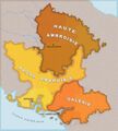 Ambroisie regions.jpg 1,126 × 1,249; 238 KB
-
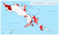 Antarephia-Coalition-Map.png 3,000 × 1,817; 1.02 MB
-
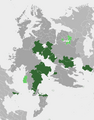
 Antarephian coalition election 2023.png 935 × 565; 123 KB
-
 ASUN Map 05 2024.png 1,937 × 2,480; 643 KB
-
 Borough assembly 25.png 1,202 × 885; 77 KB
-
 Bromley city borough council elections 2025.png 1,201 × 882; 197 KB
-
 City Mayoral election 25.png 1,218 × 882; 115 KB
-
 Counties of Trinity Island.svg 1,341 × 1,465; 298 KB
-
 Deodeca Provinces Updated.png 1,080 × 1,077; 294 KB
-
 Election 2025.png 1,546 × 1,074; 340 KB
-
 Ellarca admin blank.png 3,507 × 2,480; 667 KB
-
 FreedemiaStateMap.png 1,303 × 846; 299 KB
-
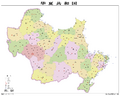 Huaxia admin 2024.png 3,730 × 3,108; 1.46 MB
-
 Huaxia admin 2025.jpg 3,309 × 3,715; 643 KB
-
 JKP-25-04 D3.0 - Political.png 2,388 × 1,774; 915 KB
-
 Khai-lma-map.png 400 × 270; 70 KB
-
 KofukuRegions.jpeg 1,536 × 1,771; 666 KB
-
 Lentia cities and boundaries.png 1,152 × 882; 110 KB
-
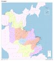
 Les Grandes Régions de Franqueterre du Sud.png 4,445 × 2,483; 595 KB
-
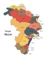 Mazan Borders-01.jpg 3,334 × 4,292; 1.21 MB
-
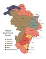 Mazan Government System-01.jpg 3,334 × 4,292; 1.32 MB
-
 Navenna admin borders.png 1,270 × 1,604; 402 KB
-
 Navenna largest cities.png 1,270 × 1,550; 406 KB
-
 Navenna largest municipalities.svg 512 × 911; 752 KB
-
 New Carnaby Counties.png 1,534 × 684; 93 KB
-
 Passamaqueets 2022 gubernatorial election map.png 3,000 × 2,429; 297 KB
-
 Passitania Counties.png 2,484 × 856; 85 KB
-
 QennesBaseMap.png 1,790 × 1,900; 1.93 MB
-
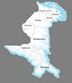
 Reun administrative.png 1,010 × 989; 57 KB
-
 San admin.svg 1,567 × 1,130; 642 KB
-
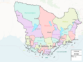
 Tempeira political.svg 1,328 × 899; 1.64 MB
-
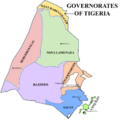 Tigeria Admin Divisions Capitals.png 1,897 × 1,897; 447 KB
-
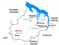
 Vilayets - Hamidiye-01.jpg 3,508 × 2,480; 978 KB


