Category:Maps
Subcategories
This category has the following 14 subcategories, out of 14 total.
A
- Airport diagrams (1 F)
C
- Climate maps (14 F)
D
- Demographic maps (28 F)
H
- Hand-drawn maps (6 F)
- Historical maps (56 F)
L
- Land use maps (1 F)
- Local maps (21 F)
M
- Maps of Izaland (10 F)
P
- Political maps (41 F)
R
- Regional maps (12 F)
- Resource maps (5 F)
T
- Topographic maps (14 F)
- Transport maps (49 F)
W
- World maps (4 F)
Media in category "Maps"
The following 20 files are in this category, out of 20 total.
-
 ALORMEN descriptive maps.jpg 2,923 × 1,528; 470 KB
-
 JKP-25-04 D2.0 - Geographic Regions.png 2,388 × 1,774; 787 KB
-
 JKP-25-04 D2.3 - Watersheds.png 2,388 × 1,774; 717 KB
-
 Kojo airport map.png 794 × 559; 51 KB
-
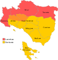 Languages of Saiol.svg 1,102 × 1,143; 177 KB
-
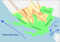 Naphon Schematic Physical.svg 1,017 × 711; 155 KB
-
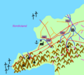
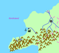 Nordicland 1.png 756 × 680; 101 KB
-
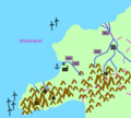 Nordicland 2.png 756 × 680; 111 KB
-
 Nordicland 3.png 756 × 680; 154 KB
-
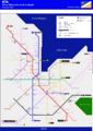 Nouveau plan RTA Métro d'Arténie-Ville - AK.png 2,215 × 3,118; 636 KB
-
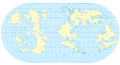 Ogf base world map.svg 1,020 × 549; 1.67 MB
-
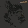 Ogfplacenight.jpg 4,960 × 4,960; 687 KB
-
 UL25 - Compressed.png 2,524 × 1,733; 1.54 MB
-
 UL27k - Application 2.png 1,340 × 810; 31 KB
-
 UL27k - Application 3.png 1,340 × 810; 19 KB
-
 UL30c sketch.PNG 1,266 × 661; 182 KB
-
 US Mints.png 1,840 × 1,128; 266 KB
-
 Volcanoes.jpg 4,960 × 4,960; 704 KB
-
 Wu mt ranges.png 1,937 × 2,480; 1.11 MB
-
 Wu waters.png 1,937 × 2,480; 1.22 MB


