Collab talk:Deodeca
Appearance
Collaborative State
I'm not sure if this is the stop to post it, however, i was directed to here so here we go.
This is my proposal for AR060-10 for the role of coordinator of the state.
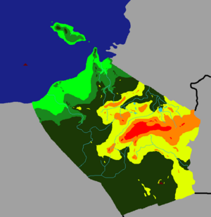
This is my proposal for the topographical map of AR060-10, taking into consideration the map provided by us, i imagine this would be the encounter of two ranges, with plains on the west side of the territory.

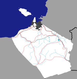
This is the general proposal for the capital location and its metro area (grey), the highways (red) and the railway system (black).

-Davieerr
- I like what you have so far. Just as a note, while the terrain may get quite hilly, there won't be any major mountains in this area, so keep that in mind. Also, would you want to be the sole coordinator of this new blue state or would you want to have one or two other mappers to team up with? -TheMayor (talk) 16:43, 29 November 2021 (UTC)