File:Eastern Uletha cycling routes map.jpg
Size of this preview: 593 × 600 pixels. Other resolutions: 2,025 × 2,048 pixels | 7,415 × 7,499 pixels.
Original file (7,415 × 7,499 pixels, file size: 3.89 MB, MIME type: image/jpeg)
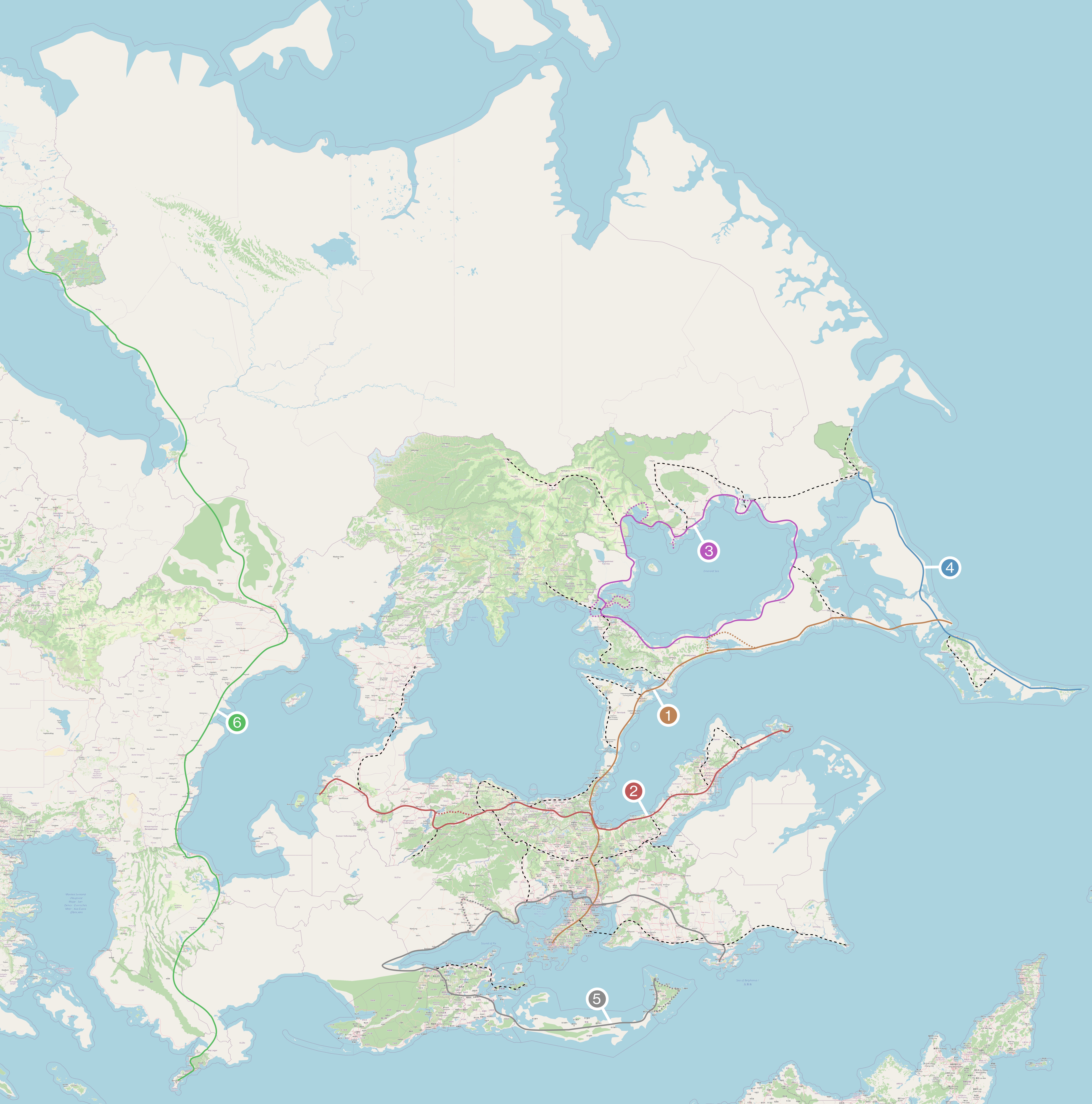
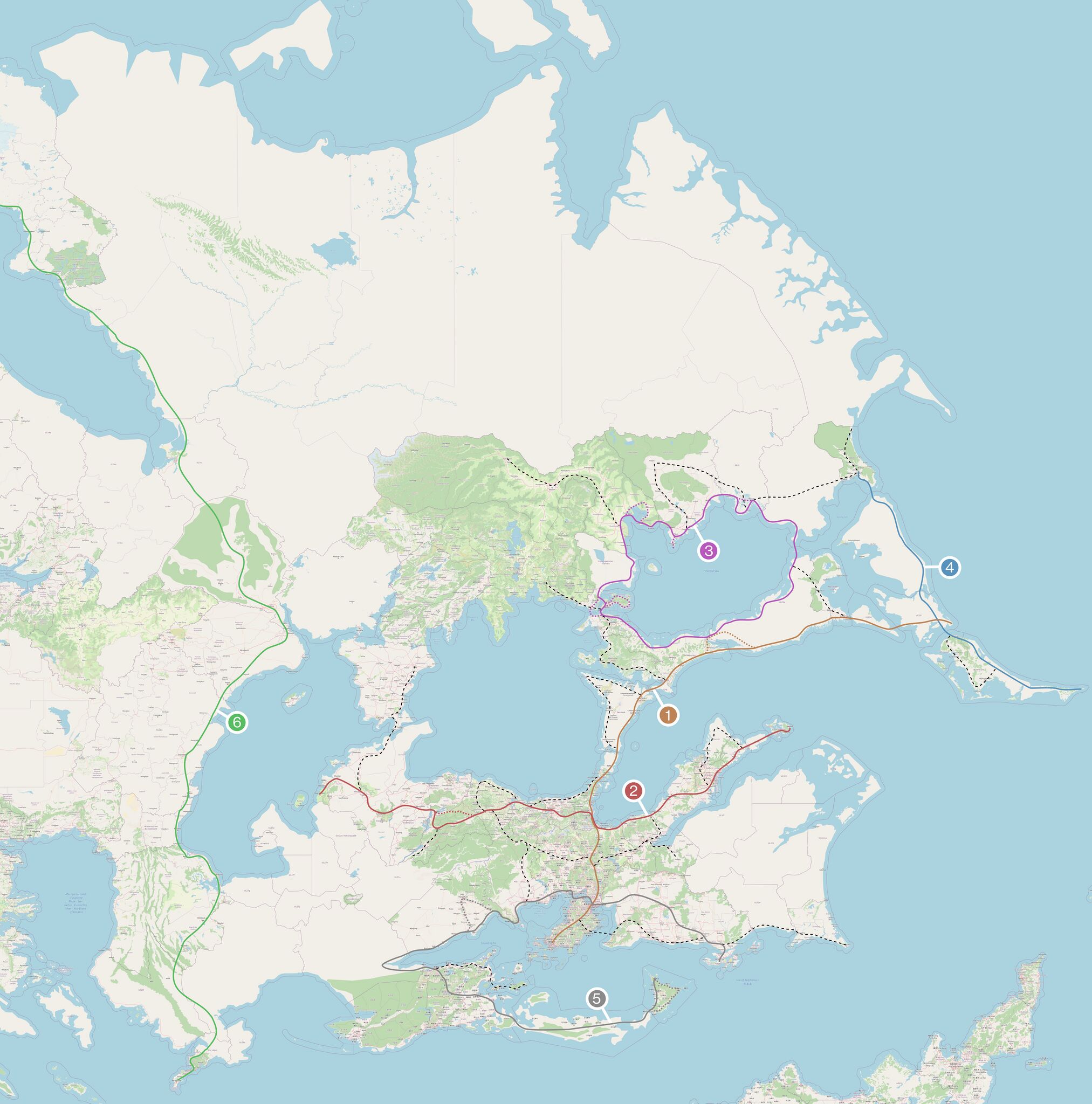
Map depicting the rough and proposed cycling routes in East Uletha. Basemap from opengeofiction.net (and creators) and annotations added self in Inkscape.
File history
Click on a date/time to view the file as it appeared at that time.
| Date/Time | Thumbnail | Dimensions | User | Comment | |
|---|---|---|---|---|---|
| current | 13:14, 2 April 2026 | | 7,415 × 7,499 (3.89 MB) | TheCubic (talk | contribs) |
You cannot overwrite this file.
File usage
The following page uses this file: