File:Stanton downtown plan.png
Size of this preview: 800 × 374 pixels. Other resolution: 1,573 × 736 pixels.
Original file (1,573 × 736 pixels, file size: 1.25 MB, MIME type: image/png)
Summary
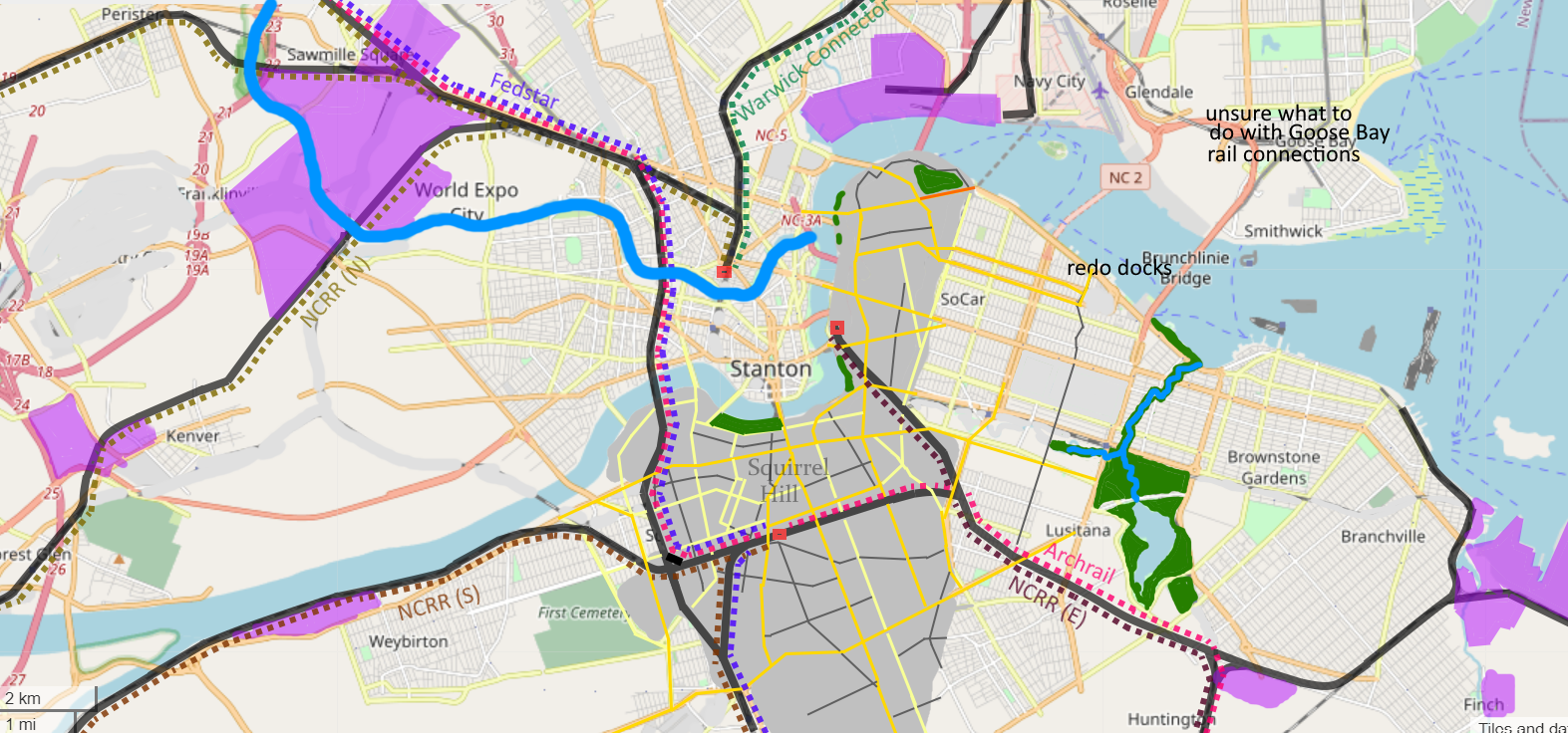
Plan for changes to Downtown Stanton geography, grid and passenger rail
Licensing
| This map is a derivative of the OpenGeofiction base map, which is licensed under the Creative Commons Attribution-NonCommercial-ShareAlike License and is released under the same license. |
File history
Click on a date/time to view the file as it appeared at that time.
| Date/Time | Thumbnail | Dimensions | User | Comment | |
|---|---|---|---|---|---|
| current | 00:11, 13 March 2025 | | 1,573 × 736 (1.25 MB) | Fluffr Nuttr (talk | contribs) | adjusted main park |
| 23:06, 12 March 2025 | 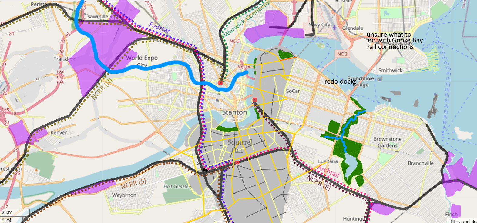 | 1,573 × 736 (1.24 MB) | Fluffr Nuttr (talk | contribs) | Plan for changes to Downtown Stanton geography, grid and passenger rail |
You cannot overwrite this file.
File usage
The following page uses this file: