File:Stanton wards.png

Size of this preview: 500 × 599 pixels. Other resolution: 1,405 × 1,683 pixels.
Original file (1,405 × 1,683 pixels, file size: 1.87 MB, MIME type: image/png)
Summary
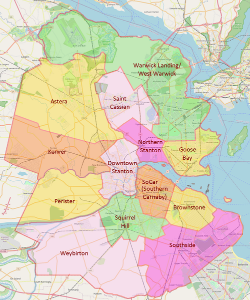
Map of Stanton Wards, update from Infrarrojo sketch based on new mapping
Licensing
| This map is a derivative of the OpenGeofiction base map, which is licensed under the Creative Commons Attribution-NonCommercial-ShareAlike License and is released under the same license. |
File history
Click on a date/time to view the file as it appeared at that time.
| Date/Time | Thumbnail | Dimensions | User | Comment | |
|---|---|---|---|---|---|
| current | 21:25, 11 May 2023 | | 1,405 × 1,683 (1.87 MB) | Fluffr Nuttr (talk | contribs) | Map of Stanton Wards, update from Infrarrojo sketch based on new mapping |
You cannot overwrite this file.
File usage
The following page uses this file: