Forum:Franqueterre/National capital - Development proposals
Aiki's proposal August 2024
Please find below some thoughts I had about potential developments for Franqueterre's national capital with some drafts done on a .joz file to help visualise the steps (each step/period is on a separate layer).
Gallo-Roman oppidum
The capital city's formal history starts with the OGF equivalent of a Gallo-Roman oppidum set on a hill next to a meander. The oppidum is walled, endowed with the usual main cardo and decumanus, a forum with the main temple, a single stone bridge and outside the walls, an area/theatre ensemble. The whole site is protected by a castellum located at the highest point of the hill. Some 5km north of the oppidum, as smaller settlement serves as the oppidum's lacustrine harbour. This settlement's name may refer to its location next to an estuary and resemble Genève (e.g. Genèvre, Geneure, Genure...) whose name is based on a Celtic root meaning estuary.
Medieval city
Local lords, and later kings, build a castle (loosely based on Château of Blois) enriched with a chapel, on top of the castellum's ruins. The cathedral is build on top of the forum's main temple and the ordered Roman street grid gives way to winding medieval streets. A main fortress, next to the castle, protects the castle while smaller ones protects new bridges that cross the river. The port village is walled and a fortress to protect it is built. Later on, a formal university develops south of the cathedral's square. North east of the city, the king's hunting ground is enriched with a hunting lodge.
Renaissance & pre-modern city
The castle morphs into a palace with new wings and Renaissance gardens. Along the lake's shore, some 20km north east of the city, the kings builds a leisure palace that will be modernised to catch up with the latest fashion. The compound may be inspired by the Châteaux of the Loire Valley, Versailles or due to its location, by Peterhof, Drottningholm or Fredensborg for the gardens. Later in the period, the medieval walls are torn down and replaced by tree-lined promenades called boulevards. The city centre merged with its faubourgs. A first pleasure park opens below the king's palace gardens.
19th century city
The city is impacted by the Industrial Revolution and new industrial neighbourhoods are developed. Potential locations are next to the lacustrine harbour if it is still active then, or south of the city along the river. Potentially, a dam can be built to generate mechanical power, and a few decades later, electrical power for the nearby workshops and factories. As the urban area expands, the royal hunting ground is turned into a public park and railway terminals are built to serve a growing population. During the last decades, the city experience a large transformation with new avenues, boulevards irrigating the city centre (based on Haussmann's works or similar developments elswhere in France or Europe. Some of those new thoroughfares link old or new buildings lined along them, others create impressive perspectives towards a focal point (square or building). Further out, new promenades lead travellers to their local destination (e.g. Dijon's cours du parc leading from the centre to Parc de la Colombière). Based on similar-located cities such as Geneva or Zurich, it is likely the upper class and upper middle class settles along the lake shores or between the royal palace (or former royal palace) and the leisure palace north east.
Mid-20th century city
During the first half of the century, a first ring of suburbs develops and expands. New commuter lines are opened, some are even electrified while metro tunnels are dug under the city centre's avenues. By 1950/1960, the first housing estates are built further out in the suburbs. The first motorways are built as is a first ring road. A first airport is built some 10/15km south of the city.
Today's city
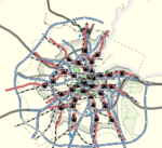
During the last 60 years, the urban area has reached its current extent, endowed with business parks or malls are elsewhere in Uletha. New ring roads and motorways are added, while a second and third airports are added further out of the urban area. The cope with the growing population and a somehow inadequate metro system, an RER system is developed with new lines and new tunnels under the city centre joining railway terminals network.--Aiki (talk) 15:15, 24 August 2024 (UTC)


