File:Wu waters.png: Difference between revisions
Bixelkoven (talk | contribs) == Summary == Self-made. Category:Administrative images Category:West Uletha |
Rustem Pasha (talk | contribs) mNo edit summary |
||
| Line 2: | Line 2: | ||
Self-made. | Self-made. | ||
== Licensing == | |||
{{Cc-ogf-map}} | |||
[[Category:Administrative images]] | [[Category:Administrative images]] | ||
[[Category:West Uletha]] | [[Category:West Uletha]] | ||
[[Category:Maps]] | |||
Latest revision as of 13:22, 25 May 2024
Summary
Self-made.
Licensing
| This map is a derivative of the OpenGeofiction base map, which is licensed under the Creative Commons Attribution-NonCommercial-ShareAlike License and is released under the same license. |
File history
Click on a date/time to view the file as it appeared at that time.
| Date/Time | Thumbnail | Dimensions | User | Comment | |
|---|---|---|---|---|---|
| current | 15:31, 13 May 2024 | 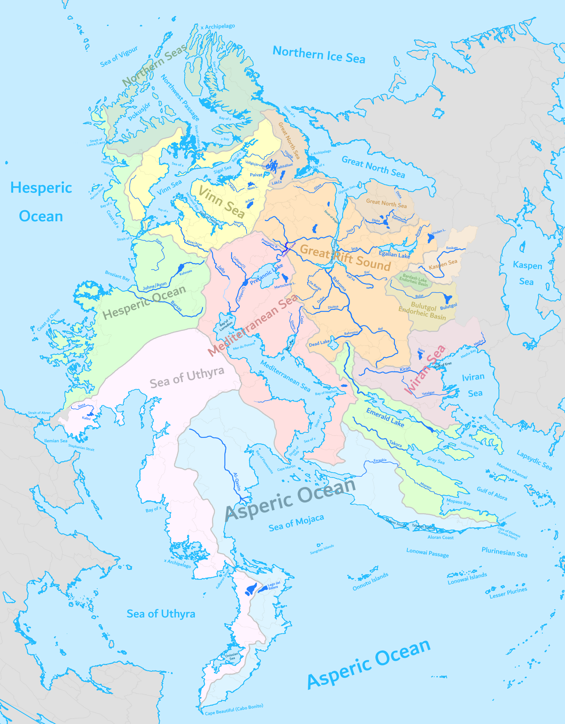 | 1,937 × 2,480 (1.22 MB) | Bixelkoven (talk | contribs) | == Summary == Self-made. Category:Administrative images Category:West Uletha |
You cannot overwrite this file.
File usage
The following page uses this file: