File:Navenna land use.png: Difference between revisions
Rough land use map of Navenna, in the style of 90s CIA land use maps. Own work. Category:Navenna Category:Land use maps |
Timboh uploaded a new version of File:Navenna land use.png |
(No difference)
| |
Revision as of 19:37, 16 August 2023
Summary
Rough land use map of Navenna, in the style of 90s CIA land use maps. Own work.
Licensing
| Error creating thumbnail: AttributionNonCommercialShareAlike | This map is a derivative of the OpenGeofiction base map, which is licensed under the Creative Commons Attribution-NonCommercial-ShareAlike License and is released under the same license. |
File history
Click on a date/time to view the file as it appeared at that time.
| Date/Time | Thumbnail | Dimensions | User | Comment | |
|---|---|---|---|---|---|
| current | 15:56, 19 April 2025 | 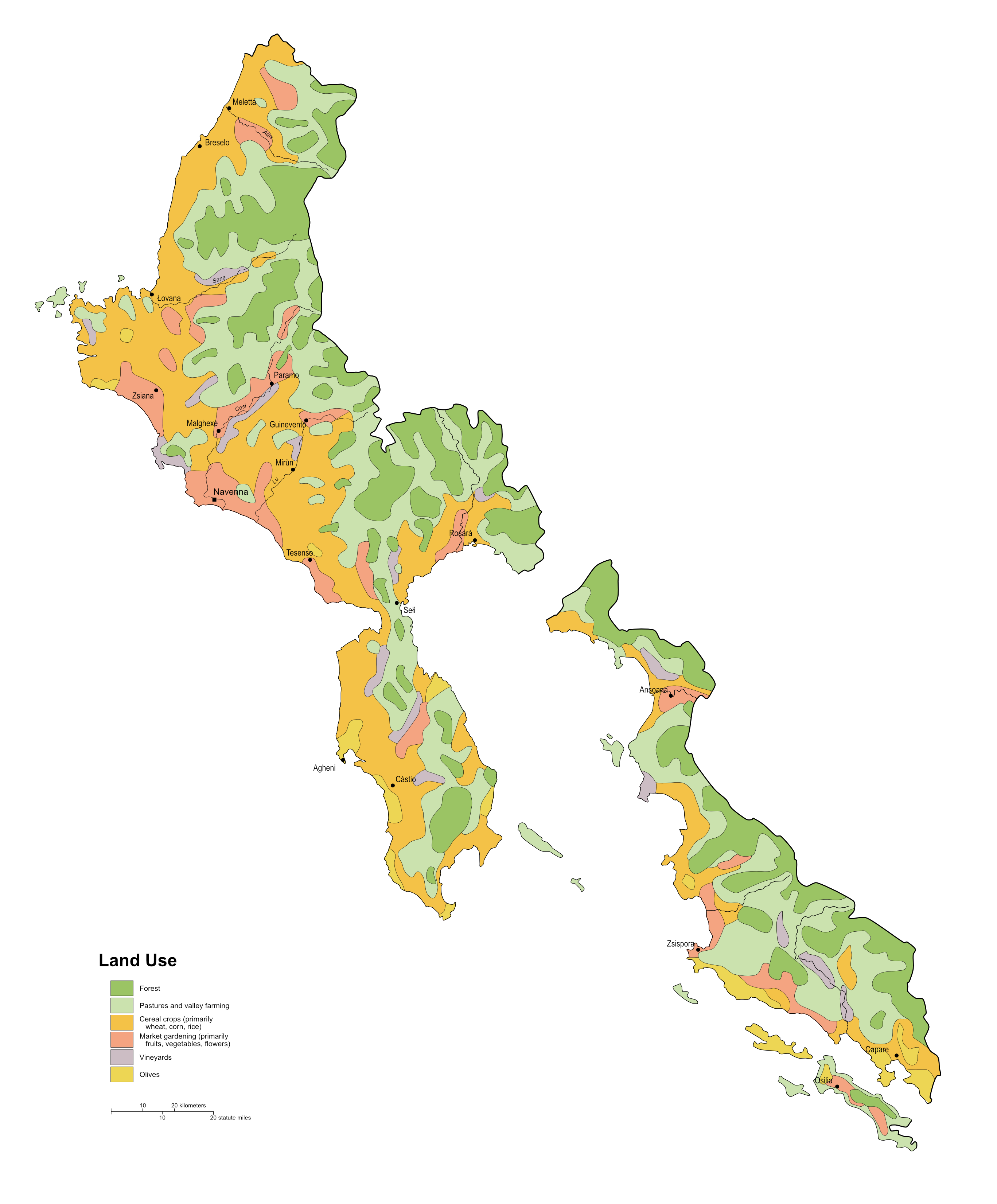 | 2,735 × 3,303 (729 KB) | Timboh (talk | contribs) | Updated to match new territory extents |
| 19:37, 16 August 2023 | Error creating thumbnail: File missing | 2,735 × 3,303 (720 KB) | Timboh (talk | contribs) | Expanded map to include new territory | |
| 22:05, 7 July 2022 | Error creating thumbnail: File missing | 1,468 × 2,626 (413 KB) | Timboh (talk | contribs) | Rough land use map of Navenna, in the style of 90s CIA land use maps. Own work. Category:Navenna Category:Land use maps |
You cannot overwrite this file.
File usage
The following page uses this file: