File:Lentia cities and boundaries.png: Difference between revisions
No edit summary |
m + cat, license |
||
| Line 1: | Line 1: | ||
A map of Lentia with the largest cities and national and regional boundaries | A map of Lentia with the largest cities and national and regional boundaries | ||
[[Category:Lentia]] | |||
[[Category:Political maps]] | |||
==License== | |||
{{Cc-ogf-map}} | |||
Latest revision as of 21:42, 2 June 2024
A map of Lentia with the largest cities and national and regional boundaries
License
| This map is a derivative of the OpenGeofiction base map, which is licensed under the Creative Commons Attribution-NonCommercial-ShareAlike License and is released under the same license. |
File history
Click on a date/time to view the file as it appeared at that time.
| Date/Time | Thumbnail | Dimensions | User | Comment | |
|---|---|---|---|---|---|
| current | 16:26, 2 June 2024 | 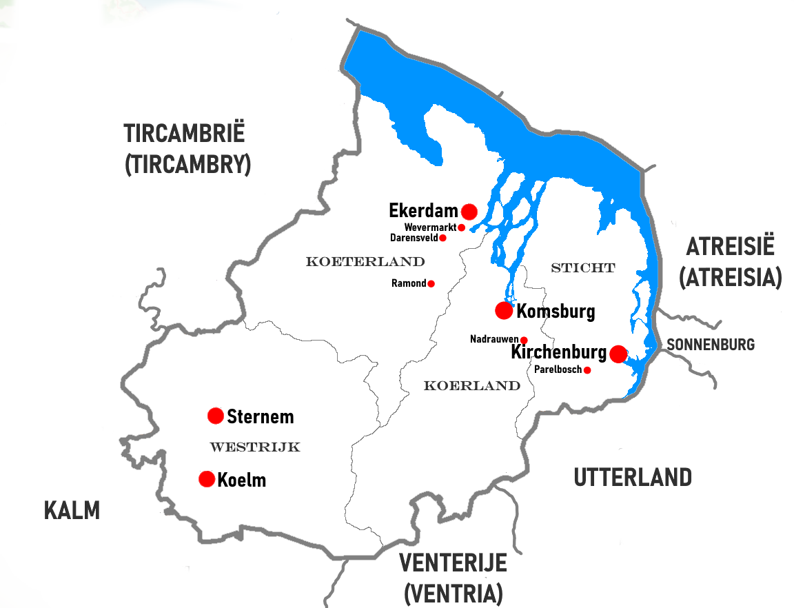 | 1,152 × 882 (110 KB) | Mantan (talk | contribs) |
You cannot overwrite this file.
File usage
The following page uses this file: