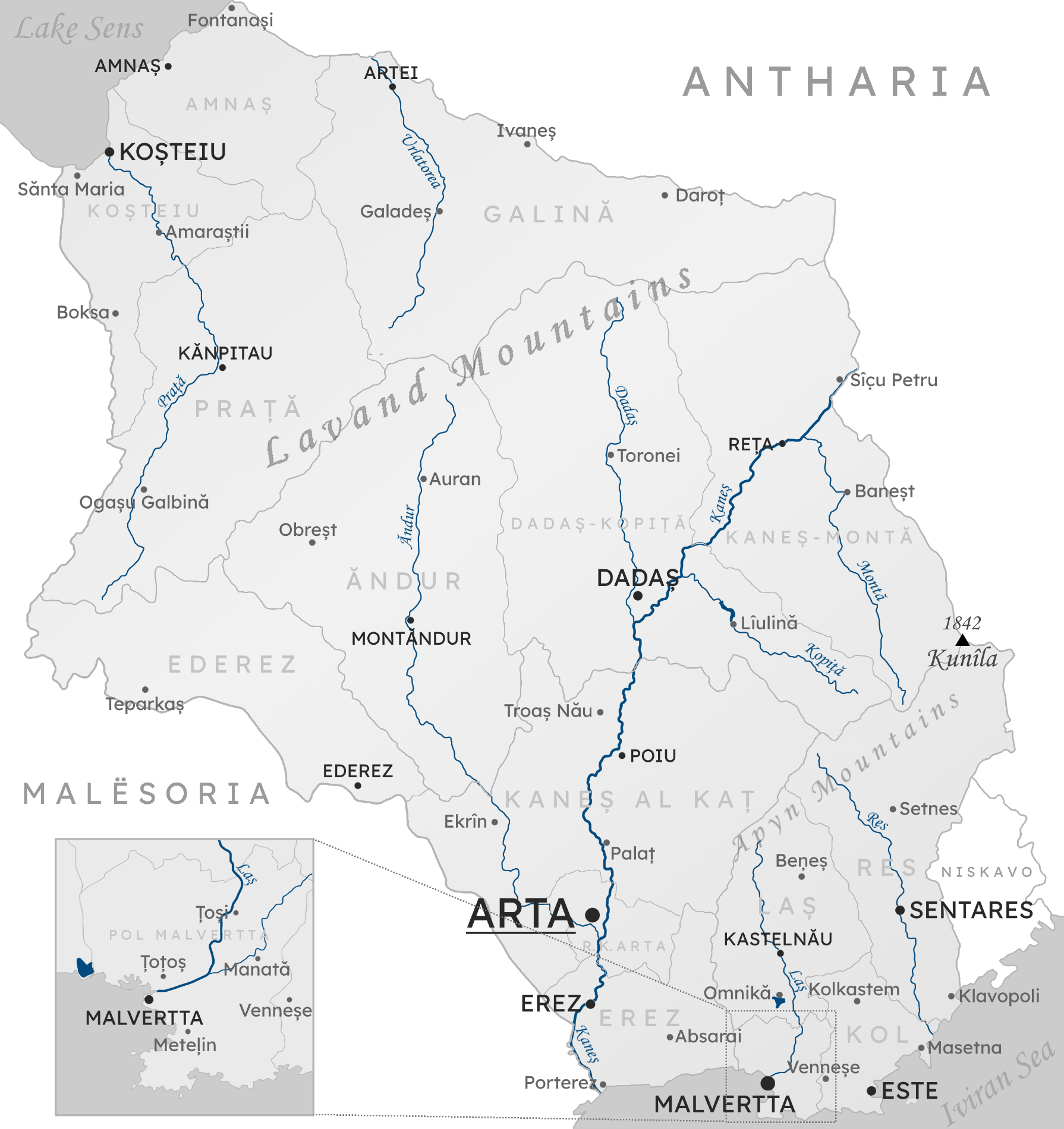
File:QennesBaseMap.png
Size of this preview: 565 × 600 pixels. Other resolution: 1,790 × 1,900 pixels.
Original file (1,790 × 1,900 pixels, file size: 1.93 MB, MIME type: image/png)
Summary
Self-made.
Licensing
| Creative Commons License AttributionNonCommercialShareAlike | This map is a derivative of the OpenGeofiction base map, which is licensed under the Creative Commons Attribution-NonCommercial-ShareAlike License and is released under the same license. |
File history
Click on a date/time to view the file as it appeared at that time.
| Date/Time | Thumbnail | Dimensions | User | Comment | |
|---|---|---|---|---|---|
| current | 15:11, 13 July 2022 | | 1,790 × 1,900 (1.93 MB) | Bixelkoven (talk | contribs) | New tallest peak location and height. |
| 21:39, 10 November 2021 | Error creating thumbnail: File missing | 1,790 × 1,900 (1.94 MB) | Bixelkoven (talk | contribs) | Self-made. |
You cannot overwrite this file.
File usage
The following page uses this file: