File:Navenna largest municipalities.svg

Size of this PNG preview of this SVG file: 337 × 600 pixels. Other resolution: 1,151 × 2,048 pixels.
Original file (SVG file, nominally 512 × 911 pixels, file size: 752 KB)
| File:Gnome-edit-delete.svg | This page has been marked for deletion This page was flagged for the following reason: obsolete and will be deleted in 14 days. |
Summary
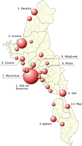
Map of the largest cities in Navenna, with the city's municipality highlighted. Based on map data exported from OGF.
Licensing
| Creative Commons License AttributionNonCommercialShareAlike | This map is a derivative of the OpenGeofiction base map, which is licensed under the Creative Commons Attribution-NonCommercial-ShareAlike License and is released under the same license. |
File history
Click on a date/time to view the file as it appeared at that time.
| Date/Time | Thumbnail | Dimensions | User | Comment | |
|---|---|---|---|---|---|
| current | 15:40, 26 January 2023 | | 512 × 911 (752 KB) | Timboh (talk | contribs) | Incorrect dimensions fix |
| 15:35, 26 January 2023 | Error creating thumbnail: File missing | 512 × 723 (751 KB) | Timboh (talk | contribs) | New map style with bubbles proportional to city size. Less text labels for more clarity, only top 10 cities shown. | |
| 19:18, 14 July 2022 | Error creating thumbnail: File missing | 512 × 982 (295 KB) | Timboh (talk | contribs) | Map of the largest cities in Navenna, with the city's municipality highlighted. Based on map data exported from OGF. Category:Navenna Category:Political maps |
You cannot overwrite this file.
File usage
There are no pages that use this file.