File:Alormen Motorway Plan 20231229.png: Difference between revisions
(Draft motorway numbering plan of Alormen, as of 29 Dec 2023. Category:Alormen) |
Rustem Pasha (talk | contribs) mNo edit summary |
||
| Line 1: | Line 1: | ||
== Summary == | == Summary == | ||
Draft motorway numbering plan of Alormen, as of 29 Dec 2023. | Draft motorway numbering plan of Alormen, as of 29 Dec 2023. | ||
== Licensing == | == Licensing == | ||
{{Cc-ogf-map}} | {{Cc-ogf-map}} | ||
[[Category:Alormen]] | |||
[[Category:Federal States collaborative documentation]] | |||
Latest revision as of 13:57, 30 December 2023
Summary
Draft motorway numbering plan of Alormen, as of 29 Dec 2023.
Licensing
| This map is a derivative of the OpenGeofiction base map, which is licensed under the Creative Commons Attribution-NonCommercial-ShareAlike License and is released under the same license. |
File history
Click on a date/time to view the file as it appeared at that time.
| Date/Time | Thumbnail | Dimensions | User | Comment | |
|---|---|---|---|---|---|
| current | 02:51, 30 December 2023 | 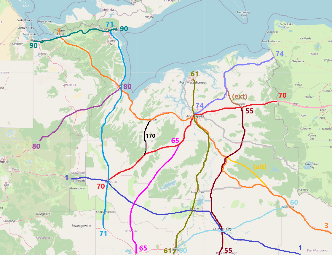 | 1,120 × 861 (499 KB) | TheMayor (talk | contribs) | Draft motorway numbering plan of Alormen, as of 29 Dec 2023. Category:Alormen |
You cannot overwrite this file.
File usage
The following 2 pages use this file: