File:Alormen colonisation.jpg: Difference between revisions
(Map of Alormen in the 1700s Category:Alormen) |
Rustem Pasha (talk | contribs) (+cat) |
||
| Line 1: | Line 1: | ||
== Summary == | == Summary == | ||
Map of Alormen in the 1700s | Map of Alormen in the 1700s | ||
== Licensing == | == Licensing == | ||
{{Cc-ogf-map}} | {{Cc-ogf-map}} | ||
[[Category:Hand-drawn maps]] | |||
[[Category:Alormen]] | |||
Latest revision as of 12:09, 14 January 2023
Summary
Map of Alormen in the 1700s
Licensing
| This map is a derivative of the OpenGeofiction base map, which is licensed under the Creative Commons Attribution-NonCommercial-ShareAlike License and is released under the same license. |
File history
Click on a date/time to view the file as it appeared at that time.
| Date/Time | Thumbnail | Dimensions | User | Comment | |
|---|---|---|---|---|---|
| current | 14:26, 1 January 2023 | 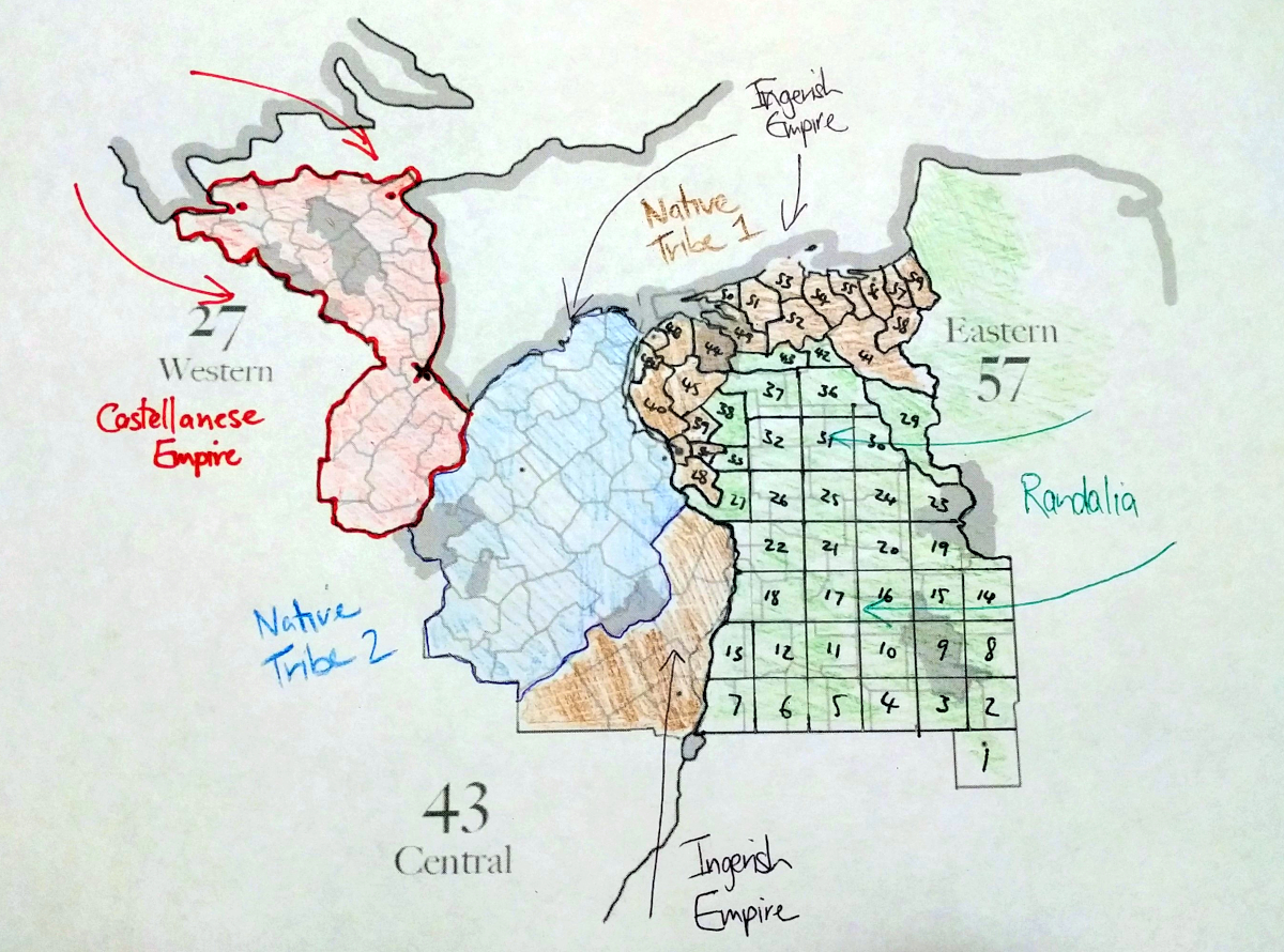 | 1,200 × 890 (1.03 MB) | Ruadh (talk | contribs) | Map of Alormen in the 1700s Category:Alormen |
You cannot overwrite this file.
File usage
The following page uses this file: