File:Alormen counties - rough population estimate.jpg: Difference between revisions
mNo edit summary |
mNo edit summary |
||
| Line 4: | Line 4: | ||
{{Cc-ogf-map}} | {{Cc-ogf-map}} | ||
[[Category:Alormen]] | [[Category:Alormen]] | ||
[[Category: | [[Category:Demographic maps]] | ||
[[Category:Federal States collaborative documentation]] | [[Category:Federal States collaborative documentation]] | ||
Latest revision as of 02:02, 22 April 2022
Summary
Alormen counties - a rough estimate of population across the state
Licensing
| This map is a derivative of the OpenGeofiction base map, which is licensed under the Creative Commons Attribution-NonCommercial-ShareAlike License and is released under the same license. |
File history
Click on a date/time to view the file as it appeared at that time.
| Date/Time | Thumbnail | Dimensions | User | Comment | |
|---|---|---|---|---|---|
| current | 15:23, 16 December 2021 | 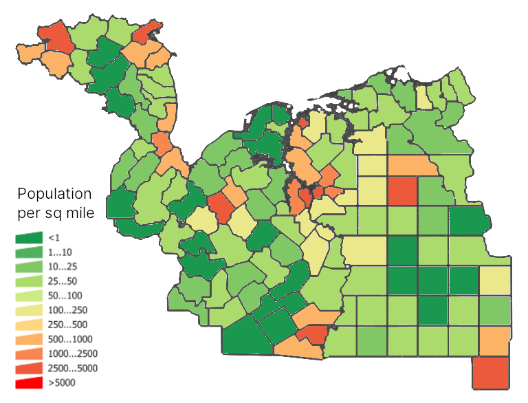 | 768 × 586 (276 KB) | Ruadh (talk | contribs) | Alormen counties - a rough estimate of population across the state |
You cannot overwrite this file.
File usage
The following page uses this file: