File:Demirhan, 1820.png: Difference between revisions
Rustem Pasha (talk | contribs) (Demirhan Empire at maximum of territorial extent, 1820. Map made by me, Rustem Pasha Category:Demirhan Empire) |
Rustem Pasha (talk | contribs) mNo edit summary |
||
| (One intermediate revision by one other user not shown) | |||
| Line 1: | Line 1: | ||
== Summary == | == Summary == | ||
[[Demirhan Empire]] at maximum of territorial extent, 1820. Map made by me, [[user:Rustem Pasha|Rustem Pasha]] | [[Demirhan Empire]] at maximum of territorial extent, 1820. Map made by me, [[user:Rustem Pasha|Rustem Pasha]] | ||
== Licensing == | |||
{{Cc-ogf-map}} | |||
[[Category:Demirhan Empire]] | [[Category:Demirhan Empire]] | ||
[[Category:Historical maps]] | |||
Latest revision as of 10:43, 7 July 2022
Summary
Demirhan Empire at maximum of territorial extent, 1820. Map made by me, Rustem Pasha
Licensing
| This map is a derivative of the OpenGeofiction base map, which is licensed under the Creative Commons Attribution-NonCommercial-ShareAlike License and is released under the same license. |
File history
Click on a date/time to view the file as it appeared at that time.
| Date/Time | Thumbnail | Dimensions | User | Comment | |
|---|---|---|---|---|---|
| current | 18:20, 13 October 2021 | 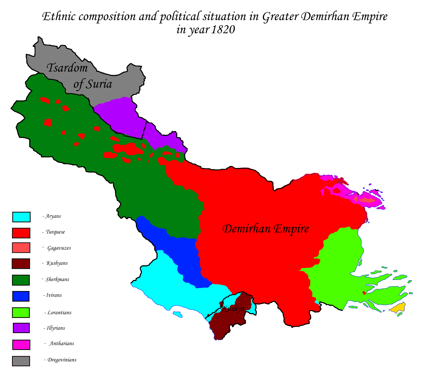 | 1,500 × 1,300 (207 KB) | Rustem Pasha (talk | contribs) | Demirhan Empire at maximum of territorial extent, 1820. Map made by me, Rustem Pasha Category:Demirhan Empire |
You cannot overwrite this file.
File usage
The following page uses this file: