File:Demirhan topomap.png

Size of this preview: 782 × 600 pixels. Other resolutions: 2,560 × 1,963 pixels | 3,000 × 2,300 pixels.
Original file (3,000 × 2,300 pixels, file size: 521 KB, MIME type: image/png)
Summary
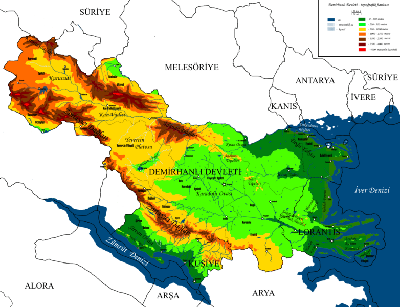
Topographic map of Demirhan Empire. Own work by me, Rustem Pasha
Licensing
| This image is licensed under the Creative Commons Attribution-NonCommercial-ShareAlike License |
File history
Click on a date/time to view the file as it appeared at that time.
| Date/Time | Thumbnail | Dimensions | User | Comment | |
|---|---|---|---|---|---|
| current | 21:01, 16 September 2022 | | 3,000 × 2,300 (521 KB) | Rustem Pasha (talk | contribs) | adjusting minor things after spring natural development |
| 21:25, 13 January 2022 | Error creating thumbnail: File missing | 3,000 × 2,300 (504 KB) | Rustem Pasha (talk | contribs) | current borders | |
| 18:13, 13 October 2021 | Error creating thumbnail: File missing | 3,000 × 2,300 (1.66 MB) | Rustem Pasha (talk | contribs) | Topographic map of Demirhan Empire. Own work by me, Rustem Pasha |
You cannot overwrite this file.
File usage
The following page uses this file: