File:L-Reglè RouteMap.png: Difference between revisions
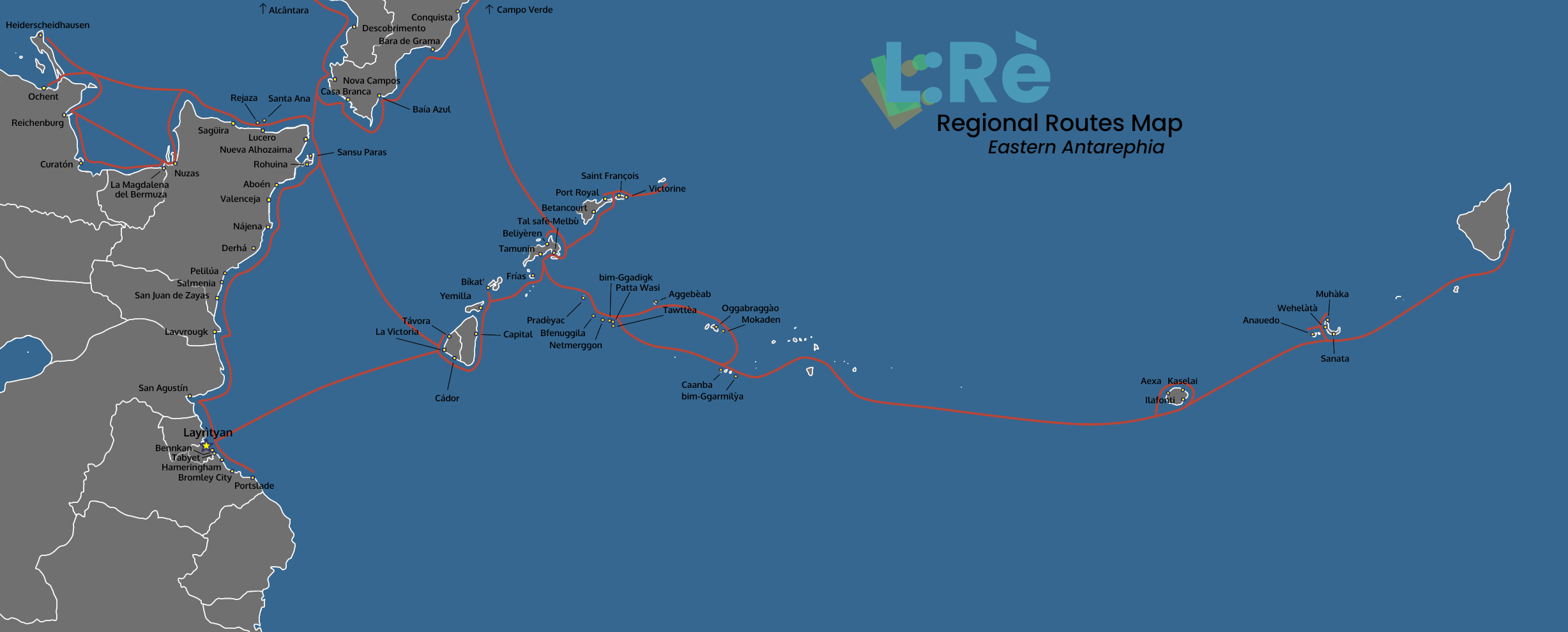
(Route map of L:Reglè ferry company, in Eastern Antarephia. Based on an adapted and redetailed version of Timboh's world map and a screenshot of the OGF regular render map.) |
mNo edit summary |
||
| Line 3: | Line 3: | ||
== Licensing == | == Licensing == | ||
{{Cc-by-nc-sa}} | {{Cc-by-nc-sa}} | ||
[[Category:Transport maps]] | |||
[[Category:Layr]] | |||
Latest revision as of 12:30, 5 December 2021
Summary
Route map of L:Reglè ferry company, in Eastern Antarephia. Based on an adapted and redetailed version of Timboh's world map and a screenshot of the OGF regular render map.
Licensing
| This image is licensed under the Creative Commons Attribution-NonCommercial-ShareAlike License |
File history
Click on a date/time to view the file as it appeared at that time.
| Date/Time | Thumbnail | Dimensions | User | Comment | |
|---|---|---|---|---|---|
| current | 12:25, 5 December 2021 | 2,455 × 989 (376 KB) | Intergan (talk | contribs) | Route map of L:Reglè ferry company, in Eastern Antarephia. Based on an adapted and redetailed version of Timboh's world map and a screenshot of the OGF regular render map. |
You cannot overwrite this file.
File usage
The following page uses this file: