File:Tolulu states.png: Difference between revisions
No edit summary |
Rustem Pasha (talk | contribs) m (cat, lic) |
||
| Line 1: | Line 1: | ||
map of Tolulu, showing the states and island groups. Also shows the flag and national symbol. | map of Tolulu, showing the states and island groups. Also shows the flag and national symbol. | ||
== License == | |||
{{cc-ogf-map}} | |||
[[Category:Territory request images]] | |||
Latest revision as of 12:28, 11 February 2023
map of Tolulu, showing the states and island groups. Also shows the flag and national symbol.
License
| This map is a derivative of the OpenGeofiction base map, which is licensed under the Creative Commons Attribution-NonCommercial-ShareAlike License and is released under the same license. |
File history
Click on a date/time to view the file as it appeared at that time.
| Date/Time | Thumbnail | Dimensions | User | Comment | |
|---|---|---|---|---|---|
| current | 20:54, 5 February 2023 | 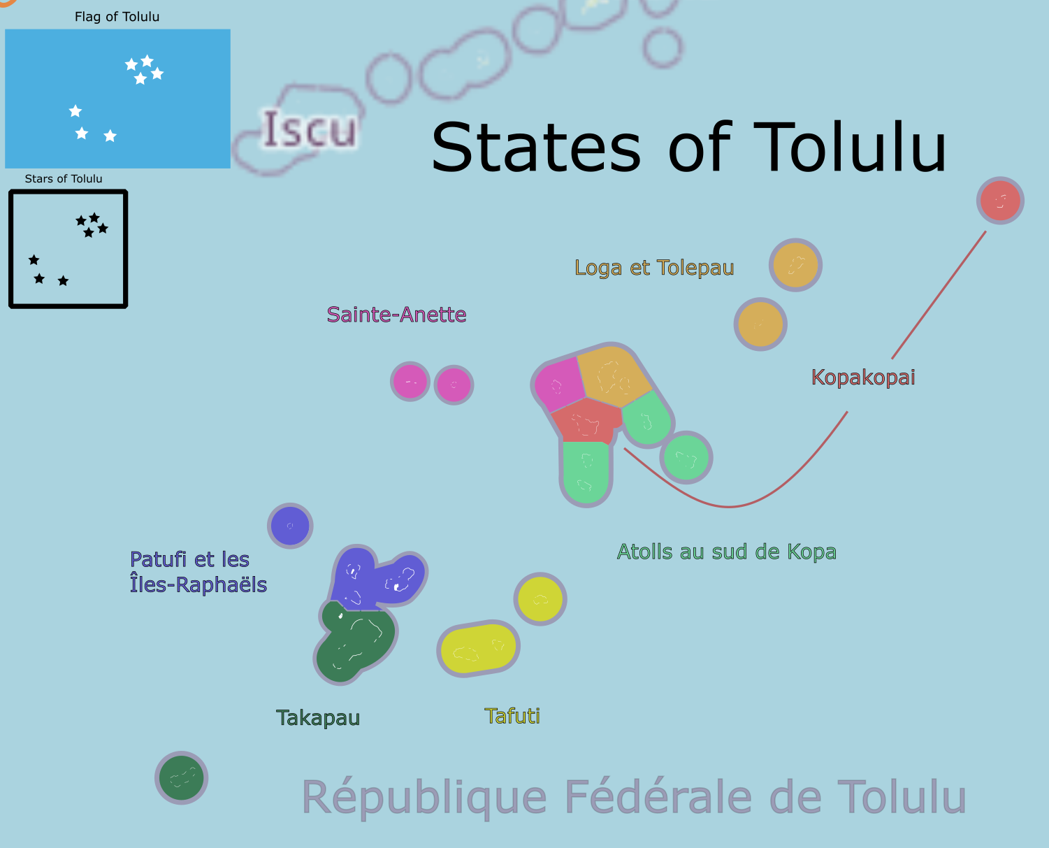 | 1,501 × 1,213 (227 KB) | Liadrien (talk | contribs) |
You cannot overwrite this file.
File usage
The following page uses this file: