Ta Seti: Difference between revisions
No edit summary |
(Rewriting the article. Information about the language was temporarily moved to User:Mapping Expert/Sandbox/Language of Ta Seti.) Tags: Replaced Visual edit: Switched |
||
| (25 intermediate revisions by 2 users not shown) | |||
| Line 1: | Line 1: | ||
{{ | {{Infocard | ||
| name = Amnic State of Ta Seti | |||
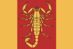
| | | flag = Flag_of_Ta_Seti.svg | ||
| | | symbol = Coat_of_arms_of_Ta_Seti.svg | ||
| symbol_caption = Coat of arms | |||
| native_name = Ⲧⲁ Ⲥⲉⲧⲓ | |||
| | | native_language = [[Index:Languages|Re Babates]] | ||
| | | capital = Khenu | ||
| | | population = ''To be determined'' | ||
| | | population_year = 2021 | ||
| | | motto = | ||
| | | anthem = | ||
| | | latitude = 25.528 | ||
| | | longitude = 26.631 | ||
| | | zoom = 6 | ||
| | | relation = 21925 | ||
| | | intro = '''Ta Seti''' ([[Index:Languages|Re Babates]]: ''Ⲧⲁ Ⲥⲉⲧⲓ''), officially the '''Amnic State of Ta Seti''', is a country in [[OpenGeofiction:Tarephia|North Tarephia]]. It is bordered by [[Andrar]], {{Relation|382|TA011}} and {{Relation|8072|Dematísna}} to the north, {{Relation|48167|TA002}} to the west, {{Relation|16942|TA020}} to the south and {{Relation|16936|TA014}} to the southeast. With a mostly Amnic-ethnic population of TBD million in an area of 262 119 km² (101 205 sq mi), Ta Seti is divided into [[Ta Seti#Administrative divisions|fourteen governorates]]. The nation's capital and largest city is Khenu, with around TBD million people in its metropolitan area. | ||
| | |||
| | Ta Seti is one of the world's oldest continuous major civilizations, beginning in the fifth millenium BCE. It was first unified as a state by Het in the seventh century BCE and reached its territorial height in the fourth century BCE when the emperor Serion the Great conquered most of northern Tarephia. | ||
| | |||
| | |||
| | |||
| | |||
| | |||
}} | }} | ||
[[Category:Ta Seti]] | [[Category:Ta Seti]] | ||
[[Category:Countries in Tarephia]] | [[Category:Countries in Tarephia]] | ||
Latest revision as of 02:07, 25 May 2024

|
Amnic State of Ta Seti Ⲧⲁ Ⲥⲉⲧⲓ (Re Babates) Capital: Khenu
Population: To be determined (2021) |
Loading map... |
Ta Seti (Re Babates: Ⲧⲁ Ⲥⲉⲧⲓ), officially the Amnic State of Ta Seti, is a country in North Tarephia. It is bordered by Andrar, TA011∈⊾ and Dematísna∈⊾ to the north, TA002∈⊾ to the west, TA020∈⊾ to the south and TA014∈⊾ to the southeast. With a mostly Amnic-ethnic population of TBD million in an area of 262 119 km² (101 205 sq mi), Ta Seti is divided into fourteen governorates. The nation's capital and largest city is Khenu, with around TBD million people in its metropolitan area.
Ta Seti is one of the world's oldest continuous major civilizations, beginning in the fifth millenium BCE. It was first unified as a state by Het in the seventh century BCE and reached its territorial height in the fourth century BCE when the emperor Serion the Great conquered most of northern Tarephia.
