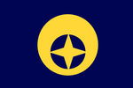
Canterra

|
Canterra Kanawhiwa Gwatera. (Toamai, Kukebi) Capital: Nautecove
Population: 20,827,914 (2022) Motto: One Nation, One Goal Anthem: The one, the glorious |
Loading map... |
The Republic of Canterra (Toamai: Kanawhiwa; Kukebi: Gwatera), known mononymously as Canterra, is a country located in the Lantian Peninsula, a peninsula of East Uletha. Canterra consists of fourteen states further split into (YY) counties; it borders Zdansk and Lantia to the north, and Westway and Fiorentia (a overseas territory of Merganien) with a coastline of the Gulf of Volta and the Gulf of Orinoco. The official language is Ingerish, with Toamai and Kukebi also as national languages (spoken in Ezamai and The Keys).
History
Etymology
Prehistory and history
Scientists believe that Canterra was first inhabited at around 40,000 BC, as stone artifacts in Parlenage, North Barshurst and Canal Nord have been recorded to have a average age of 34,000 BC. Homo erectus Lenthialis (Lenthials) have been found in caves in Torlonza, Embrosinet and Walross State. These people may have been related with Izaki hunters, however, we know that these people travelled by boat, from the modern day Yenkaido Province to the western coast of Westway and Canterra. When they got to Canterra, they made a entirely new writing system and language, known now as Toamai. By a stroke of luck, there was a fertile valley between the Sanwood Mountains and the Pascalle Mountains, known as the Miyayu Valley to the Toamai, and now known as the Ulstbern Valley. Also by this time, another group of people, this time from Orinoco, reached the outer islands of East Canterra, and established a language called Kukebi.
Izaki Influence
Around 90 AD, the Kingdom of Sopeke successfully invaded Canterra, declared the capital Iremon (modern day Iscemon), and called this territory "Kuusamo", which meant "Nine Mountains", representing the nine mountains on the outcoast of Eiha (modern day Nautecove). During this time, the Izaki set up a monarchy system that consisted of 10 kings over a time period of 92 years. The Izaki rule stopped from 180 - 190 AD, when the Canterrans won the Battle of Kremling, where Izaki troops were forced to flee to Nantaa (current day Westway). After this, the Toamai declared independence, and created the Republic of Kanawhiwa. Everything would go normally until the 9th century.
Ingerish Lantia
In 821, the Ingerish Empire started conquering the Lantian Peninsula, starting with Zdansk, then the northern half of the peninsula, then Canterra. The Ingerish had started invading from modern day Garthram, Lantia and Borderville, Zdansk. The battle was brutal, but in 822, the Ingerish had fully conquered Canterra, and the whole Lantian Peninsula. During this time, Canterra was called Dasgrundia, after "Das Grund", the Gaerman translation for "The Reason", implying that Canterra was the reason why the Ingerish had invaded the Lantian Peninsula. During the Ingerish Lantian rule, the Ingerish had tooken most of the land away from native farmers, and sold most of the resources to other major countries. This went on for the rest of Ingerish Lantia's rule, until the year 1623.
Independence
In the year 1623, a man called Reyes Maccarimi became president of Dasgrundia. Little was known to the Ingerish, but Maccarimi was a secret revolutionary, and from 1623 to early 1624, Maccarimi replaced all of the Ingerish officials with Canterran politicians, and secretly moved major government offices to a suburb of Nautecove, called Aigelle. Then, in July 1624, Maccarimi ran a vote for independence in 2 cities: Nautecove and Roscal along with votes in 189 towns and villages throughout Canterra. The result was a 92% vote for independence. On August 26th, 1624, Reyes Maccarimi declared independence from the Ingerish and called the new republic "Canterra", after the Toamai name for Canterra (Kanawhiwa) and the Castellanese suffix -terra, for land. Canterra was the first state to gain independence from Ingerish Lantia, and unknown to the Ingerish, the rest would gain independence soon after. The Ingerish started a war, but the war was fairly short in Canterra, and the Battle of Ebereinet marked the end of this war, in 1636.
Post-independence
After the war, the Ingerish immediately stopped funding for Canterra, and Canterra went into a state of famine in poverty. However, with the rule of Whana-Reitira Rellington, Canterra's 3rd president, the famine ended (from 1637-1639), and immediately after, there was a minor population boom. The population of Canterra went from 700,000 to 2,000,000 people, and Canterra had a economic boom as well. Canterra started exporting fruits, and metal products.
In the 18th and 19th century,