Administrative divisions of Izaland
This page is about the administrative divisions of Izaland.
 Main article: Izaland
 | |
|---|---|
| Administrative divisions of Izaland | |
| First-level | 24 prefectures (縣, ken) Capital Special Administration District (首都特別自治区, Shuto tukubyeschitsiku) 1 special city (特別市, tukubyesshi) 1 territory (土, do), 1 special autonomous region, |
| Second-level | city (市, -shi), town (町, -chō), and village (村, -son) |
| Third-level | ward (区, -ku), neighborhood (洞, dōn), and rural hamlet (邑, -ūs) |
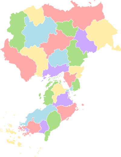
The administrative divisions of Izaland (Republic of Izaland) structure the country's territory for governance and statistical purposes. Izaland is divided into 31 primary first-level local entities. These entities include:
- 24 Prefectures (縣, ken)
- 1 Capital Special Administration District (首都特別自治區, Shuto tukubyeschitsiku)
- 1 Special City (Warohan) (深湾特別市, Warohan tukubyesshi)
- 2 Special Territories
- Yenkaido Prefecture (遠海土, Yenkaido), the only prefecture with access to the Gulf of Volta, extremely important for trade and fishing, and one of the main ports in northeastern Uletha.
- Weidtal Autonomous Area (Autonomes Gebiet Weidtal / 柳谷自治區, Waital chitsiku), primarily inhabited by Kalmish-speaking populations. Although integral parts of Izaland, they function as de facto pene-exclaves due to their location north of the Aigan Mountain range, making them accessible by land only through neighboring Blönland.
These first-level entities are further subdivided into municipalities, which form the second tier of local government. The classification of these municipalities generally depends on population size and varies somewhat between prefectures:
- Cities (市, -shi): Typically require a population of at least 50,000.
- Towns (町, -chō or -nata): Generally have populations between 15,000 and 49,999.
- Villages (村, -son or -tashi): Usually have populations under 15,000.
- Mountain communities (山岳自治団体, sankaku chitsiku), to jointly exercise certain municipal functions and to execute their functions specifically assigned by the prefecture (found in Nikorenatsuki, Usmasaki, Yenkaido and Sahasamo prefectures.
It's important to note that exceptions to these population criteria exist. Some settlements designated as cities may have fewer than 50,000 residents, while some towns, such as Nappawa (with a population of 78,669), significantly exceed the typical threshold for city designation.
Prefectures
| Region map | Flag | District Name | Hanji writing | Postal abbrev. |
District Capital | Area (km2) | Population | Pop.
Density |
|---|---|---|---|---|---|---|---|---|

|

|
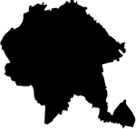
Yenkaido | 遠海土 | YK | Sannupuri (乾山市) | 33.938,70 | 3.298.780 | 97,20 |
|

|
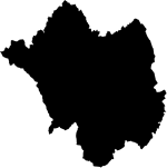
Dōnpuku | 東北縣 | DP | Sonzhin (尊神市) | 24.219,53 | 897,220 | 37,07 |
|

|
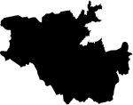
Usmashaki | 越馬石懸 | UM | Rihaul (高崎市) | 9.356,01 | ||
|

|
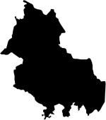
Makkenoke | 平坂懸 | MN | Makkenoke (平坂市) | 8.572,31 | ||
|

|
Shinsun | 信旬懸 | SU | Hidankoibo (森袋市) | 12.081,30 | ||

|

|
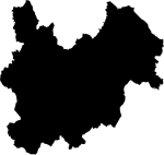
Nikorenatsuki | 越不原懸 | NN | Tsobunetoka (旭市市) | 18.951,05 | ||
|

|
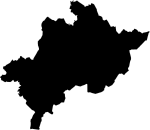
Kasaki | 加羽懸 | KS | Poridake (登館市) | 25.088,93 | ||
|

|
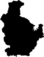
Riyatoma | 追庥懸 | RT | Riyatoma (追庥市) | 16.937,74 | 7.256.780 | 428,43 |
|
Sahasamo | 佐羽山縣 | SS | Yuisheo | 12.934,29 | 425.700 | 267,03 | |

|
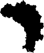
Toasa | 土阿嵯懸 | TA | Nagareki (沼浦市) | 25.719,72 | |||
|

|
Anbira | 案備羅懸 | AR | Tarago (多羅悟市) | 17.066,85 | ||
| Yuttsamo | 氷山縣 | YS | Gaintei | 10.493,46 | 782.500 | 424,46 | ||
| Kwando | 関渡縣 | KD | Shirukami(荒釜市) | 9.156,26 | 1.456.609 | 989,01 | ||
| Otsumisamo | 東山縣 | OS | Isadashi (安村市) | 4.925,90 | 3.287.980 | 667,48 | ||
| Karuhama | 松島縣 | KH | Kawayatsu (嘉夬苫市) | 1376,34 | 1.867.900 | 1.357,15 | ||
 |
National Capital District | 首都特別自治区 | CD | Sainðaul (作安崎) | 502,60 | 12.345.600 | 24.563,47 | |
| Tōkai | 東海縣 | TK | Sabullan (𖬖𖬇𖬰𐐢𖬈𖬳ᐢ市) | 3.164,84 | 3.567.809 | 1.127,33 | ||
| Komokata | 其泉縣 | KT | Riimibaiken | 3.164,84 | 5.560.398 | 1.476,92 | ||
| Otsumirunka | 東道縣 | OR | Onnojaris (恩之鰹市) | 4059,05 | 521.920 | 128,58 | ||
| La Piana | 等平奈領 | LP | La Piana | 10,38 | 252 | 24,28 | ||
| Midōhinnan | 美道花縣 | MH | Kichatsura (亀茶汐市) | 974,55 | 652.069 | 669,10 | ||
| Nawatsawa | 翠林縣 | NT | Kanlisahna (船灣市) | 2754,35 | 927.556 | 336,76 | ||
| Ōhan | 大弯縣 | ON | Panaireki (若浦市) | 5626,98 | 4.456.772 | 792,04 | ||
 |
Warohan Special City | 深湾特別市 | WH | Warohan (深灣市) | 516,99 | 6.345.502 | 12.273,94 | |
 |
Nankai | 南海縣 | NI | Satsokoibo(青袋市) | 2073,64 | 1.789.765 | 863,10 | |
 |
Daishin | 大進縣 | DS | Daishin (大進市) | 3992,88 | 1.556.782 | 389,89 | |
 |
Shōlyon | 祥籠縣 | SL | Jinneisoke (神寍昃市) | 2610,85 | |||
 |
Itakiri | 雷磯縣 | IK | Sagoma (叉古万市) | 3848,21 | 1.925.678 | 500,41 | |
 |
Izaland Total | 307,403.27 | 117.000.000 | 380.75 | ||||
Cities of Izaland
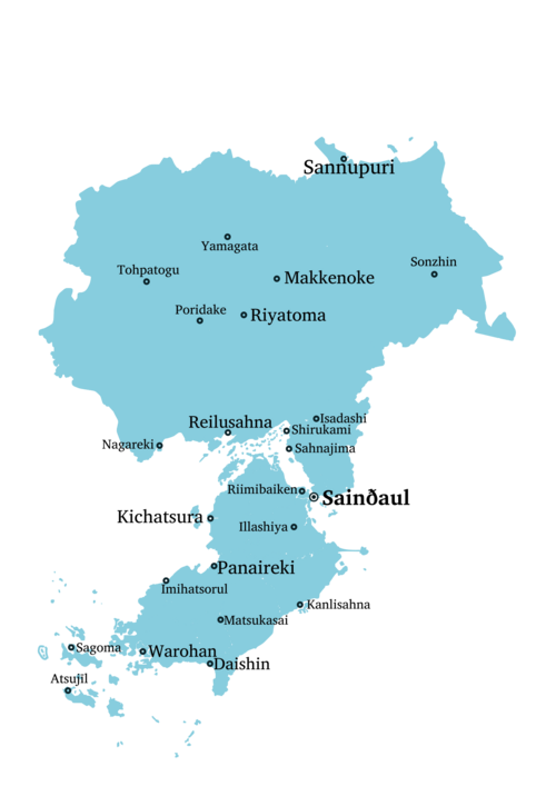
Izaland is a highly urbanized nation, with 86.7% of its population living in urban areas. The distribution of its cities is strongly shaped by the country's geography. Major population centers and urban development are predominantly concentrated along coastal plains and lowlands. Key urban agglomerations are found along the western coast of Kubori Island, the shores facing the Eira Inner Sea, the region east of the capital Sainðaul, and within the extensive Makke-Riya metropolitan area (one of the largest urbanised areas located higher than 1200 m on sea level in Eastern Uletha). These areas likely represent corridors of high population density and economic activity.
In contrast, the flatter, primarily agricultural prefectures of Kasaki, Anbira, Toasa, and Doonpuku exhibit a different pattern; here, mid-sized cities (typically 150,000 to 300,000 inhabitants) are more evenly dispersed, acting as regional centers surrounded by numerous smaller towns and villages. Conversely, the largely mountainous regions, such as Shinsun, Yuttsamo, and Usmashaki, host significantly fewer cities due to the challenging terrain, with most settlements consisting of smaller towns and villages nestled in mountain valleys.
Formal designation as a "city" (shi) requires meeting several conditions set by law, reflecting their status as significant urban centers. While a minimum population of 50,000 is a general benchmark, it is not the sole criterion. A potential city must also demonstrate a strong urban character: at least 70% of its households must be located within a defined central urban area, and a minimum of 60% of households must derive their livelihood from commerce, industry, or other typically urban occupations, rather than agriculture. Additionally, prospective cities must satisfy any further conditions stipulated by the specific prefecture's ordinances. The final designation is granted upon approval by both the relevant prefectural governor and the national Ministry of Land, Infrastructure and Transport.
| Rank | City | Askaoza | Byakuji | View | 2010 census | 2022 estimate | Change | Region |
|---|---|---|---|---|---|---|---|---|
| 1 | Sainðaul | ટ૮ાપ્ઢૃ૮ેધ્ | 作安崎市 |  |
11.342.957 | 12.127.335 | ↗ | |
| 2 | Warohan | ૮િદ૾તપ્ | 深灣特別市 |  |
5.987.227 | 6.036.829 | ↗ | |
| 3 | Panaireki | રપ૮ાદૅડા | 若林氏 | 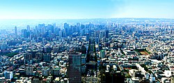 |
3.367.229 | 3.572.889 | ↗ | Ōhan |
| 4 | Kichatsura | ડામઢેદ | 亀茶汐市 |  |
2.678.223 | 2.997.900 | ↗ | Midōhinnan |
| 5 | Sannupuri | ટપ્પેરેદા | 乾山市 | 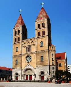 |
1.878.990 | 1.821.901 | ↘ | |
| 6 | Daishin | ઠૃ૮ાયાપ્ | 大進市 |  |
1.528.990 | 1.587.889 | ↗ | |
| 7 | Riimibaiken | દાઃઇારૃ૮ાડૅપ્ |  |
1.323.229 | 1.315.119 | ↘ | File:Komokata flag.svg Komokata | |
| 8 | Riyatoma | દા૮ોઠ૾ઇ | 追庥市 |  |
922.110 | 1.124.002 | ↗ | |
| 9 | Makkenoke | ઇડ્ડૅપ૾ડૅ | 平坂市 |  |
1.020.992 | 1.115.232 | ↗ | |
| 10 | Illashiya | ૮ાધ્ધયા૮ો | 狐棲市 |  |
978.229 | 1.025.220 | ↗ | Otsumirunka |
| 11 | Isadashi | ૮ાટઠૃયા | 安村市 | 
|
824.005 | 897.550 | ↗ | Otsumisano |
| 12 | Kanlisahna | ડપ્ધાટત્પ | 船灣市 | 
|
711.229 | 783.480 | ↗ | Nawatsawa |
| 13 | Sonzhin | ટ૾પ્યૃાપ્ | 尊臣市 | File:2020상무시청로.jpg | 792.880 | 782.330 | ↘ | Dōnpuku |
| 14 | Shirukami | યાદેડઇા | 荒釜市 | 
|
621.223 | 678.920 | ↗ | Kwandō |
| 15 | Nagareki | પડૃદૅડા | 沼浦市 | 
|
642.992 | 623.990 | ↘ | Toasa |
Warohan
| Warohan | |
|---|---|
| 深灣特別市 | |
| Special City | |
| Country | Izaland |
| Population | |
| • Estimate (2020) | 6,345,502 |
| Demonym | Warohanese |
| Government | |
| • City Governor | Eika Sattasoi |
| • Vice Governor | Mikos Erikamu |
| Area | |
| • Total | 516,99 km2 |
| Postal Code | 500-0001 - 505-499 |
| Telephone Code | 03 |
| Metro | tbd |
| Website | toshi.warohan.gov.iz |
Warohan (深灣特別市, Warohan tukubyesshi; IPA reading: /'wa:rohan/) is the second largest city of Izaland, located in the southwestern part of Kubori Island within a deeply rugged inlet. The name comes from this location and means "deep bay". With a population of over 6 million, rising to around 10 million when the metropolitan area is included, Warohan is an important international port, controlling traffic within the Sound of Pa.
Warohan is located in the innermost part of Warohan Bay, and its formidable position has protected the city from invasions and intruders. In particular, during the Khaiwan period, the ancient Ipseris built many fortifications along the bifurcated forms of the coastline that led from the open sea to the harbour.
Today's Warohan territory is spread over a 500 square kilometre peninsula that separates Warohan Bay from the lagoon to the east. The historic centre of Warohan is on Kokennaka Island, linked to the modern city by the old Kogyo Bridge and the newer Irasone Tunnel.
Administrative divisions
Warohan is a special city, due to its status and economic, cultural and historical importance. Warohan is further divided into 12 wards (区, ku):
- Juwon-gu (中央区)
- Aimasa-ku (愛馬沙区)
- Runijakkai-ku (ーー区)
- Awanae-ku (ーー区)
- Sennora-ku (ーー区)
- Bibaisone-ku (ーー区)
- Hāndō-ku (杭峒区)
- Seyeka-ku (ーー区)
- Takarun-ku (太加柳区)
- Kakudonga-ku (小雷区)
- Chipotsoi-ku (ーー区)
- Kaidasayo-ku (刀木区)
Sibling Cities
Warohan has a sibling city partnership with the following worldwide cities, as per the guidelines of Sibling Cities of the World:
Panaireki
| Panaireki | |
|---|---|
| 若浦市 | |
| city | |
| Country | Izaland |
| • Prefecture | Ōhan |
| Population | |
| • Estimate (2020) | 3,246,016 |
| Demonym | Panairekians |
| Government | |
| • Mayor | Tarissao Hekamore |
| • Vice mayor | Shijinka Yasetori |
| Area | |
| • Total | 825,34 km2 |
| Postal Code | 325-0001 - 327-499 |
| Telephone Code | 04 |
| Metro | tbd |
| Website | toshi.panaireki.gov.iz |
Panaireki (若浦市 - File:Panaireki in kasechi.png Panaireki-shi; IPA reading: /pa'naj:reki/) is the third largest city of Izaland, located more or less in the center of the west coast of Kubori island within an ample bay (Ōhan bay). Panaireki hosts the prestigious Panaireki Institute of Technology (PIT), one of the most advanced research centers in the field of medicine and nanotechnologies worldwide, and thus attract a wide number of students from Izaland and Eastern Uletha as well as many farmaceutical companies. Among them, in Panaireki we can find the headquarters of Naðuro Yakujai, an important medicines developer.
Geography
Panaireki is located in the center of a wide bay, protected by a handful of islands and some peninsulas, thus has been an important port since prehistoric times. The city develops on a wide plain area with almost no hills or mountains, and this allowed it to stretch in many directions more easily than other cities. Two rivers, the Etsukui and the Shwamul make their way to the sea by passing through Panaireki center.
- Islands
Some islands are located off-shore the main city: Kinchōri (金丁里) right in front of the port, Ihanus, a former volcanic island topped by the 1128 m Mount Sashamui, and the uninhabited island of Roroyo (絽絽与), right south the former. The port area is made of 8 man made islands, built between 1991 and 2016 to expand the cargo port, which is one of the most actives in the country.
- Lakes
Panaireki city boundaries also include a certain number of natural lakes, what remains of a former marsh, reclaimed in the 20th century during the role of King Atsakin VI. The most remarkable remaining lakes are the Nemishoha, the Utsama and the Genjō lakes, oasis of peace and relax for many locals as well as tourists.
Demography
Panaireki, with a population of 3,2 million inhabitants is the third largest city in Izaland, and including the neighboring cities, the metro area population reaches 5,289,446 inhabitants (2019). If we include the suburban area of Kichatsura city, located 70 km north, the Panaireki-Kichatsura megalopolis (若亀大都市圏, Nyakki daitoshiken) counts x.xxx.xxx people, making it the second most populated region in Izaland after the capital, and before Warohan city area.
| City | Population |
|---|---|
| Panaireki | 3,246,016 |
| Nugamochi | 670,210 |
| Kimusasari | 324,020 |
| Dongamoe | 224,220 |
| Ishiraro | 196,330 |
| Sasarua | 173,890 |
| Rimultan | 125,220 |
| Ajahissan | 105,220 |
| Issaroiko | 63,220 |
| Ehakuro | 54,660 |
| Yokona | 34,220 |
| Kashioka | 72,220 |
Main metropolitan areas of Izaland
Izaland is a high-densely populated country, and most of its population lives in urbanized areas. In addition to the Greater Sainðaul area (about 23.4 million inhabitants), other noteworthy metropolitan areas are that of Warohan-Eyenniyul (15 million), Panaireki (5.6 million), Kichatsura (3.2 million), Isadashi (2.7 million), Shirukami-Sahnajima (1.7 million), Makkeriya (Riyatoma and Makkenoke, 2.9 million), Sannupuri (2.2 million), Daishin (1.6 million), Ikkashiya-Katayoshi ( 1.7 million) and Reilusahna (1.5 million).
Other towns of some importance are, in no particular order: Atsujīl, Sagoma, Kanlisahna, Muanake, Jinneisoke, Nagareki and Poridake. The list of the main metropolitan areas (consideres as "community of commuters to the central city") follows.
Greater Sainðaul
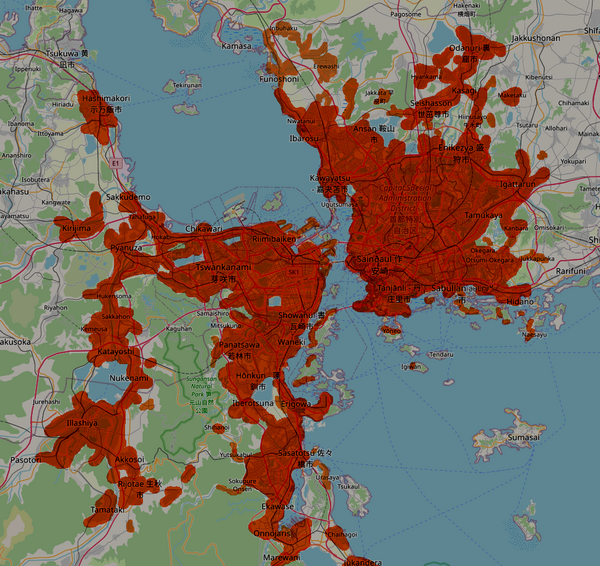
The Greater Sainðaul, includes the whole Capital Special Administration District (CSAD), as well as a number of cities and towns located in the neighboring prefectures (Tōkai, Karuhama, Komokata and Otsumirunka). The special cities and towns included in the special district are:
- Shakihori-shi (石登市)
- Shimoroboe-shi (亀岡市)
- Dankau-shi (檀洪市)
- Ibaruno-shi
- Kaimura-nata
- Yōneo-nata
List of the cities and towns of the Greater Sainðaul metropolitan area (work in progress):
| Name | Izaki | Population | Type | Prefecture |
|---|---|---|---|---|
| Shakihori-shi | 石登市 | 552,679 | city | CSAD |
| Shimoroboe-shi | 亀岡市 | 54,762 | city | CSAD |
| Dankau-shi | 檀洪市 | 178,560 | city | CSAD |
| Ibaruno-shi | 121,778 | city | CSAD | |
| Kaimura-nata | town | CSAD | ||
| Yōneo-nata | town | CSAD | ||
| Riimibaiken | 1,323,229 | city | Komokata | |
| Tahamuro | 78,227 | city | Komokata | |
| Bibaisone | 133,429 | city | Komokata | |
| Tswankanami | 芽咲市 | 425,670 | city | Komokata |
| Taikinda | 51,880 | city | Komokata | |
| Chikawari | 312,889 | city | Komokata | |
| Naesoya | 92,228 | city | Komokata | |
| Seika | 西鹿市 | 261,889 | city | Komokata |
| Tahafuga | city | Komokata | ||
| Sakkudemo | city | Komokata | ||
| Pyanuza | 145,330 | city | Komokata | |
| Kirijima | city | Komokata | ||
| Sakkahon | city | Komokata | ||
| Katayoshi | city | Komokata | ||
| Hukensoma | town | Komokata | ||
| Hashimakori | 示万飯市 | 287,229 | city | Komokata |
| Kemeusa | city | Komokata | ||
| Nukenami | city | Komokata | ||
| Kaguhan | town | Komokata | ||
| Tanjānli | 丹庄里市 | city | Tōkai | |
| Osenude | 124,550 | city | Tōkai | |
| Mokoba | city | Tōkai | ||
| Sabullan | 558,790 | city | Tōkai | |
| Oitsura | 351,990 | city | Tōkai | |
| Watarui | city | Tōkai | ||
| Tamukaya | city | Tōkai | ||
| Hajayatsu | 324,550 | city | Tōkai | |
| Takurige | city | Tōkai | ||
| Hidano | 145,220 | city | Tōkai | |
| Naesayu | town | Tōkai | ||
| Tendaru | town | Tōkai | ||
| Kanbara | town | Tōkai | ||
| Hānsai | town | Tōkai | ||
| Igattarun | 287,660 | city | Tōkai | |
| Enikezya | 盛狩市 | 467,890 | city | Tōkai |
| Tatsunuka | city | Tōkai | ||
| Rippama | 高島町 | town | Tōkai | |
| Seishasson | 世茁尊市 | 206,337 | city | Tōkai |
| Hinusayo | 牛木町 | town | Tōkai | |
| Kasagi | city | Tōkai | ||
| Hyankama | city | Tōkai | ||
| Maketaku | city | Tōkai | ||
| Ronnukata | town | Tōkai | ||
| Odanuri | 裏窟市 | city | Tōkai | |
| Moriyose | city | Karuhama | ||
| Urabato | city | Karuhama | ||
| Ugutsumasa | town | Karuhama | ||
| Kawayatsu | 387,229 | city | Karuhama | |
| Ibarosu | 128,990 | city | Karuhama | |
| Ansan | 鞍山市 | 242,229 | city | Karuhama |
| Akiwara | 間緩町 | town | Karuhama | |
| Rujikami | city | Karuhama | ||
| Nwatanui | city | Karuhama | ||
| Sakamo | town | Karuhama | ||
| Showanul | 書瓦崎市 | 172,880 | city | Otsumirunka |
| Jisahara | 67,289 | city | Otsumirunka | |
| Kishine | 72,330 | city | Otsumirunka | |
| Yanimoto | city | Otsumirunka | ||
| Mitsukuno | town | Otsumirunka | ||
| Ruisekoi | town | Otsumirunka | ||
| Panatsawa | 若林市 | 218,790 | city | Otsumirunka |
| Waneki | 192,889 | city | Otsumirunka | |
| Kashimochi | 42,339 | town | Otsumirunka | |
| Sasagoi | 87,229 | city | Otsumirunka | |
| Hōnkun | 蓬釧市 | city | Otsumirunka | |
| Iberotsuna | city | Otsumirunka | ||
| Erigowa | city | Otsumirunka | ||
| Shakusa | city | Otsumirunka | ||
| Sejisebu | 井終市 | city | Otsumirunka | |
| Sasatotsu | 佐々橋市 | city | Otsumirunka | |
| Gaimuka | town | Otsumirunka | ||
| Yutsukabul | town | Otsumirunka | ||
| Sokupure Onsen | town | Otsumirunka | ||
| Ekawase | city | Otsumirunka | ||
| Onnojaris | city | Otsumirunka | ||
| Urasaya | city | Otsumirunka | ||
| Chaihagoi | city | Otsumirunka | ||
| Marewani | city | Otsumirunka | ||
| Jukandera | city | Otsumirunka | ||
| Dairamuno | 大良音町 | town | Otsumirunka | |
| Illashiya | city | Otsumirunka | ||
| Akkosoi | town | Otsumirunka | ||
| Rijotae | 生秋市 | city | Otsumirunka | |
| Tamataki | city | Otsumirunka | ||
| Zhinkōman | 秦甲満町 | town | Otsumirunka |
Greater Warohan ("Nankai")
The Greater Warohan metropolitan area, also called "Nankai" (南海大都市圏), includes, among the others, Warohan, Eyenniyul, Ironodate, Shiotsunen, Tsuruwani, Shisokata, Manauri, Tosakutō, Yatatoshi, Jakunebo, Poseyoe, Katasogi, Denshiruni, Hakibo, Naraki, Kamensore, Mirakitento, Tokasake, Hapasu, Rihasebu and Horomuno.
Panakicha metropolitan area
The names comes from "Panaireki" and "Kichatsura", respectively the 3rd and 4th most populous cities of Izaland. Although they are about 70 km far each others, they work in synergy as a unique megacity. Other cities in the commuting area include Daidōtsei, Miyakuri, Teba, Hirosaki, Benojai, Kashioka, Nugamochi, Kumusasari, Samokari, Dongamoe, Gindō, Rimultan, Ishiraro, Watasamo, Tomako, Sasarua, Natebu and Iretsikami.
Makkeriya conurbation
This urban area converges on the two >1 million inhabitants cities of Riyatoma and Makkenoke. Other minor cities around them are Haðohano, Kironaga, Tansaka, Haketsawa, Tappitotsu, Tokkamo, Sakode, Kōsa, Hannan, Soritsun and Akachi.
Sannupuri "Hukkai-toshikōn" area
One of the largest conurbations on the Gulf of Volta, is made of Sannupuri, the main city, and Haisaraha, Meanlera, Wakkanupu, Pekonai, Chunnitai, Atsuras, Otamun, Askokorsu, and Hwarin.