File:JKP-25-04 D2.0 - Geographic Regions.png

Size of this preview: 800 × 594 pixels. Other resolution: 2,388 × 1,774 pixels.
Original file (2,388 × 1,774 pixels, file size: 787 KB, MIME type: image/png)
Summary
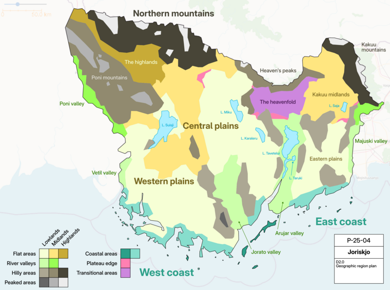
Geographic region plan for JKP-25-04. A legend is provided below, along with the thematic elevation regions.
Own work, with OGF map in background.
Licensing
| This map is a derivative of the OpenGeofiction base map, which is licensed under the Creative Commons Attribution-NonCommercial-ShareAlike License and is released under the same license. |
File history
Click on a date/time to view the file as it appeared at that time.
| Date/Time | Thumbnail | Dimensions | User | Comment | |
|---|---|---|---|---|---|
| current | 17:42, 28 June 2025 | | 2,388 × 1,774 (787 KB) | Varnel maiser (talk | contribs) | Geographic region plan for JKP-25-04. A legend is provided below, along with the thematic elevation regions. Own work, with OGF map in background. Category:Joriskjo |
You cannot overwrite this file.
File usage
The following page uses this file: