File:Nouveau plan RTA Métro d'Arténie-Ville - AK.png
Size of this preview: 426 × 600 pixels. Other resolution: 2,215 × 3,118 pixels.
Original file (2,215 × 3,118 pixels, file size: 636 KB, MIME type: image/png)
Summary
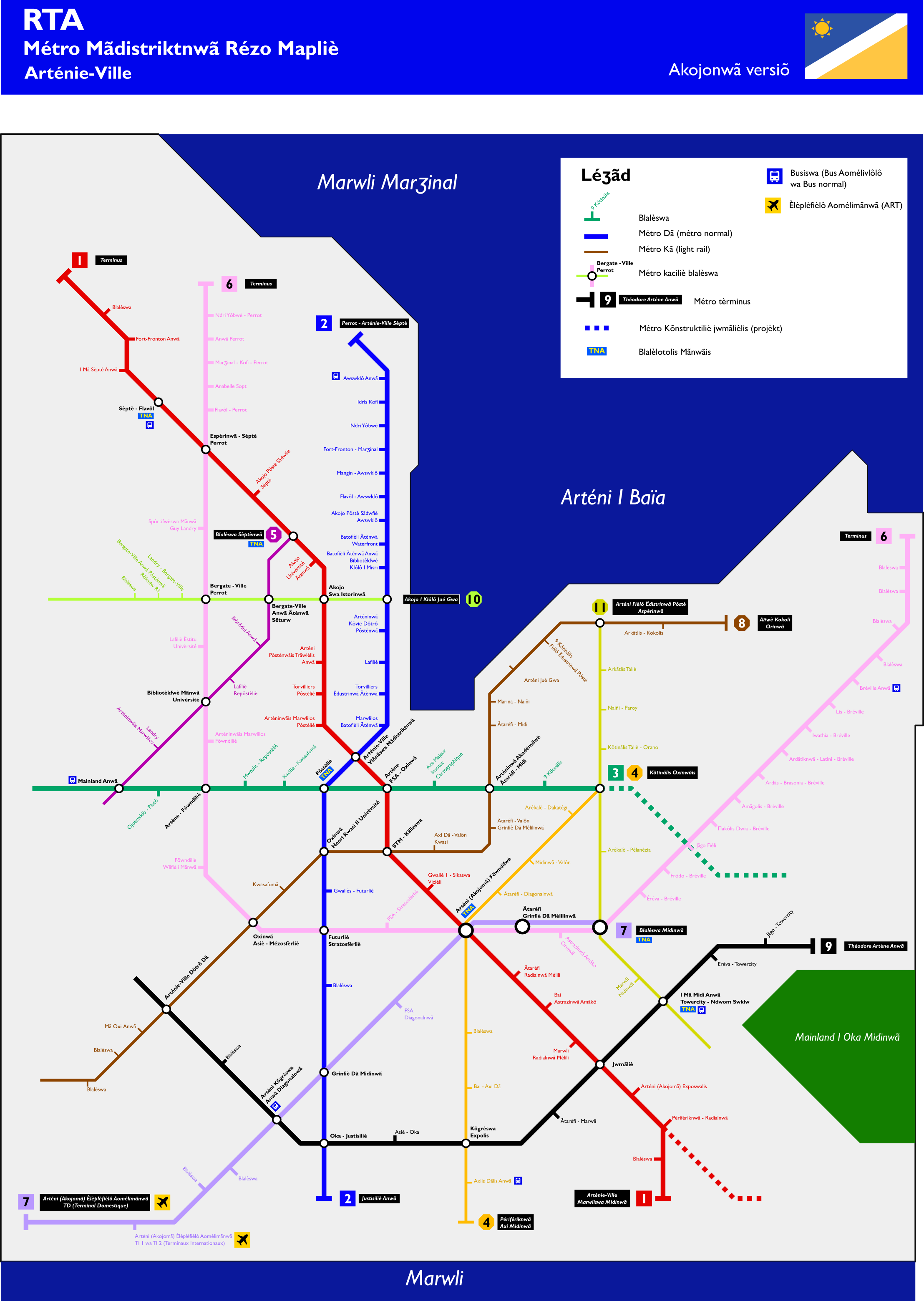
Rapid transit map network of Arténie-Ville. Network incomplete, the unnamed stations (=Blalèswa in Akodjonian) and the incomplete lines will be completed later. Own work (including the bus and airplane logos), all made by myself with Inkscape.
Licensing
| This image is licensed under the Creative Commons Attribution-NonCommercial-ShareAlike License |
File history
Click on a date/time to view the file as it appeared at that time.
| Date/Time | Thumbnail | Dimensions | User | Comment | |
|---|---|---|---|---|---|
| current | 15:50, 16 November 2025 | | 2,215 × 3,118 (636 KB) | Sweetykid (talk | contribs) | Rapid transit map network of Arténie-Ville. Network incomplete, the unnamed stations (=Blalèswa in Akodjonian) and the incomplete lines will be completed later. Own work (including the bus and airplane logos), all made by myself with Inkscape. |
You cannot overwrite this file.
File usage
The following page uses this file: