File:Furgenia proposal.png: Difference between revisions
Rustem Pasha (talk | contribs) Furgenia development proposal for Papal state. |
Rustem Pasha (talk | contribs) m recat |
||
| Line 3: | Line 3: | ||
== Licensing == | == Licensing == | ||
{{Cc-ogf-map}} | {{Cc-ogf-map}} | ||
[[Category:St. Lazarus and Thilius collaborative documentation]] | |||
[[Category:Topographic maps]] | |||
Revision as of 20:05, 24 June 2024
Summary
Furgenia development proposal for Papal state.
Licensing
| This map is a derivative of the OpenGeofiction base map, which is licensed under the Creative Commons Attribution-NonCommercial-ShareAlike License and is released under the same license. |
File history
Click on a date/time to view the file as it appeared at that time.
| Date/Time | Thumbnail | Dimensions | User | Comment | |
|---|---|---|---|---|---|
| current | 19:42, 14 June 2024 | 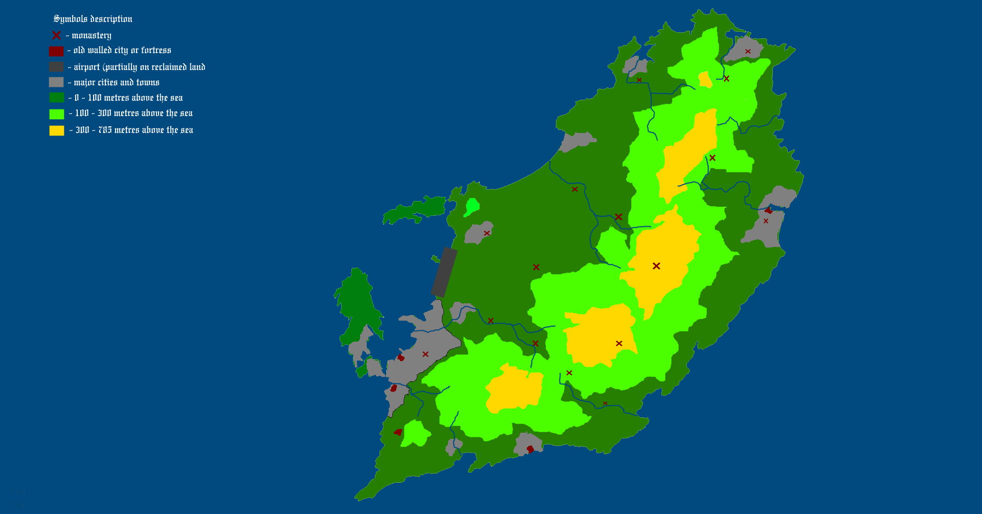 | 1,920 × 1,005 (139 KB) | Rustem Pasha (talk | contribs) | Furgenia development proposal for Papal state. |
You cannot overwrite this file.
File usage
The following 2 pages use this file: