File:JKP-25-04 D3.0 - Political.png: Difference between revisions
No edit summary |
Rustem Pasha (talk | contribs) mNo edit summary |
||
| Line 5: | Line 5: | ||
[[Category:Joriskjo]] | [[Category:Joriskjo]] | ||
[[Category:Political maps]] | |||
== Licensing == | == Licensing == | ||
{{Cc-ogf-map}} | {{Cc-ogf-map}} | ||
Latest revision as of 08:12, 19 July 2025
Summary
Political division plan for JKP-25-04.
Own work, with OGF map in background.
Licensing
| Creative Commons License AttributionNonCommercial | This map is a derivative of the OpenGeofiction base map, which is licensed under the Creative Commons Attribution-NonCommercial-ShareAlike License and is released under the same license. |
File history
Click on a date/time to view the file as it appeared at that time.
| Date/Time | Thumbnail | Dimensions | User | Comment | |
|---|---|---|---|---|---|
| current | 17:45, 28 June 2025 | 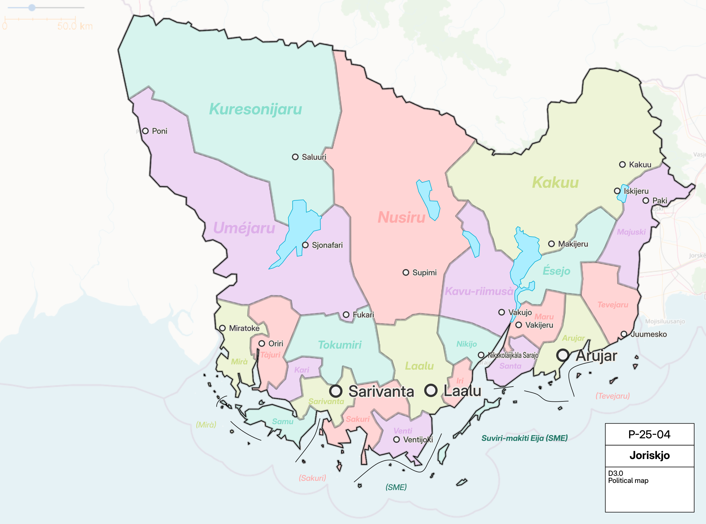 | 2,388 × 1,774 (915 KB) | Varnel maiser (talk | contribs) | Political division plan for JKP-25-04. Own work, with OGF map in background. Category:Joriskjo |
You cannot overwrite this file.
File usage
The following page uses this file: