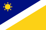
Artenia

|
Artenia République Arténienne (Franquese) Artenian Republic (Ingerish) Arténinwã Kwasafomã (Akodjonian (Akojonwã)) |
Loading map... |
Artenia (Arténie in Franquese, Arténi or Akojomã in Akodjonian) is an island country in northern Antarephia. Its localisation is within the islands archipelagos of northern Antarephia; north of Artenia is AN100 and south of the country is Marize. Further East of Artenia, there are the shores of AN113, AN103, San Marcos and further West of the island, are located the shores of Meilan, Geare, AN105 and Freedemia.
Artenia is an archipelago of 4 islands: 1 big island above the tiny others (Mainland) and 3 others which 2 of them are islets: Rochville (little island), Ilôt Marginal (islet) and Îlot Fronton (islet) north of Fort-Fronton.
 | |
|---|---|
| Administrative divisions of Artenia | |
| First-level | 4 Régions / Mãdistriktlis |
| Second-level | Communes / Vlôlôhlis Villages / Klôlôhlis |
| Third-level | Arrondissements / Vlôdistriktlis |
| Fourth-level | Hameaux / Klôlôhkãlis Quartiers / Trãwlèlis |
| Infrastructure of Artenia | |
|---|---|
| Roadways | |
| • Driving side | Right |
| Railways | |
| • Passing side | Right |
| • Gauge | 1435mm |
| • Electrification | Varies |
| Mains electricity | 230 V, 50 Hz |
