File:Demirhan topomap.png: Difference between revisions
Rustem Pasha (talk | contribs) (Rustem Pasha uploaded a new version of File:Demirhan topomap.png) |
Rustem Pasha (talk | contribs) m (ogf-map) |
||
| Line 2: | Line 2: | ||
Topographic map of Demirhan Empire. Own work by me, [[user:Rustem Pasha|Rustem Pasha]] | Topographic map of Demirhan Empire. Own work by me, [[user:Rustem Pasha|Rustem Pasha]] | ||
== Licensing == | == Licensing == | ||
{{ | {{cc-ogf-map}} | ||
[[Category:Demirhan Empire]] | [[Category:Demirhan Empire]] | ||
[[Category:Topographic maps]] | [[Category:Topographic maps]] | ||
Revision as of 10:59, 7 July 2022
Summary
Topographic map of Demirhan Empire. Own work by me, Rustem Pasha
Licensing
| This map is a derivative of the OpenGeofiction base map, which is licensed under the Creative Commons Attribution-NonCommercial-ShareAlike License and is released under the same license. |
File history
Click on a date/time to view the file as it appeared at that time.
| Date/Time | Thumbnail | Dimensions | User | Comment | |
|---|---|---|---|---|---|
| current | 21:01, 16 September 2022 | 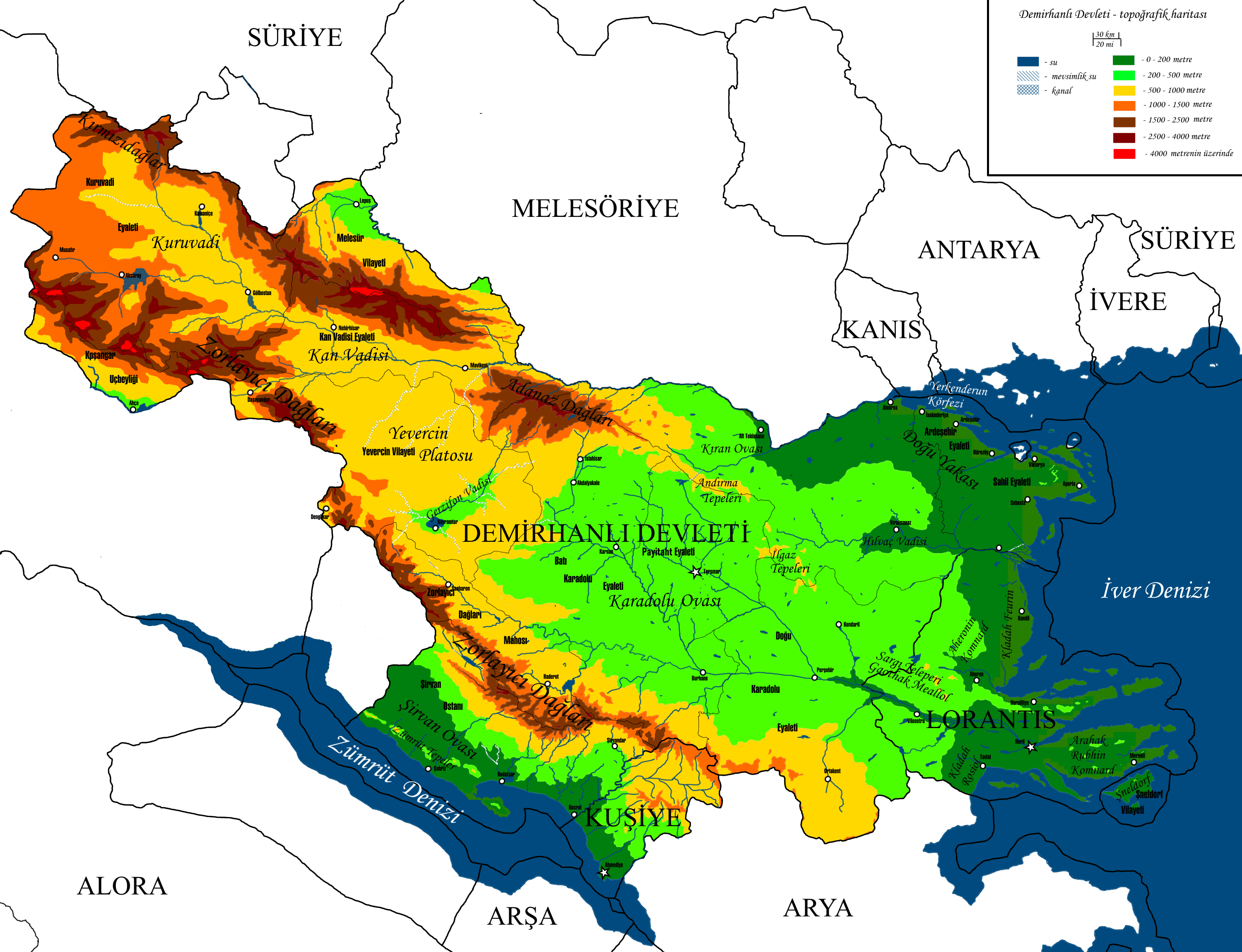 | 3,000 × 2,300 (521 KB) | Rustem Pasha (talk | contribs) | adjusting minor things after spring natural development |
| 21:25, 13 January 2022 | Error creating thumbnail: File missing | 3,000 × 2,300 (504 KB) | Rustem Pasha (talk | contribs) | current borders | |
| 18:13, 13 October 2021 | Error creating thumbnail: File missing | 3,000 × 2,300 (1.66 MB) | Rustem Pasha (talk | contribs) | Topographic map of Demirhan Empire. Own work by me, Rustem Pasha |
You cannot overwrite this file.
File usage
The following page uses this file: