File:Deodeca Provinces Updated.png: Difference between revisions
(Updated map based on provinces and new territorial annexations. Base map created by diamantschiff) |
Rustem Pasha (talk | contribs) m (cat, link) |
||
| Line 2: | Line 2: | ||
Updated map based on provinces and new territorial annexations. | Updated map based on provinces and new territorial annexations. | ||
Base map created by diamantschiff | Base map created by {{OGF user|diamantschiff}} | ||
== Licensing == | == Licensing == | ||
{{Cc-ogf-map}} | {{Cc-ogf-map}} | ||
[[Category:Deodeca]] | |||
[[Category:Political maps]] | |||
Latest revision as of 13:07, 25 December 2023
Summary
Updated map based on provinces and new territorial annexations.
Base map created by diamantschiff
Licensing
| This map is a derivative of the OpenGeofiction base map, which is licensed under the Creative Commons Attribution-NonCommercial-ShareAlike License and is released under the same license. |
File history
Click on a date/time to view the file as it appeared at that time.
| Date/Time | Thumbnail | Dimensions | User | Comment | |
|---|---|---|---|---|---|
| current | 08:12, 22 December 2023 | 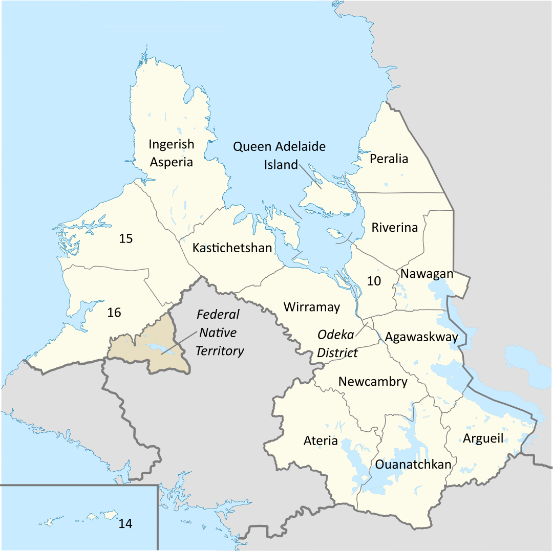 | 1,080 × 1,077 (294 KB) | Arlo (talk | contribs) | Updated map based on provinces and new territorial annexations. Base map created by diamantschiff |
You cannot overwrite this file.
File usage
The following page uses this file: